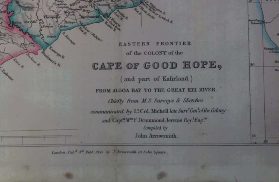
Eastern Frontier of the Colony Of the Cape of Good Hope Wall Map 1853, Reproduction Print
Secondhand
1 was available
R295.00
0% off
Shipping
Free shipping is available from CapeCollectables for all orders above R1,500.00, using one of our trusted couriers. Check my rate
The seller allows collection for this item. Buyers will receive the collection address and time once the order is ready.
The seller has indicated that they will usually have this item
ready to ship within 3 business days.
Shipping time depends on your delivery address.
The most accurate delivery time will be calculated at checkout,
but in general, the following shipping times apply:
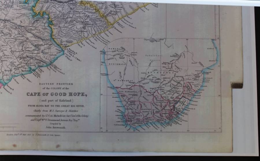
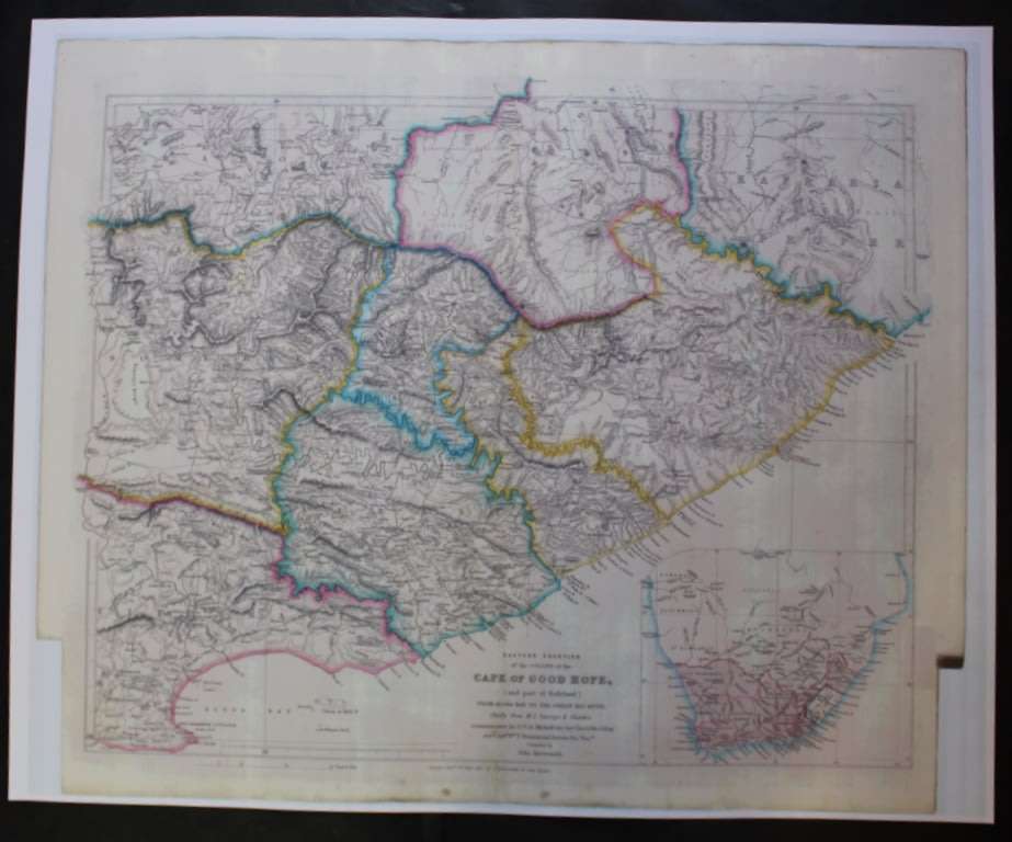
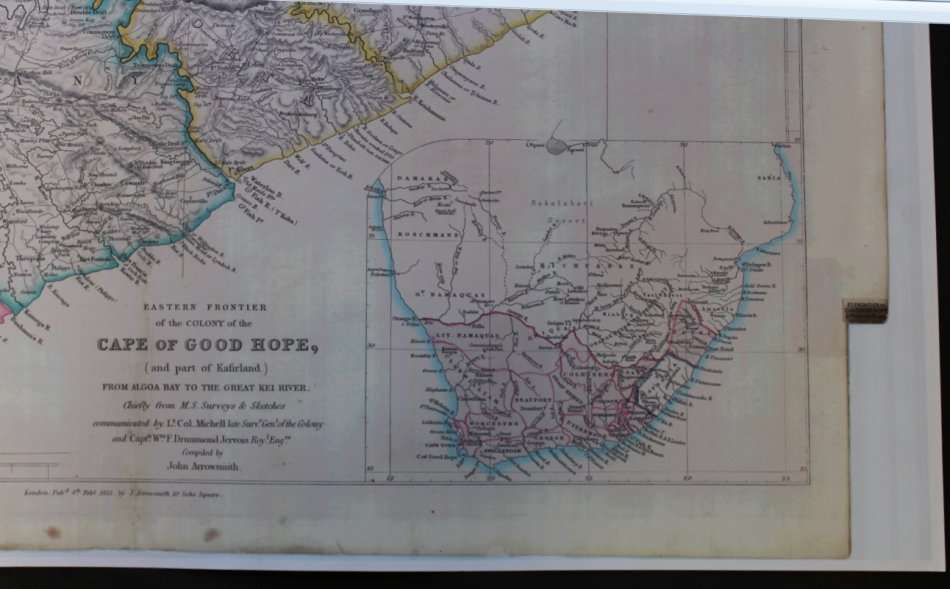
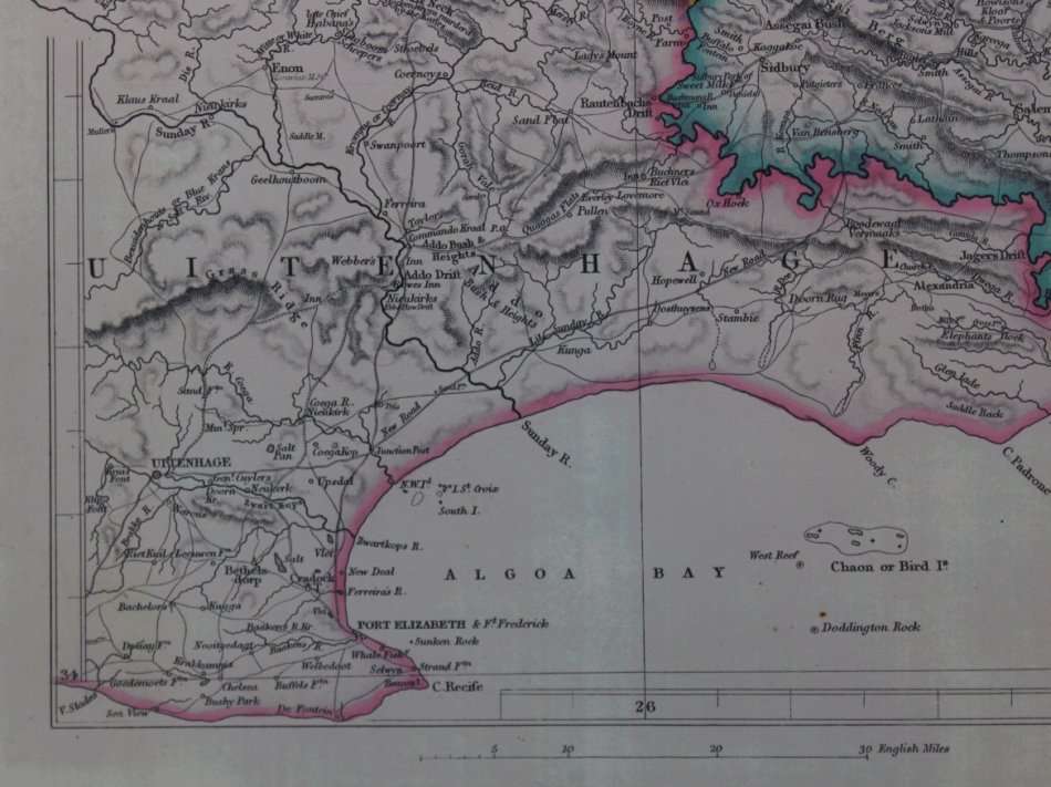
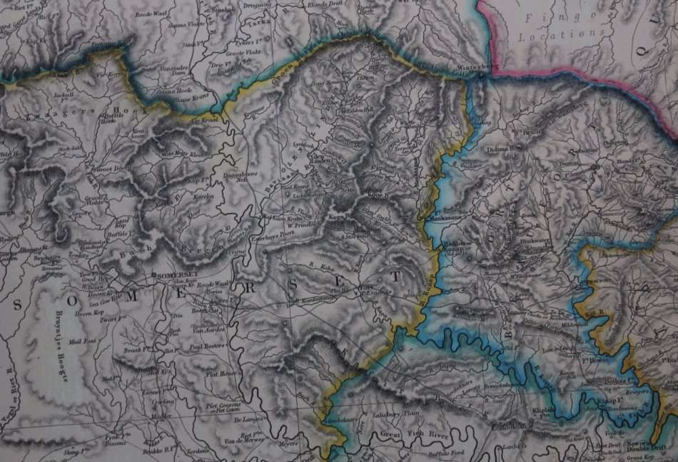
Title: Eastern Frontier of the Colony Of the Cape of Good Hope Wall Map 1853, Reproduction Print. Publisher: J Arrowsmith 10 Soho Square London Pub.d 4th Feb 1853. Height: 58cm. Width: 71cm. Info: Eastern Frontier of the Colony Of the Cape of Good Hope Wall Map 1853. from Algoa Bay to the Great Kei River. Chiefly from M.S Surveys & Sketches communicated by Lt. Col. Michell, late Surv Gen of the Colony and Capt. Wm Drummond Jervois Royal Engineers. Compiled by John Arrowsmith. The Eastern Cape Border areas after the 1820 Settlers had arrived in the area. Districts are colour coded. A very colourful and well presented map for the time, the map would look stunning in the correct frame and in the correct setting.
Published in London 4 February 1853 by John Arrowsmith 10 Soho Square.
Lieutenant-Colonel Charles Collier Michell, KH (29 March 1793 in Exeter 28 March 1851 in Eltham, London), later known as Charles Cornwallis Michell, was a British soldier, first surveyor-general in the Cape, road engineer, architect, artist and naturalist.
Scale: 1.5 Inches = 10 Miles. Map Type: Reproduction Print, scanned from an Original and printed on poster paper. Condition: Very Good. Price: R 295.00 Inc Vat.