This auction has been won.
View other items offered by ErnRex15453172
Leading
ivan2007954 1 × R1,545.00
6 Dec 22:33
Runners-up
SA Collect Invest1415 1 × R1,515.00
6 Dec 22:32
Blue Stone Antiques460 1 × R1,000.00
6 Dec 22:24
MarOss8868550 1 × R360.00
6 Dec 10:44
123 weg4276 1 × R250.00
6 Dec 20:11
naaskop114 1 × R121.00
5 Dec 16:09
AliHar51632750 1 × R105.00
5 Dec 12:06
nieldivvie964 1 × R31.00
5 Dec 12:06

Similar products

R30 shipping
Antique Maps by Douglas Gohm, First Edition
R200
R30 shipping
1855 Map of Africa, Excellent Condition, Original Antique Map
R235
R30 shipping
Ducatus Eboracensis Anglice Yorkshire, England - Joannes and Willem Blaeu 1645-1646 Ref. MA-5
R5,000
R30 shipping
29% OFF
ONE OF A KIND, ANTIQUE MAP OF WALES (GOLD FOILED)
R8,500 R12,000

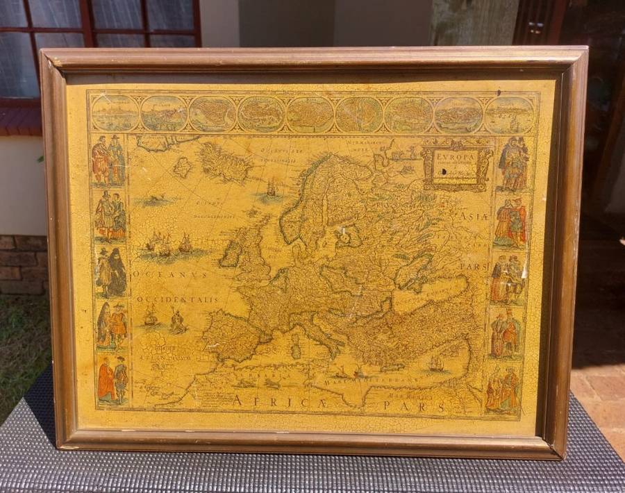
EUROPA ANTIQUE MAP RECENS DESRIPTA BY WILLEM BLAEU (1571-1638) HAND COLOURED LINE ENGRAVING

1 was available / secondhand
R1,545.00 auction closed
Shipping
Standard courier shipping from R30
R30 Standard shipping using one of our trusted couriers applies to most areas in South Africa. Some areas may attract a R30 surcharge. This will be calculated at checkout if applicable.
Check my rate
Free collection from Doornpoort, Pretoria
The seller allows collection for this item and will be in contact with the full collection address once the order is ready. Ready for collection by Monday, 13 May.
Ready to ship in
The seller has indicated that they will usually have this item ready to ship within 7 business days. Shipping time depends on your delivery address. The most accurate delivery time will be calculated at checkout, but in general, the following shipping times apply:
 
Standard Delivery
Main centres:  1-3 business days
Regional areas: 3-4 business days
Remote areas: 3-5 business days
Buyer Protection How you're covered

Product information

Condition:
Secondhand
Location:
South Africa
Area:
Europe
Time Period:
Pre-1800s
Type:
Physical Map
Customer ratings:
Bob Shop ID:
601071859

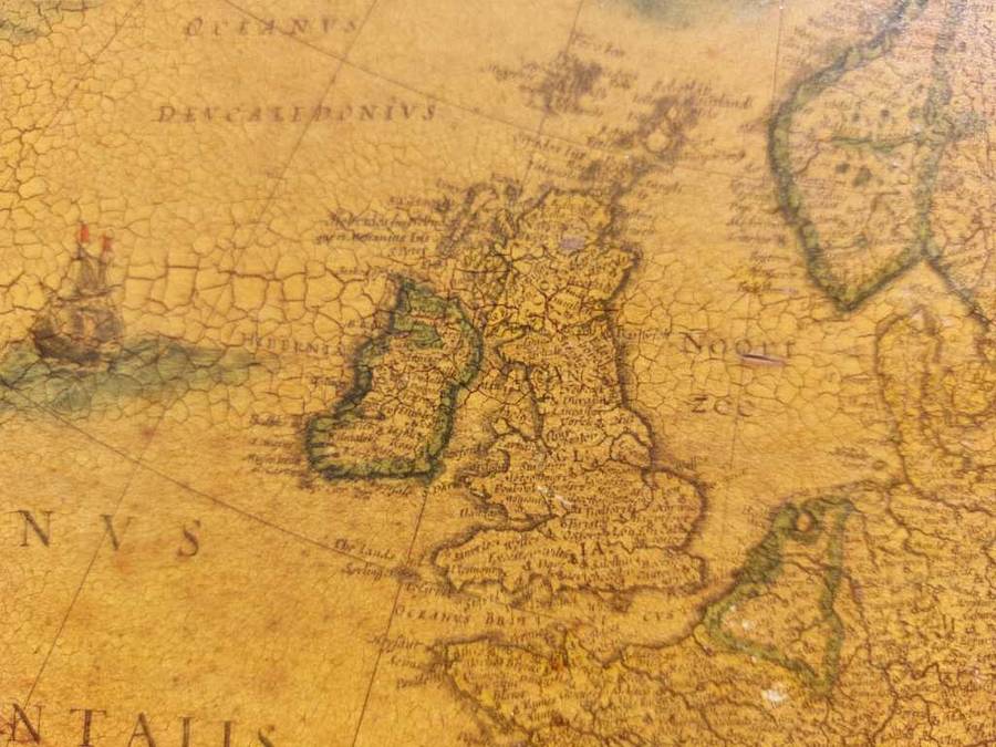
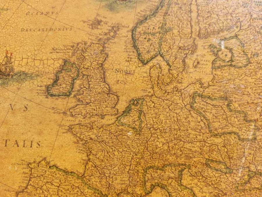
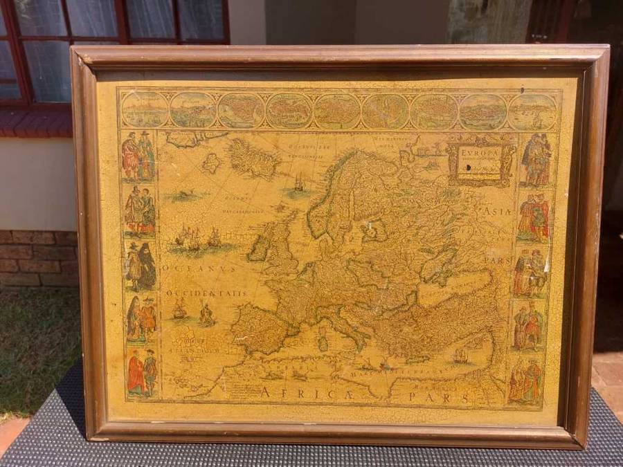
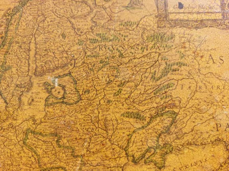
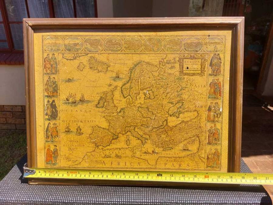
EUROPA RECENS DESRIPTA BY WILLEM BLAEU (1571-1638) HAND COLOURED LINE ENGRAVED PRINT (CIRCA 1621-1642)

ON AUCTION IS A RARE UNIQUELY HAND COLOURED LINE ENGRAVED PRINT OF AN EARLY MAP OF EUROPE TITLED EVROPA RECENS DESCRIPTA (EUROPE RECENTLY DESCRIBED) FROM THE EARLY 17TH CENTURY PRODUCED BY WLLEM BLAEU A FAMOUS DUTCH CARTOGRAPHER.
 
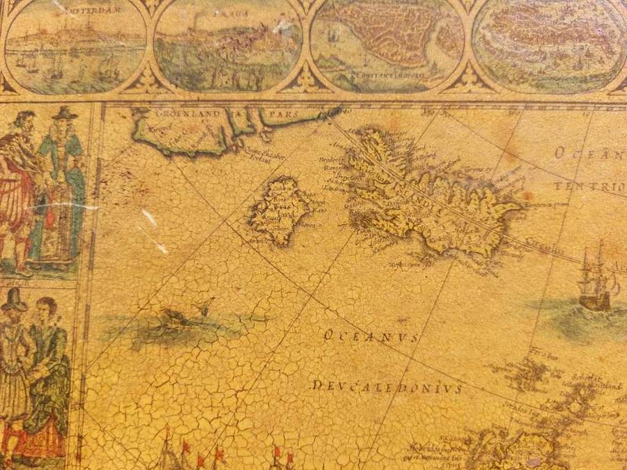
As can be inferred from online sources this is Willem Blaeu's 1 state edition (mythical island of Frisland still prominent in left corner) map of the continent of Europe which dates back to 1617, although the date was removed from later printings prior to the inclusion of the map in the first of a long series of World atlases which began to appear in 1630. That date marks the first atlas publication of this and the other continental maps.
 
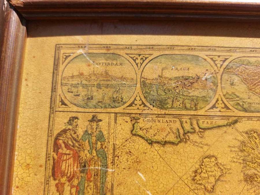
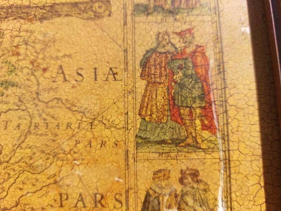
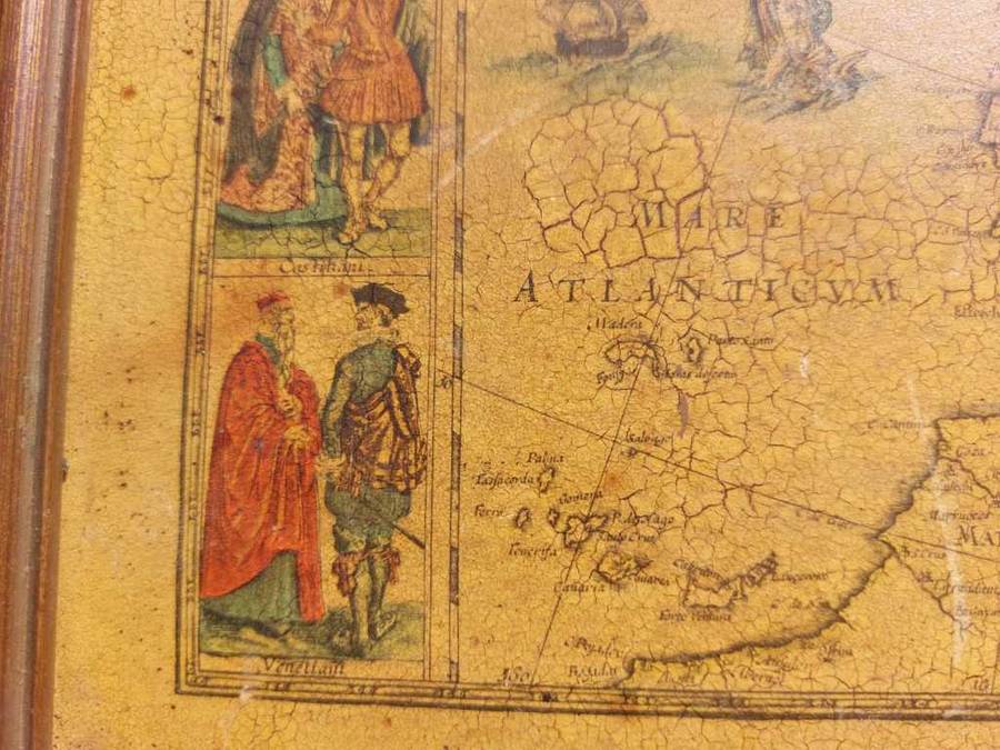
Blaeus striking map of Europe, framed on both sides by five costumed figures. Left border: Angli, Galli, Belgi, Castiliani, Venetiani. Right border: Germani, Hungari, Bohemi, Poloni, Graeci. Along the upper edge runs a decorative border with nine European towns in oval frames: Amsterdam, Praga, Constantinopolis, Venetia, Roma, Paris, London, Toledo and Lisboa. 
 
FOR EUROPEAN MAPMAKERS THEIR OWN CONTINENT CONTAINED FEW MYSTERIES OR SECRETS BY THE SEVENTEENTH CENTURY. HOWEVER, THE MYTHICAL ISLAND OF FRISLAND STILL APPEARS BETWEEN ICELAND AND GREENLAND.
 
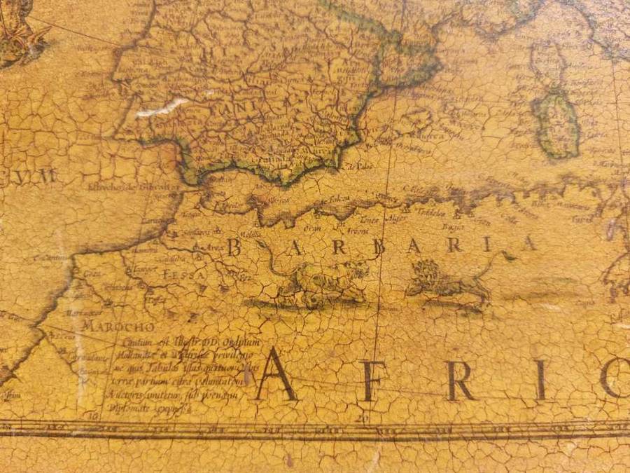
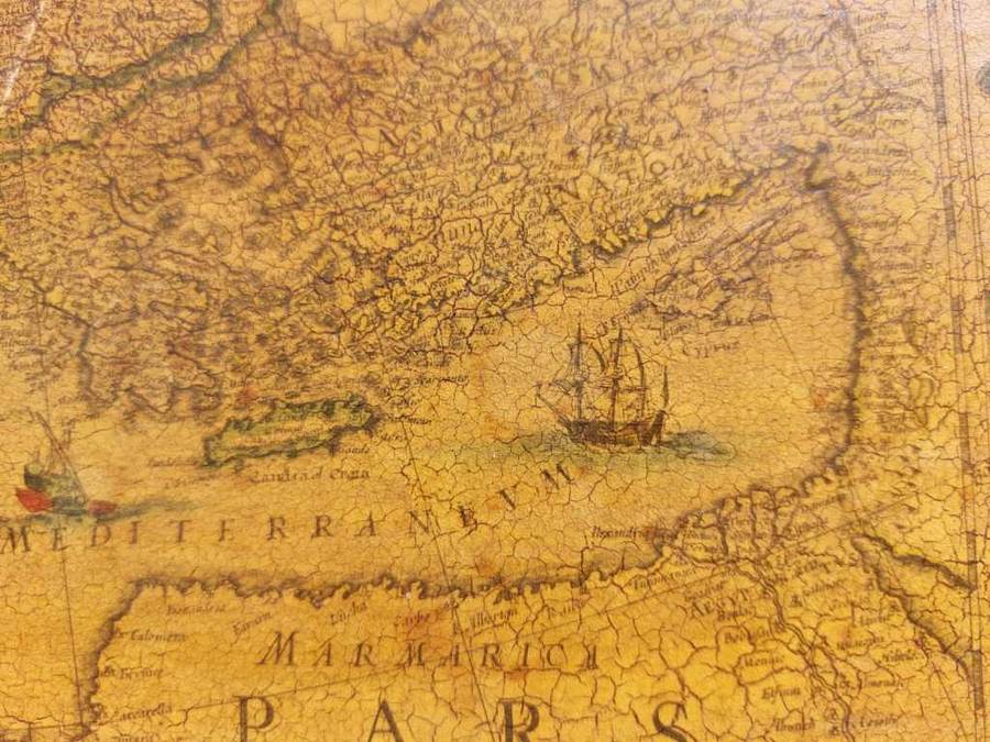
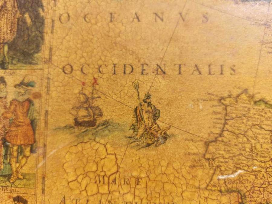
THE MAP IS EMBELLISHED WITH SAILING SHIPS, SEA MONSTERS, BEARS IN NORTHERN RUSSIA, AND LIONS IN NORTH AFRICA AND NEPTUNE RIDING A DOLPHIN AND HOLDING HIS TRIDENT.

 
Willem Janszoon Blaeu (1571-1638) 
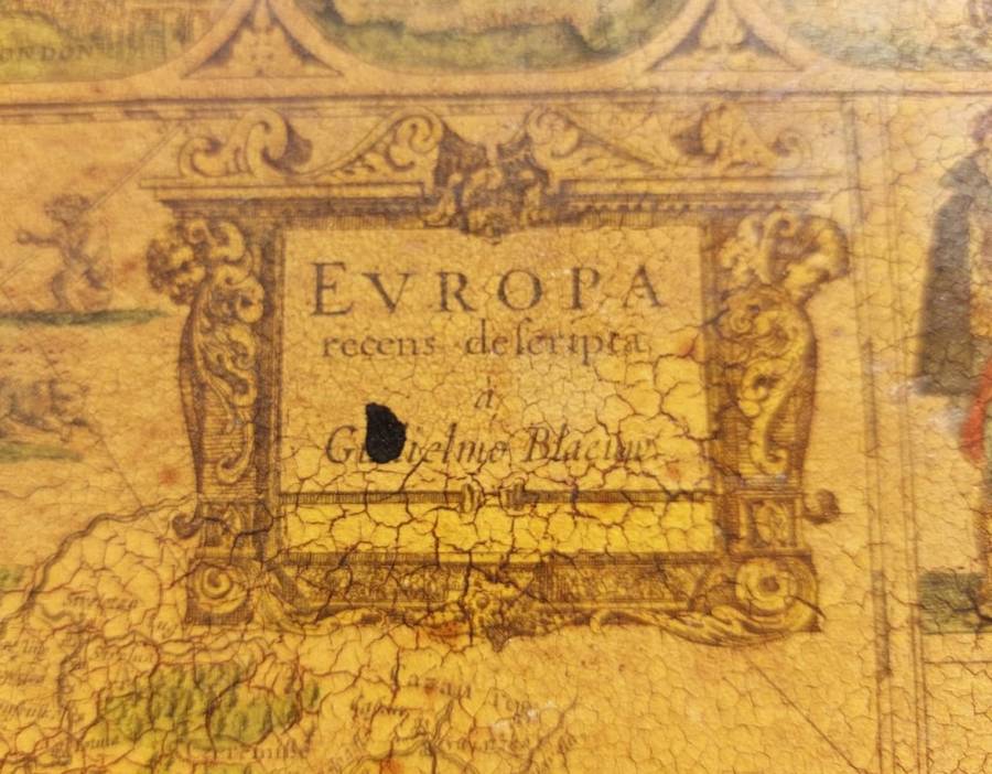
Title: Evropa recens descripta a Guiljelmo Blaeuw
Edition: Its is 1st state Edition (confirmed with the mythtical island of Frisland in the north Atlantic. This would be removed in the second state after 1660.) most propably from a stand alone engraved print (no center folding mark visible) although it can be also from one of the Le Grand Atlas Unknown 3rd State Editions into which this map was published.
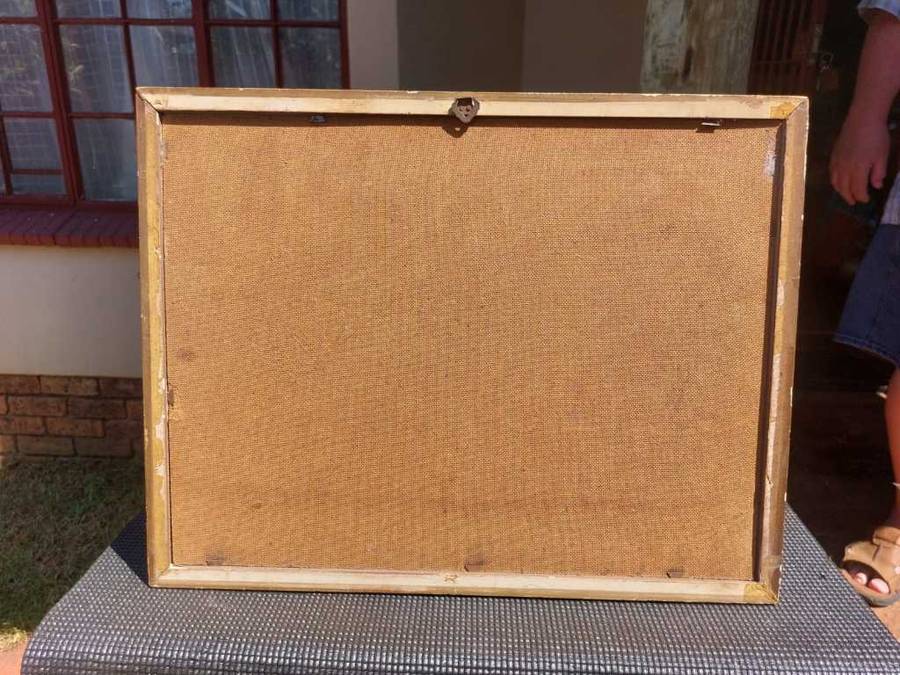
(Since the Map seem pasted onto a hardboard the language edition that was usually printed on the back is obscure.)

SIZE: LINE ENGRAVING 44CM WIDE 33CM HIGH
FRAME 48CM WIDE 37CM HIGH
CONDITION: PAPER IS DISCOLORED AND CRACKLED BUT TEXT STILL READABLE AND ARTWORK STILL CLEAR WITH HAND COLOURING STILL BEAUTIFUL. HAND COLOURED LINE ENGRAVING WAS MOUNTED OR PASTED ONTO A HARDBOARD. FEW CHIPS TO FRAME. TWO BLACK SPOTS AND A FEW WHITE SMUDGES AND SCRAPES VISIBLE.
 
MARKINGS: Evropa recens descripta (Europa recently described) a Guiljelmo Blaeuw in cartouche
 
WILLEM BLAEU (1571-1638):

Willem Janszoon Blaeu (1571-1638) was a prominent Dutch geographer and publisher. Blaeu set up shop in Amsterdam. In 1635, he released his atlas in Latin, Theatrum Orbis Terranum, ("Theatre of the Lands of the World"), sive (or), Atlas Novus (new atlas). German, Dutch and French versions of this atlas were published through about 1667. Willem died in 1638. He had two sons, Cornelis (1610-1648) and Joan (1596-1673). Later in life, Joan would modify and greatly expand his fathers Atlas Novus eventually releasing his masterpiece, the Atlas Major between 1662 and 1672 which reached 12 volumes. The Blaeus' atlas production came to an abrupt end with the fire in their workshop and the resulting destruction of many printing plates in 1672.
 
PLEASE ALSO SEE MY OTHER ITEMS LISTED. I HAVE ANOTHER OLD MAP OF THE AMERICAS BY BLAEU ON AUCTION THIS WEEK. COPY THE URL UNDERNEATH AND PASTE INTO GOOGLE AND IT WILL TAKE YOU DIRECTLY TO ALL MY LISTINGS THIS WEEK. https://www.bidorbuy.co.za/seller/3685641/ErnRex1545

Customer ratings: 1 ratings

Excellent service
13 Dec 2023