This item has closed with no items sold
View the relisted Item
View the relisted Item
View other items offered by CapeCollectables1035

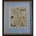
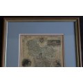
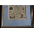
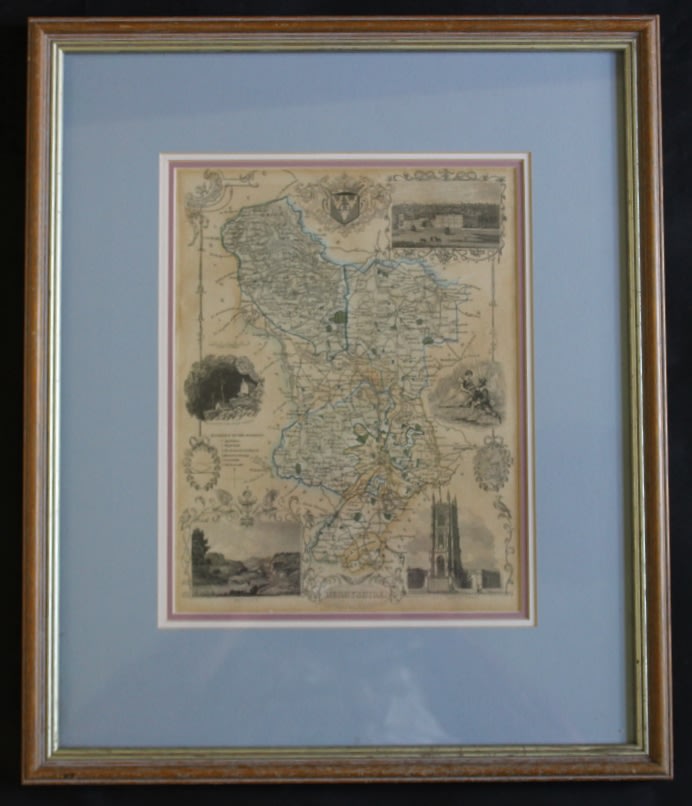
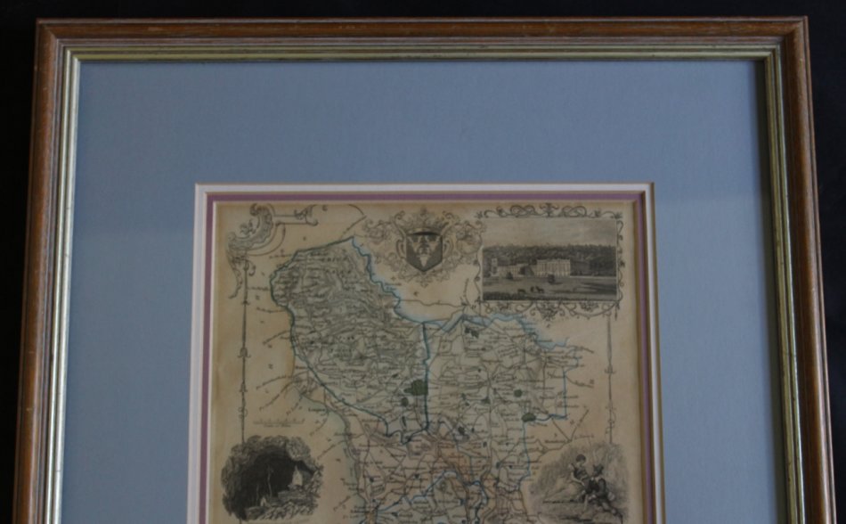
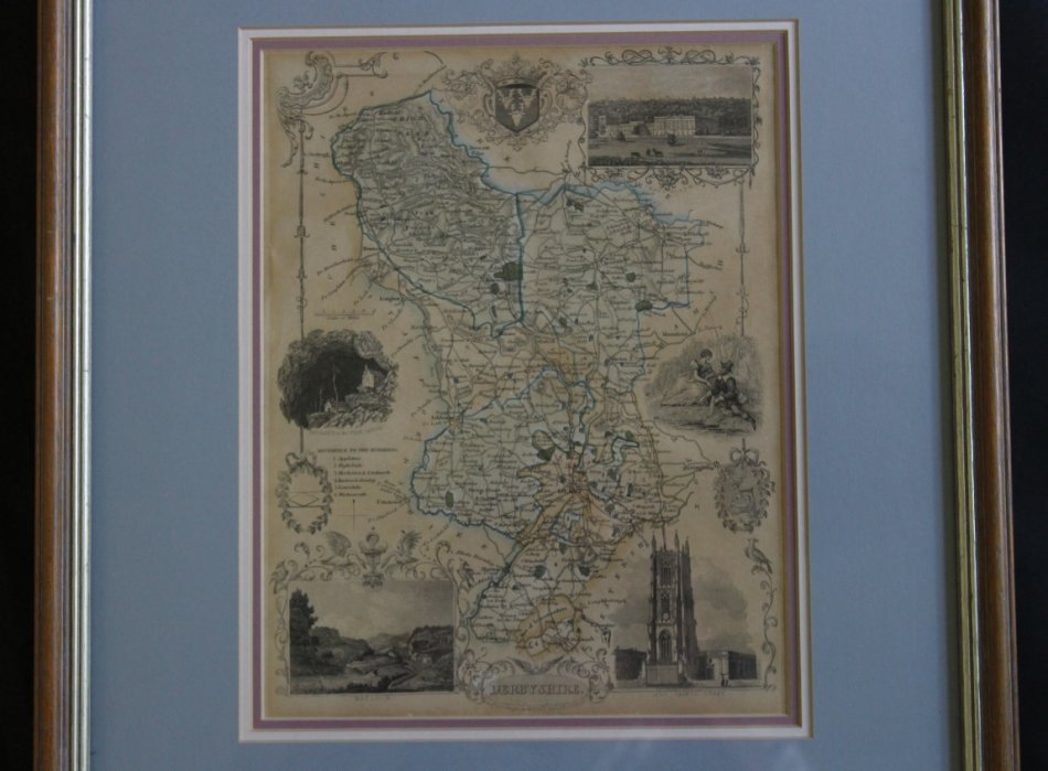
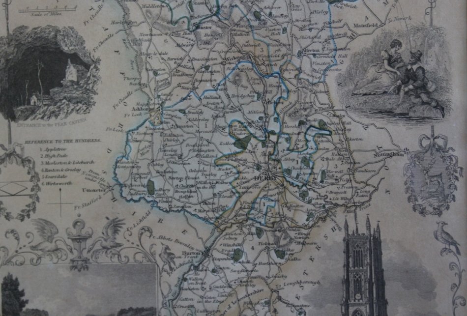
Framed Antique Map of Derbyshire by Thomas Moule 1842
Secondhand
R895.00
Closed
4 May 24 17:16
Shipping
Standard courier shipping from R30
R30 Standard shipping using one of our trusted couriers applies to most areas in South Africa. Some areas may attract a R30 surcharge. This will be calculated at checkout if applicable.
Check my rate
Check my rate
Free collection from
Kuils River, Cape Town
The seller allows collection for this item and will be in contact with the full collection address once the order is ready.
Ready for collection by Tuesday, 21 May.
Ready to ship in
The seller has indicated that they will usually have this item
ready to ship within 3 business days. Shipping time depends on your delivery address. The most
accurate delivery time will be calculated at checkout, but in
general, the following shipping times apply:
Standard Delivery
| Main centres: | 1-3 business days |
| Regional areas: | 3-4 business days |
| Remote areas: | 3-5 business days |
Returns
Get it now, pay later
Seller
Buyer Protection
Product details
Condition
Secondhand
Location
South Africa
Area
Europe
Time Period
1800s
Type
Political Map
Bob Shop ID
611752319
Title: Framed Antique Map of Derbyshire by Thomas Moule 1842
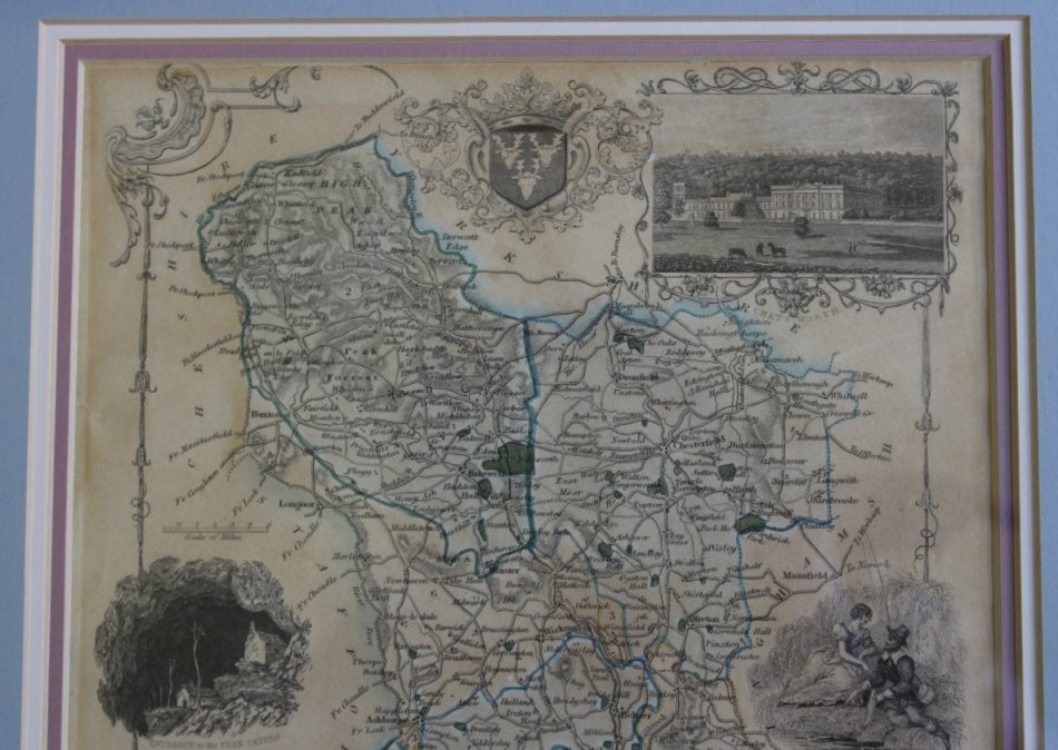
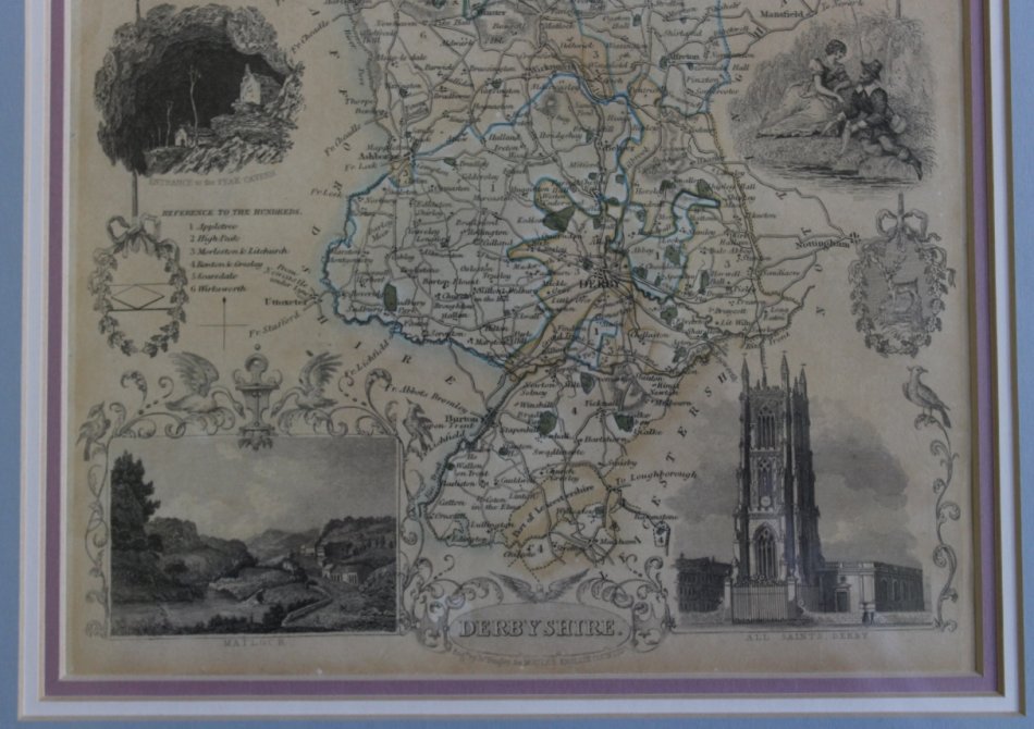
Vignettes of All Saints: Derby, Matlock, Chatsworth, Entrance to the Peak Cavern.
Published: London circa 1842.
An attractive and detailed antique county map of Derbyshire by the celebrated Thomas Moule.
Moule's maps are are well known and rightly sought after for their trademark ornate decorative borders,
inset engravings and artistic presentation. Moule paid as much attention to aesthetic appeal as he did to cartographic detail .
These county maps for which he is best known were first published in the 1830s and re-issued in 1841. The original steel plates were used for all issues, but they were amended in the later edition to show the railways.
This map of Derbyshire is embellished with heraldic devices, a reference to the hundreds and inset vignette engravings of Chatsworth,
Entrance to the Peak Cavern, Matlock in 1790 & All Saints, Derby.
A crisp dark impression, fine condition without fold lines, without hand colouring.
Publisher: Thomas Moule c 1842.
Engraved By: J A Bingley for Moules English Counties.
Map size: 23cm w x 28cm h
Framed Size: 38cm w x 46cm h.
Condition: Excellent condition and well framed Map.
Map: Original release.
Price: R 895.00 Inc Vat.
![]()