This item has closed with no items sold
View the relisted Item
View the relisted Item
View other items offered by CapeCollectables1055
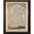
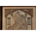
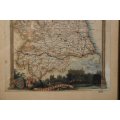
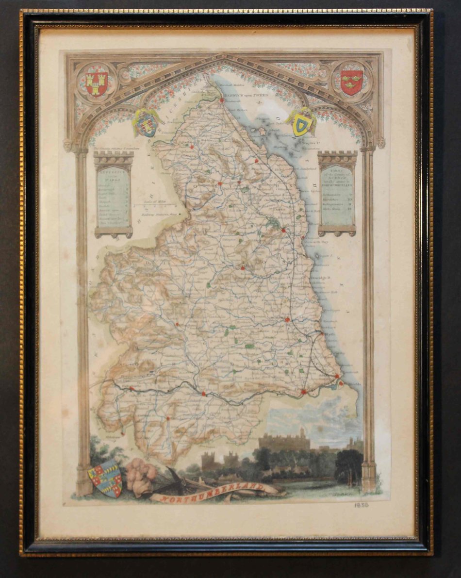
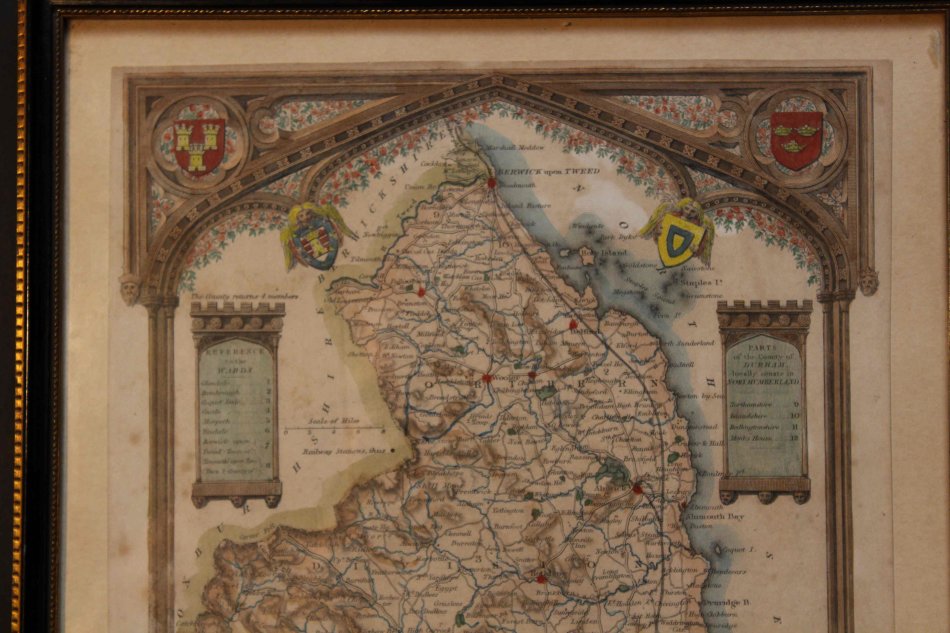
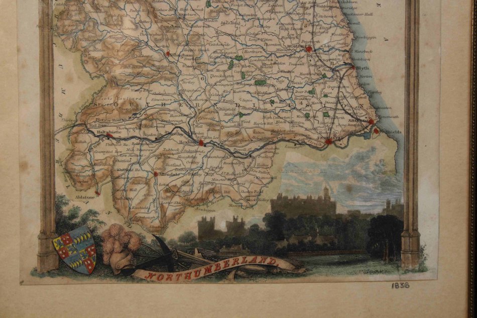
Framed Antique Map of Northumberland By Thomas Moule 1836
Secondhand
R1,200.00
Closed
8 Jun 24 14:46
Shipping
Standard courier shipping from R30
R30 Standard shipping using one of our trusted couriers applies to most areas in South Africa. Some areas may attract a R30 surcharge. This will be calculated at checkout if applicable.
Check my rate
Check my rate
Free collection from
Somerset West, Cape Town
The seller allows collection for this item and will be in contact with the full collection address once the order is ready.
Ready for collection by Friday, 14 June.
Ready to ship in
The seller has indicated that they will usually have this item
ready to ship within 3 business days. Shipping time depends on your delivery address. The most
accurate delivery time will be calculated at checkout, but in
general, the following shipping times apply:
Standard Delivery
| Main centres: | 1-3 business days |
| Regional areas: | 3-4 business days |
| Remote areas: | 3-5 business days |
Returns
Get it now, pay later
Seller
Buyer Protection
Product details
Condition
Secondhand
Location
South Africa
Area
Europe
Time Period
1800s
Type
Political Map
Bob Shop ID
614626565
Title: Framed Antique Map of Northumberland By Thomas Moule 1836
Description: Map of Northumberland, circa 1836.
Vignette of Alnwick Castle, bottom right.
Type: Colour Engraving - Decorative steel engraved antique map.
The Moule county maps were unusual for the period in that they were highly decorative.
The scientific rationality of the late 18th & early 19th century had seen a move away from the flamboyance of earlier map making;
emphasising instead a greater desire for accuracy and detail.
Thomas Moule, like many of his contemporaries, however, was drawn to a more simplistic, pre-industrial age.
This was clearly reflected in his maps with their neo-Gothic borders, heraldic shields and views of ancient buildings; ironically, the Moule maps issued later in the 1840's were amongst the first to show the newly constructed railways.
This highly decorative antique county map of Northumberland has been embellished with armorials and other features. It was first published in 1836 and subsequent editions were published until 1842.
This map includes railways and has been coloured by hand.
Publisher: George Virtue 1836 and the James Barclay's Complete and
Universal Dictionary, about 1841, with railways depicted.
Drawn By: Thomas Moule
Engraver: I Dower.
Framed: 24cm x 31cm.
Condition: Very Good, slight tear bottom right.
Map: Original release.
Price: R 1200.00 Inc Vat.
![]()