This item has closed with no items sold
View other items offered by 19 Century Living437

Similar products

MAP - AI-AIS - Ref 2716 - Topographical edition 1977 Suidwes-Afrika 1 : 250,000
Secondhand
R280.00
French map of The United Provinces Of The Netherlands dated 1702 First edition Ref. MP 11
Secondhand
R3,000.00
Circa 1890 Map of the Nile Provinces, Excellent condition, Original MacKenzie Map
Secondhand
R125.00
Vintage Folded Map Motorists` Map of South East & East Midlands, #2 First Edition 1977
Secondhand
R155.00
French map of The United Provinces Of The Netherlands dated 1702 First edition Ref. MP 11 French map of The United Provinces Of The Netherlands dated 1702 First edition Ref. MP 11 French map of The United Provinces Of The Netherlands dated 1702 First edition Ref. MP 11 French map of The United Provinces Of The Netherlands dated 1702 First edition Ref. MP 11 French map of The United Provinces Of The Netherlands dated 1702 First edition Ref. MP 11 French map of The United Provinces Of The Netherlands dated 1702 First edition Ref. MP 11 French map of The United Provinces Of The Netherlands dated 1702 First edition Ref. MP 11 French map of The United Provinces Of The Netherlands dated 1702 First edition Ref. MP 11 French map of The United Provinces Of The Netherlands dated 1702 First edition Ref. MP 11 French map of The United Provinces Of The Netherlands dated 1702 First edition Ref. MP 11 French map of The United Provinces Of The Netherlands dated 1702 First edition Ref. MP 11 French map of The United Provinces Of The Netherlands dated 1702 First edition Ref. MP 11 French map of The United Provinces Of The Netherlands dated 1702 First edition Ref. MP 11
French map of The United Provinces Of The Netherlands dated 1702 First edition Ref. MP 11 French map of The United Provinces Of The Netherlands dated 1702 First edition Ref. MP 11 French map of The United Provinces Of The Netherlands dated 1702 First edition Ref. MP 11 French map of The United Provinces Of The Netherlands dated 1702 First edition Ref. MP 11
French map of The United Provinces Of The Netherlands dated 1702 First edition Ref. MP 11
+9
Closed

French map of The United Provinces Of The Netherlands dated 1702 First edition Ref. MP 11

Secondhand 1 was available
R3,000.00
Shipping
R35.00 Standard shipping using one of our trusted couriers applies to most areas in South Africa. Some areas may attract a R30.00 surcharge. This will be calculated at checkout if applicable.
Check my rate
The seller has indicated that they will usually have this item ready to ship within 3 business days. Shipping time depends on your delivery address. The most accurate delivery time will be calculated at checkout, but in general, the following shipping times apply:
 
Standard Delivery
Main centres:  1-3 business days
Regional areas: 3-4 business days
Remote areas: 3-5 business days
Buyer protection
Get it now, pay later

Product details

Condition
Secondhand
Location
South Africa
Area
Europe
Time Period
Pre-1800s
Type
Physical Map
Bob Shop ID
607363700
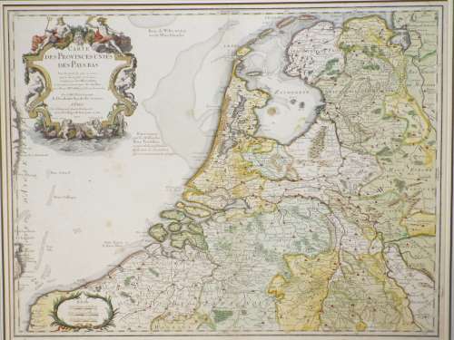
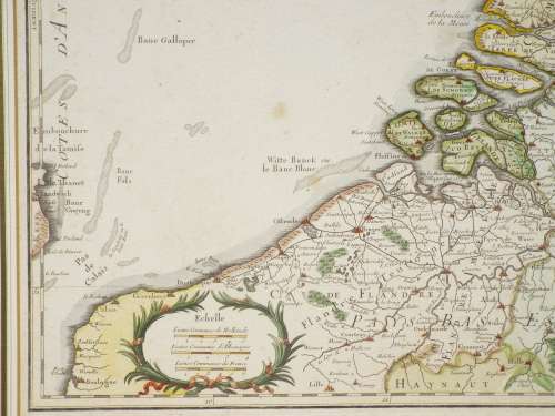
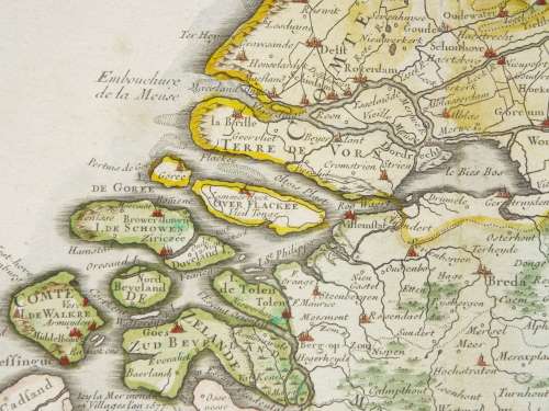
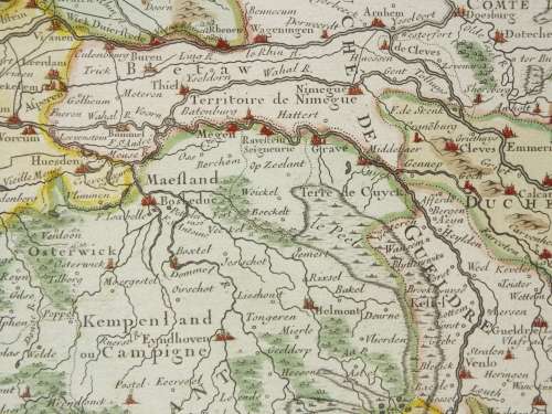
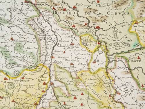
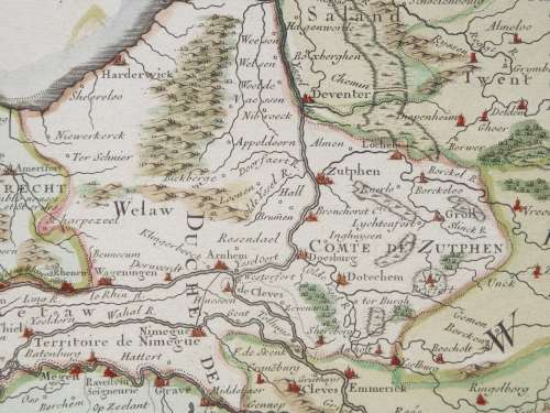
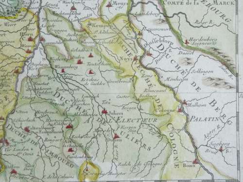
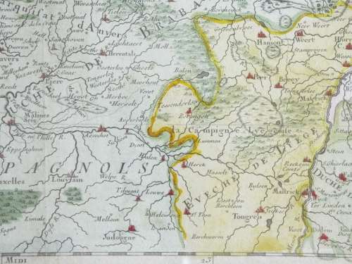
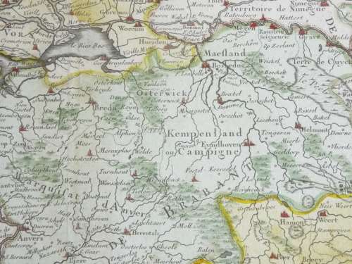
Description: French map of The United Provinces Of The Netherlands dated 1702 First edition Ref. MP 11
Maker: Delisle, Guillaume, 1675-1726   Also spelt Guillaume de l'Isle.
Date: 1702, making this a First Edition.  A later edition was printed in Amsterdam.  This was the end of the Golden Age of the Dutch Republic. In the 17th and 18th centuries, the Dutch were arguably the most economically wealthy and scientifically advanced of all European nations, which put them in a privileged position to transfer Western knowledge to Japan.
The transition by the Netherlands to becoming the foremost maritime and  in the world has been called the "Dutch Miracle"
History: Guillaume Delisle (de LIsle), was one of the key figures in the development of French cartography, noted for his outstanding work and was constantly updating his maps as new information was discovered. is the son of Claude Delisle, a cartographer, and the half-brother of astronomers Joseph-Nicolas Delisle and Louis de l'Isle de la Croyère. Delisle's first atlas appeared around 1700, and in 1702 he became a member of the French Académie Royale des Sciences. He taught geography to the young Louis XV, and in 1718 he received the title of Premier Géographe du Roi. On a commission from Peter the Great, he produced a map of the Caspian Sea, a region barely known. Many of the place names he gave are still in use. His Carte de la Louisiane et du cours du Mississippi (1718) is the first detailed map of this region.
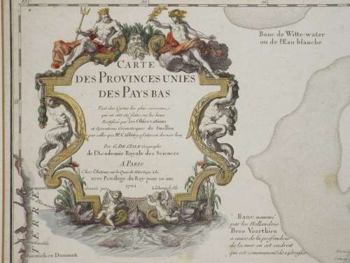
Marks/Observations: Copper engraving, printed on paper. The English translation of the upper cartouche reads Map Of The United Provinces Of The Netherlands Drawn From The Most Correct Maps Which Have Been Made There, Rectified By The Observations And Geometric Operations Of Snellius And By Those Last Made There By Mr. Cassini. By G. De L'Isle. Geographer of the Royal Academy of Sciences. Engraved by Lièbaux the son
Condition: Very good overall condition, slight foxing observed.
Dimensions: 68.5 cm x 52 cm.  Sent unframed, not mounted.
Price: R3,000.00
Courier & Packing: R30.00
 
Please note, I am NOT a qualified archaeologist/antiquarian and the description I have given is based on research of the subject.
This is a genuine antique. Please remember the classification of an 'antique' is that it should be 100 years old, OR MORE.
 
Terms: We offer a strict three-day approval period from the date the parcel reaches you. Refunds/credits are based on the cost of the article, NOT including delivery charges. Please advise us within this period whether you would like to return any article for a refund/credit. Although we pride ourselves in our packing, the buyer remains responsible for loss, non-arrival or damage to goods being sent to, or returned.

Recently viewed

See more
55% OFF
Intel Core i5-7th Gen CPUs different model in stock
Secondhand
R720.00 R1,600.00
Monty Python's Flying Circus Just the Words Graham Chapman
Secondhand
R110.00
Bumper LED DRL With Amber Turn Indicator - MONSTER
New
R150.00
80% OFF
iPHONE 4S BOX ONLY
Secondhand
R99.00 R500.00