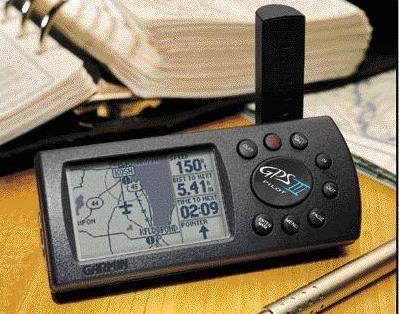
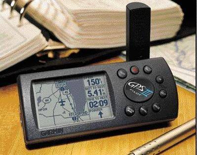
Garmin GPS III Pilot Aviation GPS with external antenna, Car lighter cable, PC interface cable, carry bag. Price negotiable.

Garmin Site with features and specifications
Navigation Features
Waypoints: Total: 500 each with name, symbol and map display optional
Nearest: 9 (automatic) continuously updated
Routes: 20 reversible with up to 30 waypoints each, plus TracBackTM
Map Datums: Over 106
Performance
Receiver: 12 parallel channels continuously tracks and uses up to 12 satellites to compute and update position
Acquisition Times: Warm: Approx. 15 seconds, Cold: Approx. 45 seconds
AutoLocateTM: Approx. 5 minutes
Update Rate: 1/second, continuous
Accuracy: Position: 15 meters (49 feet) RMS*
Velocity: 0.1 knot RMS steady state
Dynamics: 6 g ’ s
Interfaces: NMEA 0183, RTCM 104 DGPS corrections and proprietary GARMIN for all GARMIN panel mounts, PC interface kit and database updates
Antenna: Detachable with standard BNC-type connector
Physical
Size: 2.32"H x 5"L x 1.62"W (5.9 x 12.7 x 4.1 cm)
Weight: 9 ounces (255g) with batteries
Display: 2.2"W x 1.5"H (5.6 x 3.8 cm) high-contrast electroluminescent
backlit FTN display; switchable orientation
Memory: Internal lithium battery backup lasts up to 10 years
Power Source: 4 AA batteries or 10-32vDC
Usage: 0.75 watts – battery life 8 to 10 hours
Accessories (Optional)
Standard: GPS III PILOT Receiver
Dash Mount
Owner’s Manual
Quick Reference Guide
Wrist Strap
Optional: Yoke Mount
Cigarette Lighter Adapter
Carrying Case
Suction Cup Antenna Mount
Power/Data Cable
PC Interface Kit
PC Update Cable
Plotter/Moving Map Features
Database: Built-in Jeppesen®; includes worldwide airports and VOR’s, plus Americas, or Atlantic International, or Pacific International NDB’s, Intersections, special use and controlled airspace, runway data, plus airport, FSS, and ARTCC frequencies
Base Map: Americas or International; Includes: state/country boundaries, lakes, rivers, railroads, cities, coastlines, US, state, and interstate highways, and local thoroughfares
Plotting Scales: 500 ft to 5000 mile screen width with push-button zoom control