This item has closed with no items sold
View the relisted Item
View other items offered by Heritage Trades1076

Similar products

Modern Handguns, the complete illustrated guide, military and civilian handguns
R40.00
Multilingual illustrated dictionary CD-ROM - Nthuseng Tsoeu
R620.00
Ultimate Atlas of the World by P Steele and K Lye. 1999. H/C. Large format. 256 pp. Weight: 1,4 kg
R65.00
Old world lace a concise illustrated guide
R50.00
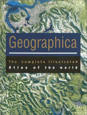
Geographica - The Complete Illustrated Atlas of the World ( with CD) - LARGE
Closed

Geographica - The Complete Illustrated Atlas of the World ( with CD) - LARGE

1 was available / new
R850.00
Shipping
R35.00 Standard shipping using one of our trusted couriers applies to most areas in South Africa. Some areas may attract a R30.00 surcharge. This will be calculated at checkout if applicable.
Check my rate
The seller allows collection for this item. Buyers will receive the collection address and time once the order is ready.
The seller has indicated that they will usually have this item ready to ship within 2 business days. Shipping time depends on your delivery address. The most accurate delivery time will be calculated at checkout, but in general, the following shipping times apply:
 
Standard Delivery
Main centres:  1-3 business days
Regional areas: 3-4 business days
Remote areas: 3-5 business days
Buyer protection
Get it now, pay later

Product details

Condition
New
Location
South Africa
Product code
bhs15
Bob Shop ID
644832385

Mynah Books, 2003, hardcover, illustrated, with CD, protective case with carry handle,  617 pages, folio size (26.7 cms x 39.5 cms x 5.7 cms), condition: as new.

Produced by Random House (Australia). The Atlas opens with a two-part introduction that includes essays and topical maps grouped as "Planet Earth" and "People and Society," respectively. The core of book is, of course,  an atlas, containing maps arranged into eight world regions, each including entries for all independent countries and dependencies with text, flag, and "fact file." 

 Geographica reflects most of the recent geopolitical changes, (new) provincial boundaries in South Africa, the return of Hong Kong and Macao to China,, the establishment of the Canadian territory of Nunavut, and the reversion of Zaire to the Democratic Republic of the Congo.

The Atlas concludes with a gazetteer/index and features many color illustrations throughout. The accompanying CD features most maps from the atlas as well as informative text and images. 

                                                                                      A SUMPTUOUS LARGE COFFEE TABLE PRODUCTION.

Recently viewed

See more
WALL MAINS SOCKET SINGLE 16A 4x4 STI-1075
R38.77
CK Tools (3780F) Cutter, Tapered, Side, 110 mm, Full Flush, 0.8 mm
R2,659.00
Fit For VW Passat CC 2009-2010 Front Left Side Corner Signal Clear Amber Light
R766.00
Hungary 1936 Airmail
R2.00 1 bid