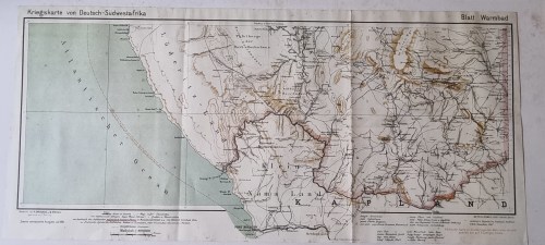
German 1904 War Map Richtersveld , Kriegskarte von Deutsch-Sudwestafrika. 1987 National Archives

Secondhand
1 available
R495.00
Shipping
Standard courier shipping from R30
R30 Standard shipping using one of our trusted couriers applies to most areas in South Africa. Some areas may attract a R30 surcharge. This will be calculated at checkout if applicable.
Check my rate
Free collection from Newlands, Cape Town
The seller allows collection for this item and will be in contact with the full collection address once the order is ready. Ready for collection by Friday, 10 May.
Ready to ship in
The seller has indicated that they will usually have this item ready to ship within 3 business days. Shipping time depends on your delivery address. The most accurate delivery time will be calculated at checkout, but in general, the following shipping times apply:
 
Standard Delivery
Main centres:  1-3 business days
Regional areas: 3-4 business days
Remote areas: 3-5 business days
Buyer Protection How you're covered
Get it now, pay later

Product information

Condition:
Secondhand
Location:
South Africa
Bob Shop ID:
612225389

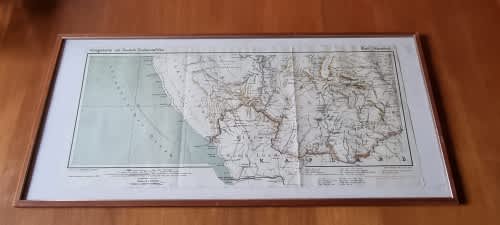
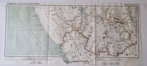
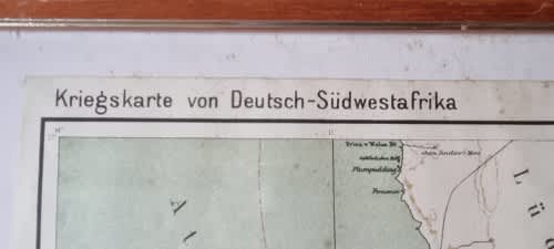
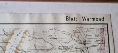
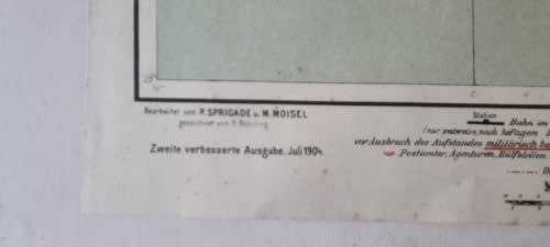
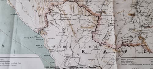
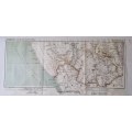
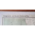
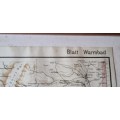
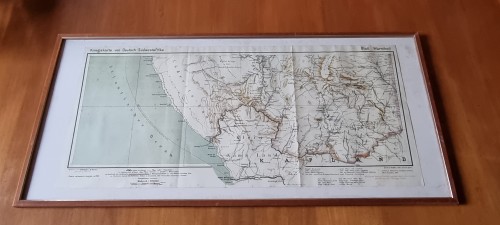
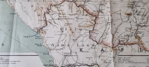
Here we have a large map of the area in Namibia, then German South-West Africa,  around the southern border with South Africa, including Port Nolloth and the coastline north to "Luderitz-land"  the Richtersveld, and the southern part of Namibia ( then German South-West Africa ) centering on Warmbad.  The map was drawn in 1904 by the German authorities then in control of South-West Africa.

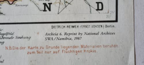
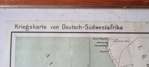
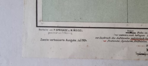
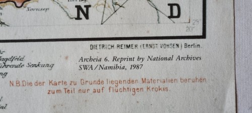
Drawn by Dietrich Reimer and Ernst Vohsen in Berlin from work done by P. Sprigade and M. Moisel. Official title is Kriegskarte von Deutsch-Sudwestafrika. Blatt Warmbad

This map is a reprint as re-issued in 1987 by the National Archives of SWA/Namibia as part of their Archeia 6 series.

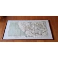
Map is overall in very good condition with very minimal foxing. The border area between the map and the frame has some foxed areas ( age-spotting ).

Nicely framed in a solid wooden frame with gilt border. I have treated the frame with Woodoc.  Ready to hang on your wall. 66 cm x 30.5 cm. Frame is 77.5 cm x 36.5 cm .


More from this seller

View all
R30 shipping
Painting of Bali Terraces, Figures Harvesting Rice on Cloth. Signed on back.
R595
R30 shipping
86% OFF
Abyssinian Slaves at Korti. Hand painted original 1847 tinted lithograph by Roberts and Haghe
R950 R7,000
R30 shipping
Japie Basson. Die Rammelland van `n Rotsrymelaar. No. 41/100. GETEKEN ( signed )
R495
R30 shipping
Lojale Verset deur N.P. van Wyk Louw. Skaars 1939 Eerste Uitgawe!
R775
Add to cart

Similar products

R30 shipping
13% OFF
WORLD WALL MAP National Geographic
R1,050 R1,200
Australia Map 1968 by National Mapping Digital Download
R295
R30 shipping
German 1904 War Map of Skeleton Coast. Kriegskarte von Deutsch-Sudwestafrika. 1987 National Archives
R695
Map of the Colony of Natal 1904 4 x Maps Digital Download
R295