This auction has been won.
Leading
td123393 1 × R610.00
12 Feb 06:35
Runner-up
CHorner44 1 × R610.00
12 Feb 07:41

Similar products

National geographic Africa poster map wall map
Secondhand
R270.00
1720`S MAP OF UNITED PROVINCES OF NETHERLANDS BY HERMAN MOLL
Secondhand
R12,799.00
1809 Map of Africa, Great Condition, Original Russel / Stratford Map
Secondhand
R1,350.00
Map Studio 2nd Edition Southern Africa Folded Map
Secondhand
R95.00
HERMAN MOLL MAP OF AFRICA, PUBLISHED 1729 HERMAN MOLL MAP OF AFRICA, PUBLISHED 1729 HERMAN MOLL MAP OF AFRICA, PUBLISHED 1729
Sold

HERMAN MOLL MAP OF AFRICA, PUBLISHED 1729

Secondhand 1 was available
Indicative market price: R3,000.00
R20.00 minimum increment
R610.00
Shipping
R35.00 Standard shipping using one of our trusted couriers applies to most areas in South Africa. Some areas may attract a R30.00 surcharge. This will be calculated at checkout if applicable.
Check my rate
The seller has indicated that they will usually have this item ready to ship within 3 business days. Shipping time depends on your delivery address. The most accurate delivery time will be calculated at checkout, but in general, the following shipping times apply:
 
Standard Delivery
Main centres:  1-3 business days
Regional areas: 3-4 business days
Remote areas: 3-5 business days
Buyer protection

Product details

Condition
Secondhand
Location
South Africa
Area
Africa
Time Period
Pre-1800s
Type
Cartogram
Customer ratings:
Bob Shop ID
455085571

HERMAN MOLL MAP OF AFRICA, PUBLISHED 1729
The South West Part of Africa Containing Congo, Angola, Benguel, Monomotapa, Caffers, Terrra de Natal &c.

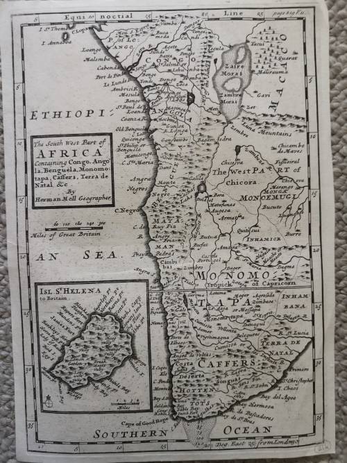
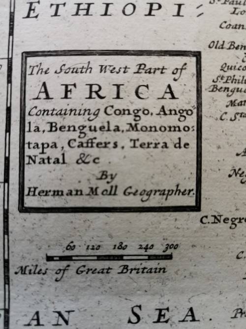
Herman Moll (c. 1654-1732) was one of the most important London mapmakers in the first half of the eighteenth century.  Moll was probably born in Bremen, Germany, around 1654. He moved to London to escape the Scanian Wars. His earliest work was as an engraver for Moses Pitt on the production of the English Atlas, a failed work which landed Pitt in debtor's prison. Moll also engraved for Sir Jonas Moore, Grenville Collins, John Adair, and the Seller & Price firm. He published his first original maps in the early 1680s and had set up his own shop by the 1690s. 

Moll's work quickly helped him become a member of a group which congregated at Jonathan's Coffee House at Number 20 Exchange Alley, Cornhill, where speculators met to trade stock. Moll's circle included the scientist Robert Hooke, the archaeologist William Stuckley, the authors Jonathan Swift and Daniel Defoe, and the intellectually-gifted pirates William Dampier, Woodes Rogers and William Hacke. From these contacts, Moll gained a great deal of privileged information that was included in his maps. 

Over the course of his career, he published dozens of geographies, atlases, and histories, not to mention numerous sheet maps. His most famous works are Atlas Geographus, a monthly magazine that ran from 1708 to 1717, and The World Described (1715-54). He also frequently made maps for books, including those of Dampiers publications and Swifts Gullivers Travels. Moll died in 1732. It is likely that his plates passed to another contemporary, Thomas Bowles, after this death. 


Recently viewed

See more
70% OFF
Battery Grip Compatible with EOS 1100D 1200D Rebel T3
New
R179.00 R600.00
Alcatel Link Key 4G Cat4 150 Mbps Dongle (All Networks)
New
R149.00 No bids
SYRI 5ML LS 2P NEEDLE 21Gx38MM H/E 100~
New
R150.94
65% OFF
Luxury Soft-Bristle Shoe Brush With Liquid Container
New
R65.00 R188.00

Customer ratings: 1 ratings

Great seller, Item as described. Very happy
03 Mar 2020