| Main centres: | 1-3 business days |
| Regional areas: | 3-4 business days |
| Remote areas: | 3-5 business days |
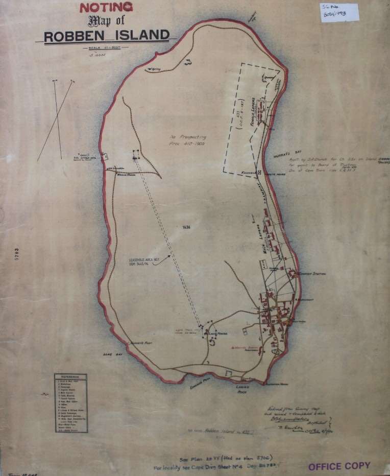
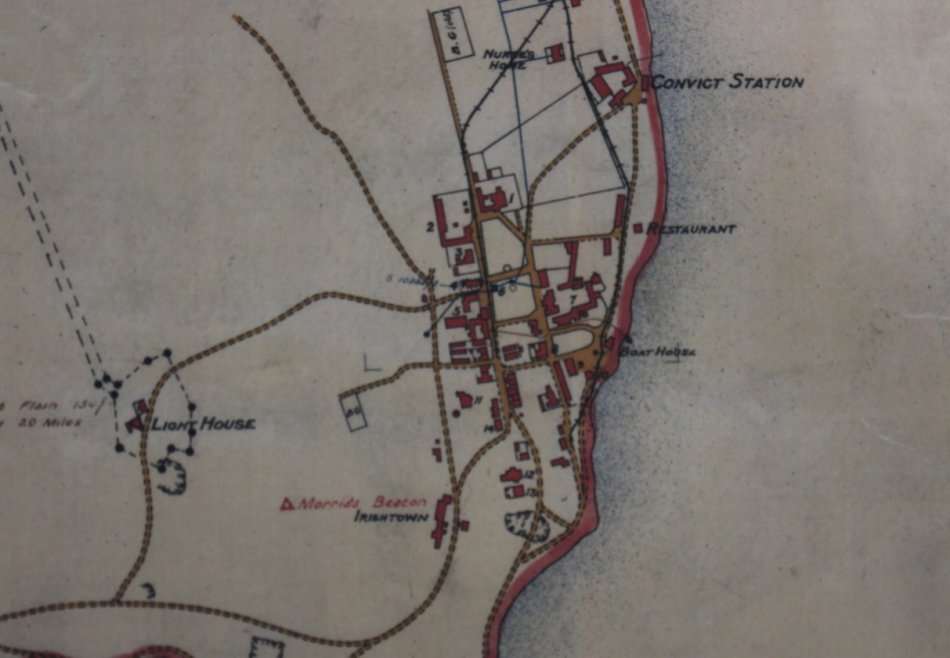
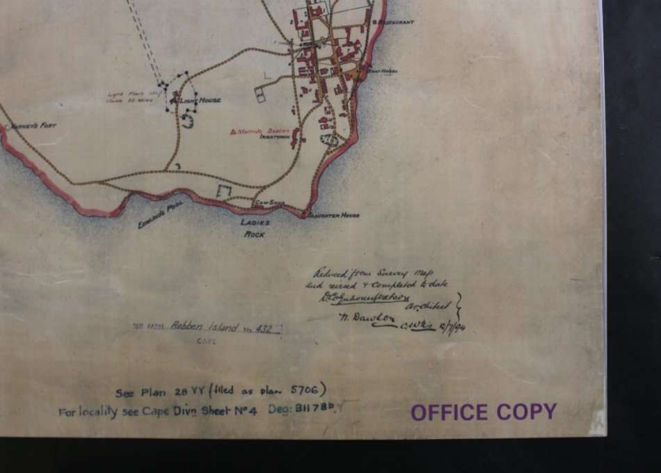
Title: Historical Map of Robben Island @ 1880's , Reproduction Print.
Publisher: Cape Survey Office.
Scale: 1 Inch = 600 Feet.
Year: approx. late 1800's.
Height: 62cm.
Width: 51cm.
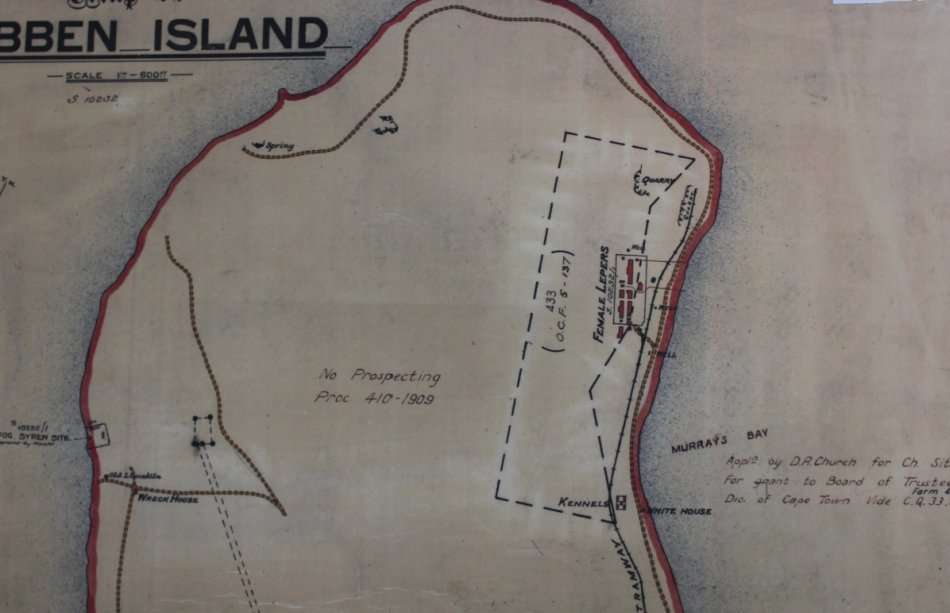
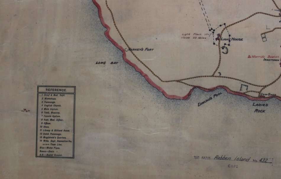
Info: Historical Map of Robben Island from circa 1880's when it was still a Leper Colony.
Buildings and Hospital Blocks as well as the Lighthouse which was constructed in 1865 are indicated.
Format: Scanned and Printed on Poster Paper.
Map Type: Reproduction Print.
Condition: Excellent.
Price: R 295.00 Inc Vat.
![]()
![]()