Historical Map of Robben Island @ 1880`s Reproduction Print
Secondhand
Shipping
Standard courier shipping from R30
R30 Standard shipping using one of our trusted couriers applies to most areas in South Africa. Some areas may attract a R30 surcharge. This will be calculated at checkout if applicable.
Check my rate
Check my rate
Free collection from
Kuils River, Cape Town
The seller allows collection for this item and will be in contact with the full collection address once the order is ready.
Ready for collection by Thursday, 30 May.
Ready to ship in
The seller has indicated that they will usually have this item
ready to ship within 3 business days. Shipping time depends on your delivery address. The most
accurate delivery time will be calculated at checkout, but in
general, the following shipping times apply:
Standard Delivery
| Main centres: | 1-3 business days |
| Regional areas: | 3-4 business days |
| Remote areas: | 3-5 business days |
Returns
Get it now, pay later
Seller
Buyer Protection
Product details
Condition
Secondhand
Location
South Africa
Area
Africa
Time Period
1900-1950
Type
Political Map
Bob Shop ID
614830072
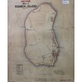
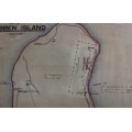
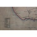
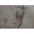
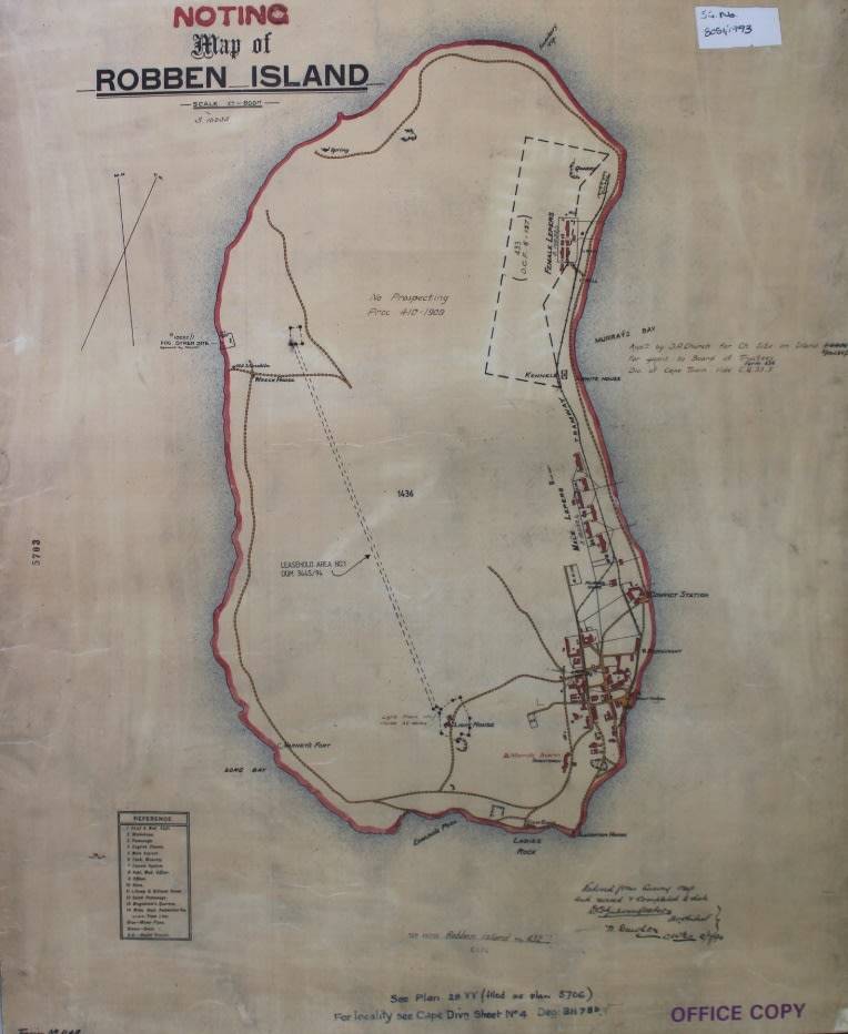
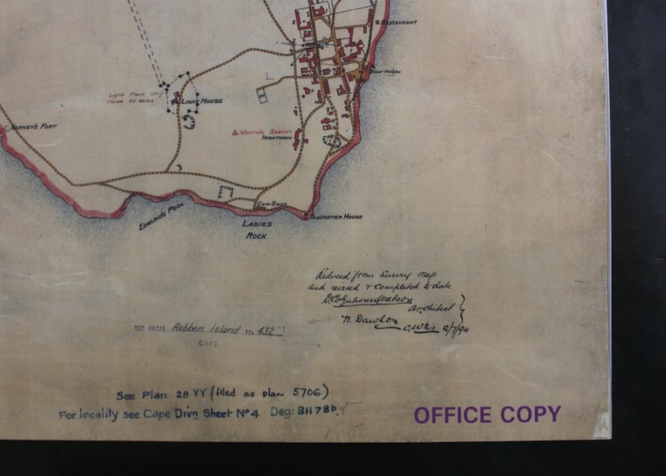
Title: Historical Map of Robben Island @ 1880's , Reproduction Print.
Publisher: Cape Survey Office.
Scale: 1 Inch = 600 Feet.
Year: approx. late 1800's.
Height: 62cm.
Width: 51cm.
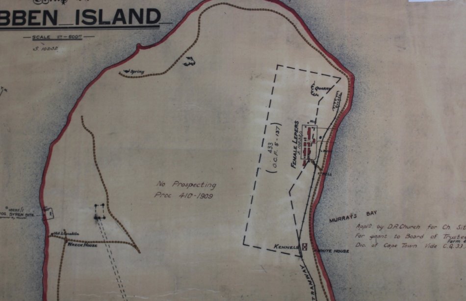
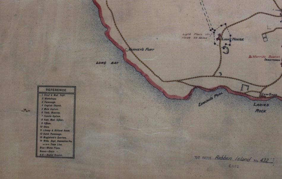
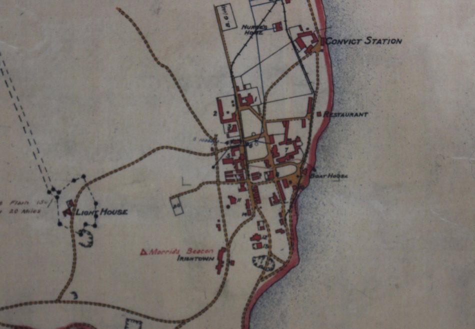
Info: Historical Map of Robben Island from circa 1880's when it was still a Leper Colony.
Buildings and Hospital Blocks as well as the Lighthouse which was constructed in 1865 are indicated.
Format: Scanned and Printed on Poster Paper.
Map Type: Reproduction Print.
Condition: Excellent.
Price: R 295.00 Inc Vat.
![]()