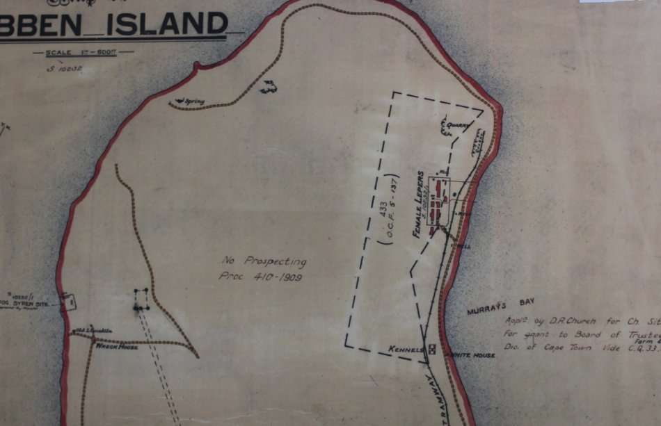
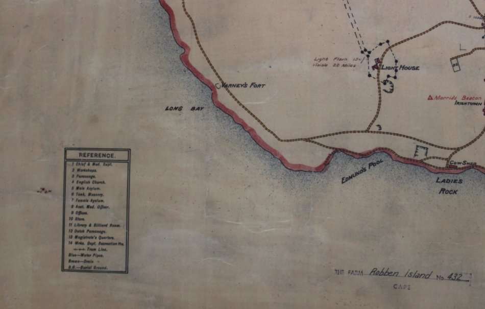
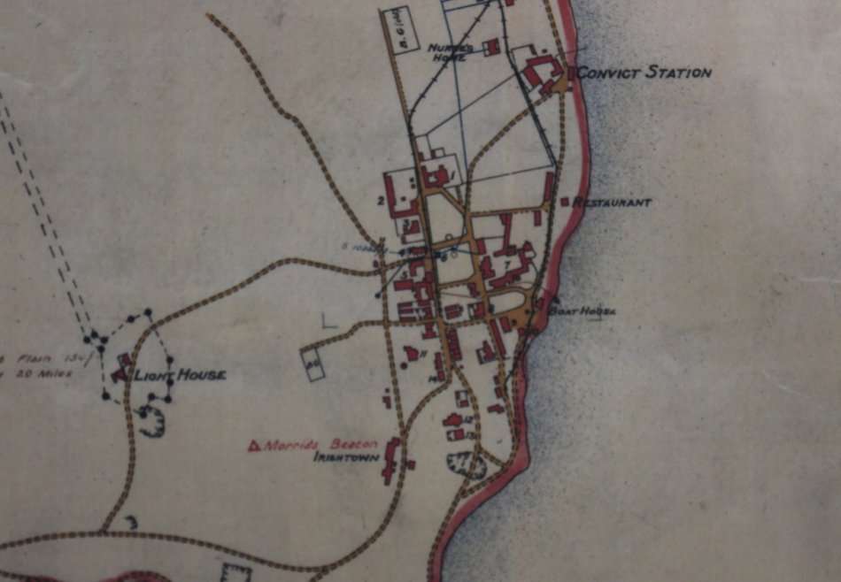
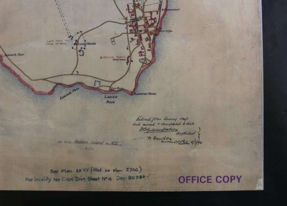
Historical Map of Robben Island @ 1880`s Reproduction Print Historical Map of Robben Island @ 1880`s Reproduction Print Historical Map of Robben Island @ 1880`s Reproduction Print Historical Map of Robben Island @ 1880`s Reproduction Print Historical Map of Robben Island @ 1880`s Reproduction Print Historical Map of Robben Island @ 1880`s Reproduction Print Historical Map of Robben Island @ 1880`s Reproduction Print
Historical Map of Robben Island @ 1880`s Reproduction Print Historical Map of Robben Island @ 1880`s Reproduction Print Historical Map of Robben Island @ 1880`s Reproduction Print Historical Map of Robben Island @ 1880`s Reproduction Print
Historical Map of Robben Island @ 1880`s Reproduction Print
+3

Historical Map of Robben Island @ 1880`s Reproduction Print

1 available / secondhand
R295.00
Shipping
Free shipping is available from CapeCollectables for all orders above R1,500.00, using one of our trusted couriers.
Check my rate
The seller allows collection for this item. Buyers will receive the collection address and time once the order is ready.
The seller has indicated that they will usually have this item ready to ship within 3 business days. Shipping time depends on your delivery address. The most accurate delivery time will be calculated at checkout, but in general, the following shipping times apply:
 
Standard Delivery
Main centres:  1-3 business days
Regional areas: 3-4 business days
Remote areas: 3-5 business days
Seller
Buyer protection
Get it now, pay later
Product details

Condition
Secondhand
Location
South Africa
Area
Africa
Time Period
1900-1950
Type
Political Map
Product code
8326209
Bob Shop ID
630336962

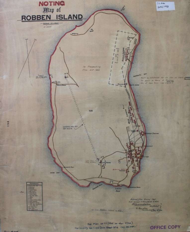
Title: Historical Map of Robben Island @ 1880's - 1894, Reproduction Print.
Publisher: Cape Survey Office.
Scale: 1 Inch = 600 Feet.
Year: approx. late 1800's  and updated in  July 1894.
Height: 62cm.
Width: 51cm.
Info: Historical Map of Robben Island from circa 1880's when it was still a Leper Colony.
Buildings and Hospital Blocks as well as the Lighthouse which was constructed in 1865 are indicated.
Format:  Scanned and Printed on Poster Paper.
Map Type: Reproduction Print.
Condition: Excellent.
Price: R 295.00 Inc Vat.


Add to cart

Recently viewed

See more
VICKS ACTAPLUS WET + DRY 200ML
R141.93
Geeko Black And Silver USB Mini Optical Mouse- 1 Year Limited Warranty
R113.14
45% OFF
1Pc Black For iPhone 12 Mini F1 Racing Pattern Phone Case
R132.00 R241.00
Dc Dc Converter Dil I=24 O=24 V 15 W Urb2424 Ymd 15 Wr3 *A*
R486.44

Similar products

Vintage Africa / Afrika Wall Map 1951 Reproduction print.
R195.00
South Western Districts, Cape and Malmesbury @ 1890, Reproduction Printed Wall Map
R395.00
Map Of Cape Town 1884 Reproduction Poster Print
R295.00
Cape Peninsula 1934 - 80th Anniversary Surveys and Mapping, Set of 4 Maps, Reproduction Prints
R550.00