This item has closed 1 buyer bought 1 item
View other items offered by Heritage Trades1196

Similar products

The Megalith Builders of Western Europe
New
R250.00
Blenheim: Battle for Europe
Secondhand
R80.00
A GENERAL HISTORY OF EUROPE PART2 1500-1922OJThatcher,FSchwill with maps and genealogical tables1928
Secondhand
R340.00
EUROPE AND AFRICA
Secondhand
R60.00
Historical Maps of Europe
Sold

Historical Maps of Europe

New 1 was available
R350.00
Shipping
R35.00 Standard shipping using one of our trusted couriers applies to most areas in South Africa. Some areas may attract a R30.00 surcharge. This will be calculated at checkout if applicable.
Check my rate
The seller allows collection for this item. Buyers will receive the collection address and time once the order is ready.
The seller has indicated that they will usually have this item ready to ship within 2 business days. Shipping time depends on your delivery address. The most accurate delivery time will be calculated at checkout, but in general, the following shipping times apply:
 
Standard Delivery
Main centres:  1-3 business days
Regional areas: 3-4 business days
Remote areas: 3-5 business days
Buyer protection
Get it now, pay later

Product details

Condition
New
Location
South Africa
Customer ratings:
Product code
BH
Bob Shop ID
575622826

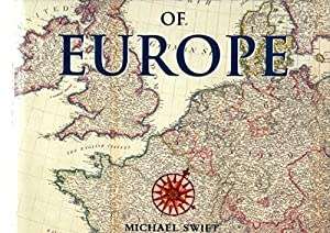
PRC Publishing, 2000, hardcover, 144 pages, landscape format, full colour page sized maps, index, 29 cms x 25.5 cms, condition: as new.

The maps in this book are reprinted from the collection held at the Public Records office in Kew, London. These superbly crafted charts, which have been accumulated from sources all over Europe over many years, are remarkable documents that until now have been accessible only to researchers. Dating from the earliest days of professional mapmaking, they chart over three centuries of European history through cartography. From the earliest representations of the mapmakers art in the 16th century, when the skills required to produce detailed scale maps first developed, to the elegant charts of the 19th century, they show the rise and fall of empires and the development of powerful nations. With an introduction that chronicles European history and detailed captions that explain the historical context of each of the maps, this is a fascinating work that is as insightful as it is attractive.

Recently viewed

See more
Al Wat Tel - Irma Venter
New
R370.00
Hard LCD Toughened Glass Screen Protection Film for Canon EOS 7D Mark I
New
R99.00
Universal Metal Screw In Lens Hood (55mm Filter Thread) - WIDE
New
R135.00
Wire World Synthetic Resin Woven Ball Pendant - White
New
R1,209.00

Customer ratings: 1 ratings

Beautifull product.
04 Jan 2023