This item has closed with no items sold
View the relisted Item
View the relisted Item
View other items offered by Imagine Books Etcetera477
Similar products

Jeppe`s Map of the Transvaal (SA Republic) - Boer War Maps - Complete Set of Six Original Maps
Secondhand
Indicative market price: R40,000
R37,500
Closed
28 Apr 24 16:16
Shipping
Standard courier shipping from R30
R30 Standard shipping using one of our trusted couriers applies to most areas in South Africa. Some areas may attract a R30 surcharge. This will be calculated at checkout if applicable.
Check my rate
Check my rate
Ready to ship in
The seller has indicated that they will usually have this item
ready to ship within 3 business days. Shipping time depends on your delivery address. The most
accurate delivery time will be calculated at checkout, but in
general, the following shipping times apply:
Standard Delivery
| Main centres: | 1-3 business days |
| Regional areas: | 3-4 business days |
| Remote areas: | 3-5 business days |
Buyer Protection
How you're covered
Product information
Condition:
Secondhand
Location:
South Africa
Area:
Africa
Time Period:
1800s
Type:
Physical Map
Product code:
JMSAR
Bob Shop ID:
610438222
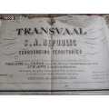
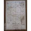
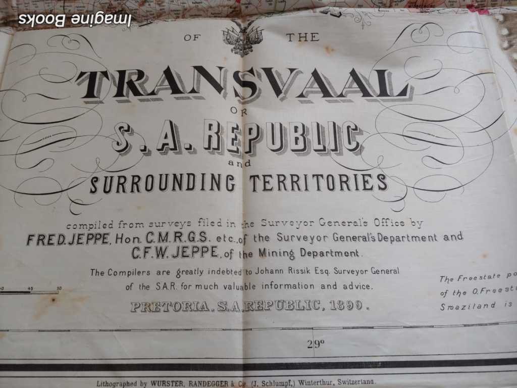
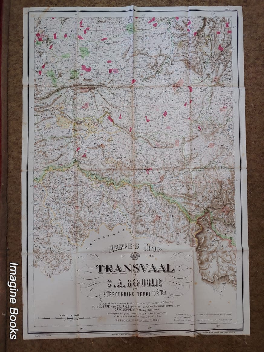
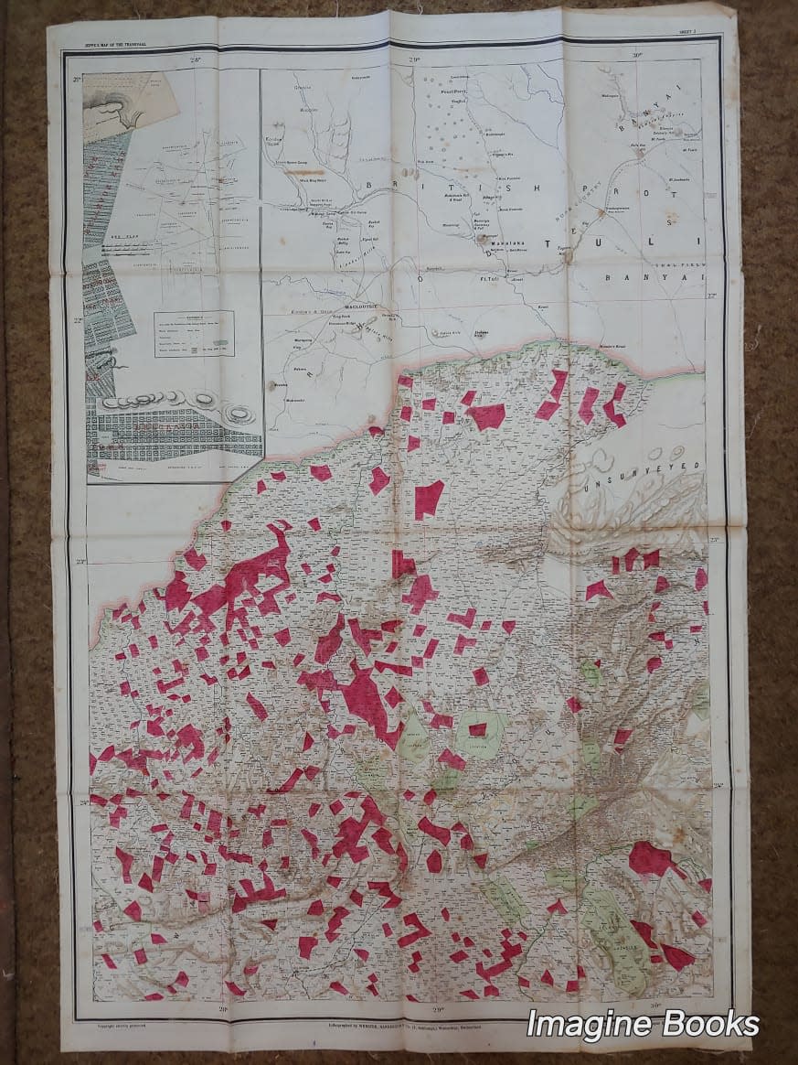
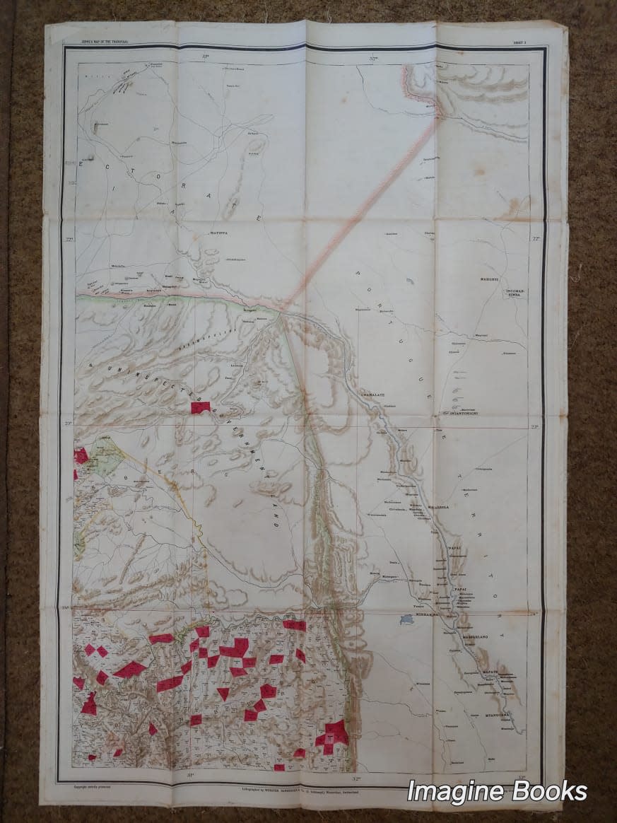
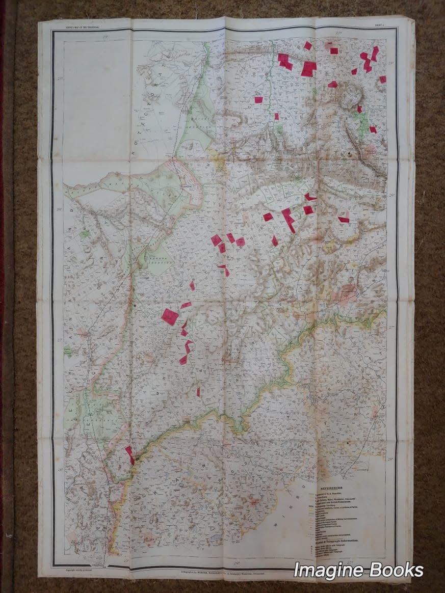
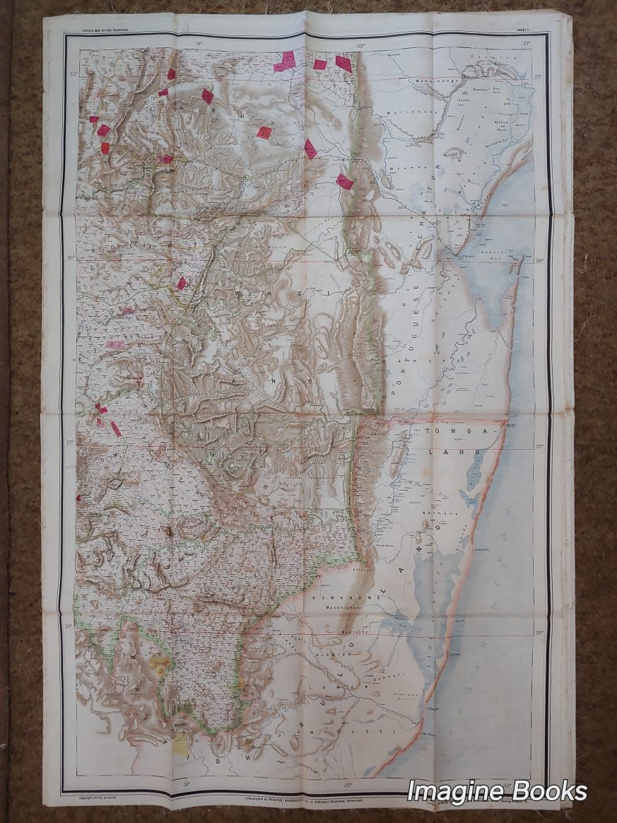
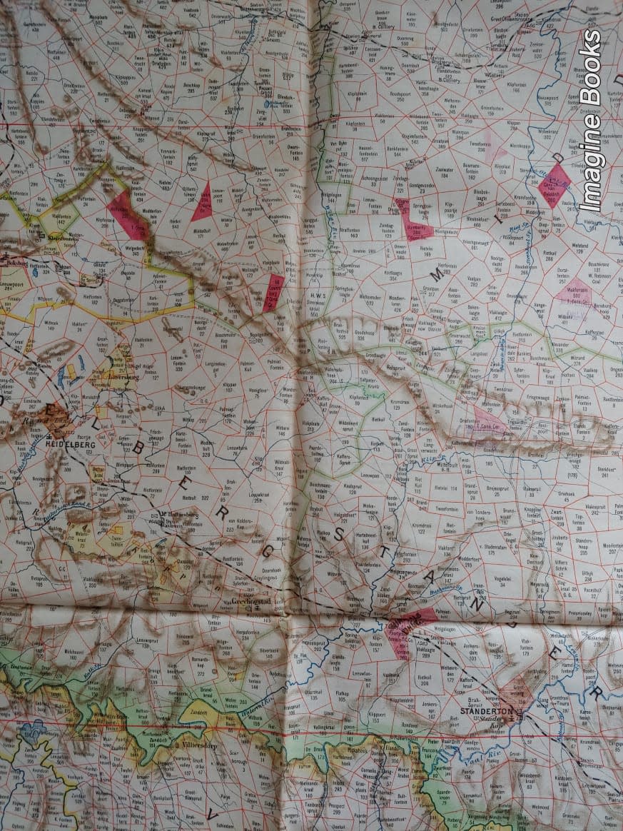
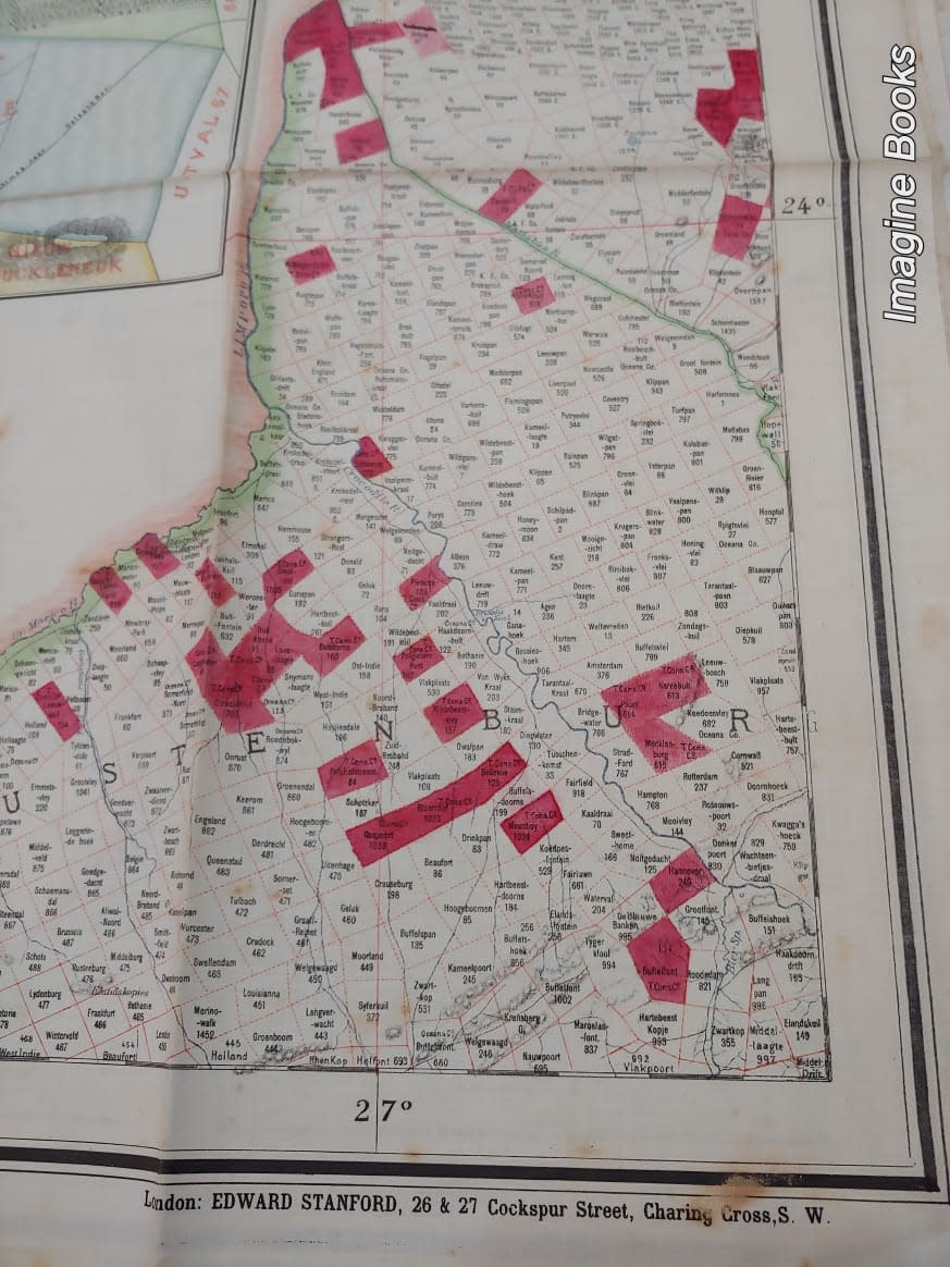
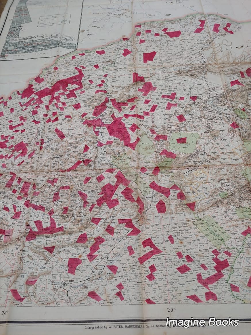
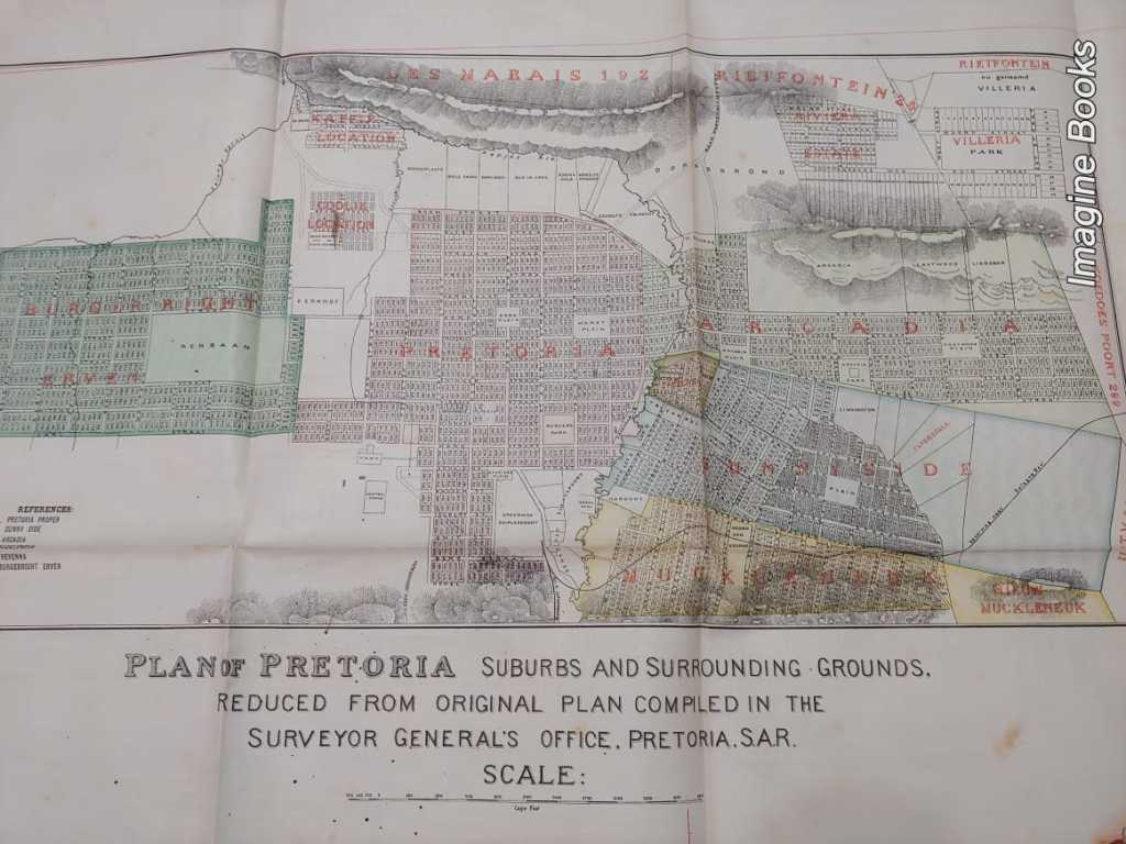
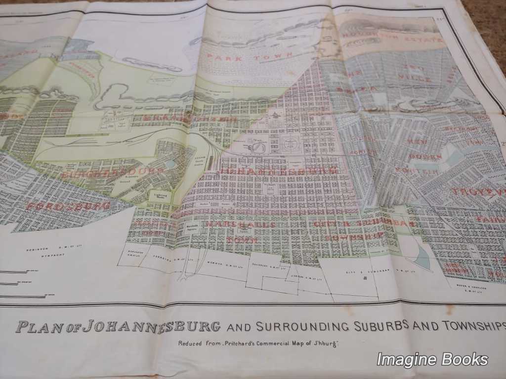
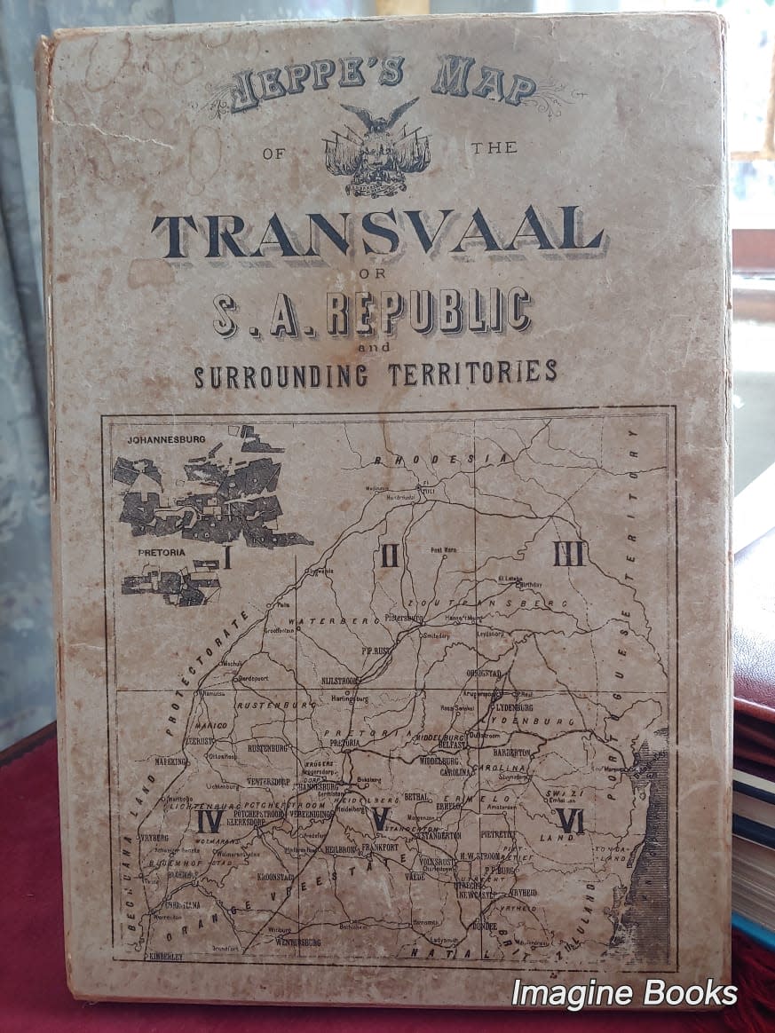
Jeppe's Map of the Transvaal or S. A. Republic and Surrounding Territories
Compiled from Surveys Filed in the Surveyor General's Office by Fred. Jeppe (Hon. C.M.R.G.S.) and C. F. W. Jeppe of the Mining Department
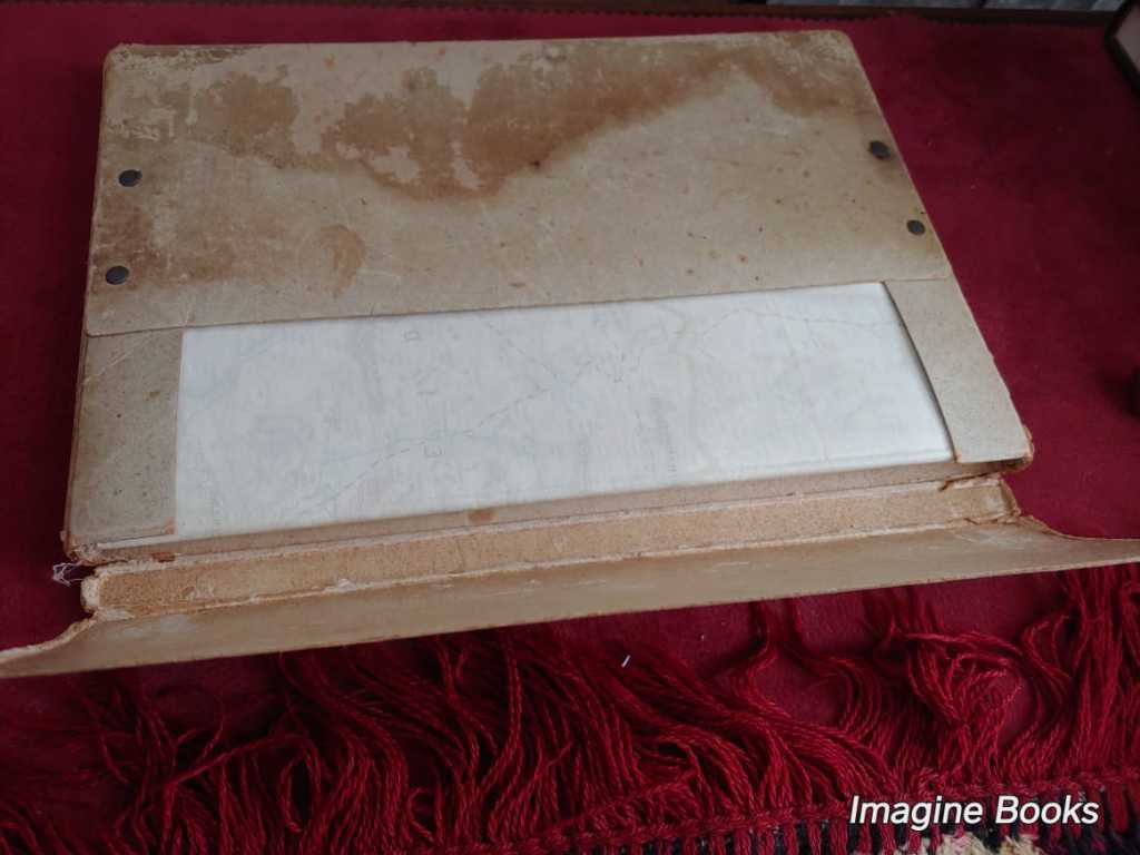
Pretoria, S. A. Republic, 1899, colour lithographs on waxed fine linen, six separate sheets (folded) housed in the original card slipcase.
Printed in Winterthur, Switzerland, by Jakob Schlumpf.
Size of each map: 670 mm x 980 mm
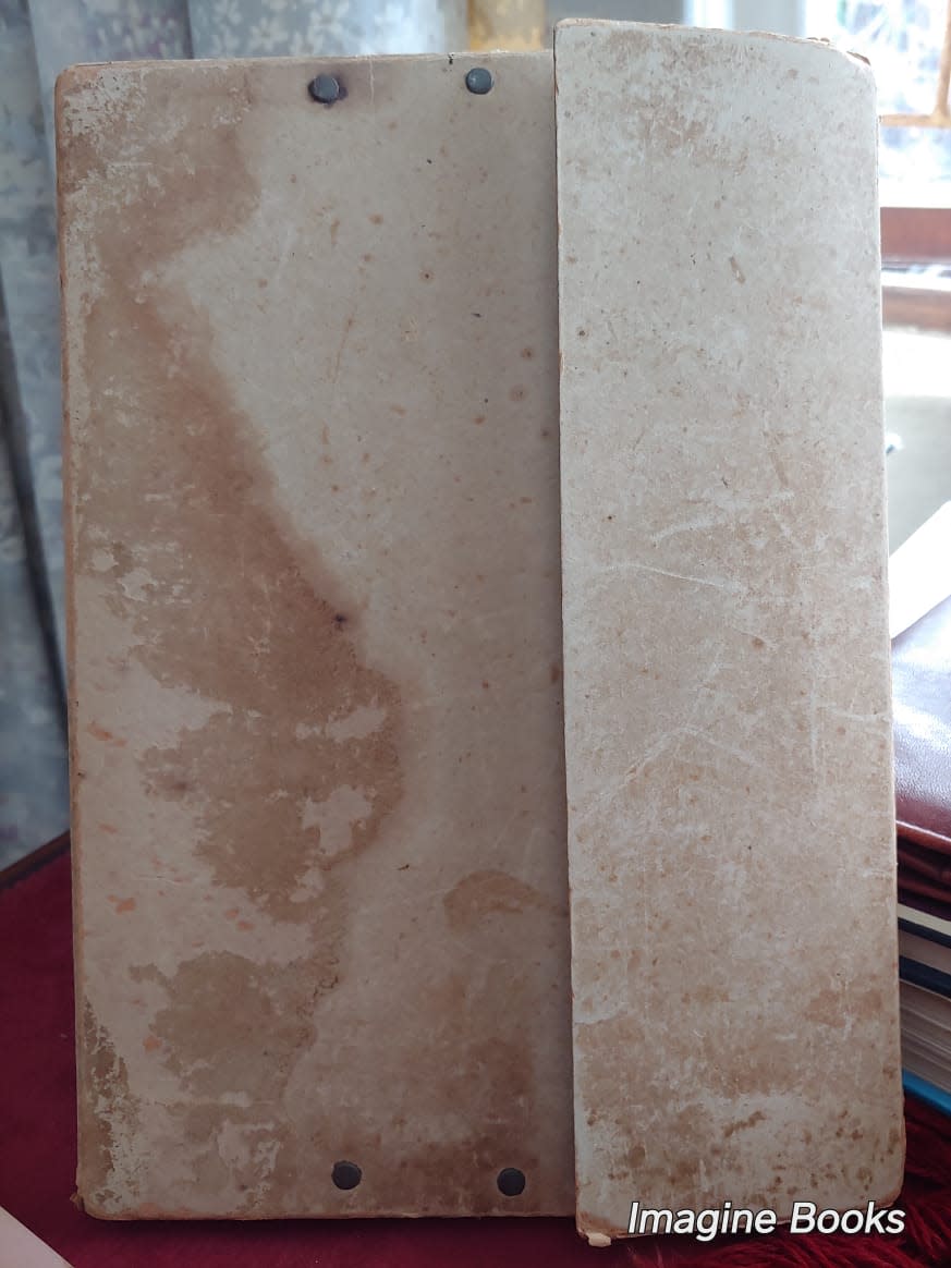
Condition: very good; occasional spotting/foxing in places, map edges fraying in places, otherwise very good condition for their age as they have been preserved in the original slipcase. The slipcase is in a worn condition, as can be expected.
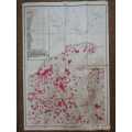
Unique feature: this particular set has a unique added feature in that many of the plots (ERFs) have been neatly highlighted in red: this is not part of the printing process and these highlighted areas appear to be hand-drawn. The significance of these highlighted plots is not indicated on the map legend, and may have had importance to either the Boer or the British forces.
The map compiles the surveys filed in the Surveyor General's Office by Friedrich Heinrich Jeppe (1834-1898) and his son Carlos Friedrich Wilhelm (Charles) Jeppe (1870-1900), with the help of Johann Rissik (1857-1925).
The Jeppes began working on the map as early as 1892 but lacked the benefit of comprehensive triangulation of the territory. This meant that the work of mapmaking took years of compilation of block surveys, sketch inspections, and a few astronomically-fixed positions, as opposed to strictly scientific surveying. "Nonetheless, it was superior to anything else available, and the British duly seized on the first shipment of some 5000 map sheets in Cape Town in January 1900." (Lindsay Frederick Braun, Royal Commission, 1903, page 452.)
Apparently, the map was originally planned to comprise only the bottom three sheets. However, additional information became available in 1898 and resulted in the expansion of the project. In fact, F.H. Jeppe, who was a Transvaal official but also a British agent, sent a copy or copies of the bottom three sheets to London via Cape Town. As a result of this, Lt. Col. Henderson, a Cape Town-based intelligence officer, was able to acquire the maps under the guise of seizure as contraband, to avoid a diplomatic incident.
Friedrich Jeppe became severely ill during the production of the map. He died in 1898 of a liver ailment, and the work was carried on by Johann Rissik and Charles Jeppe. The latter completed the map in 1899, one year before his own death, and sent away to Switzerland to have it printed.
The Second Boer War began later in 1899 and concluded in 1902 with Britain stamping out resistance and taking control of the whole country.
The map was co-published by Edward Stanford of London.
(Above information credit: https://www.raremaps.com/gallery/detail/84245)