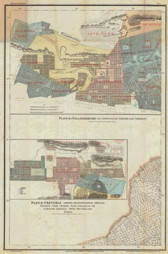
Title: Jeppe's Transvaal 1899 6 x Maps Digital Download.
Publisher: Surveyor Generals Office, Pretoria, SA Republic, 1899.
Format: Vintage Printed Maps that have been scanned and saved as Tiff images.
Printed Size on a large format printer would be as follows:-
Height: @ 100cm.
Width: 70cm.
File Size: Total of 225MB
Total Number of Files: 6 x Tiff images @ 30 to 40MB MB each
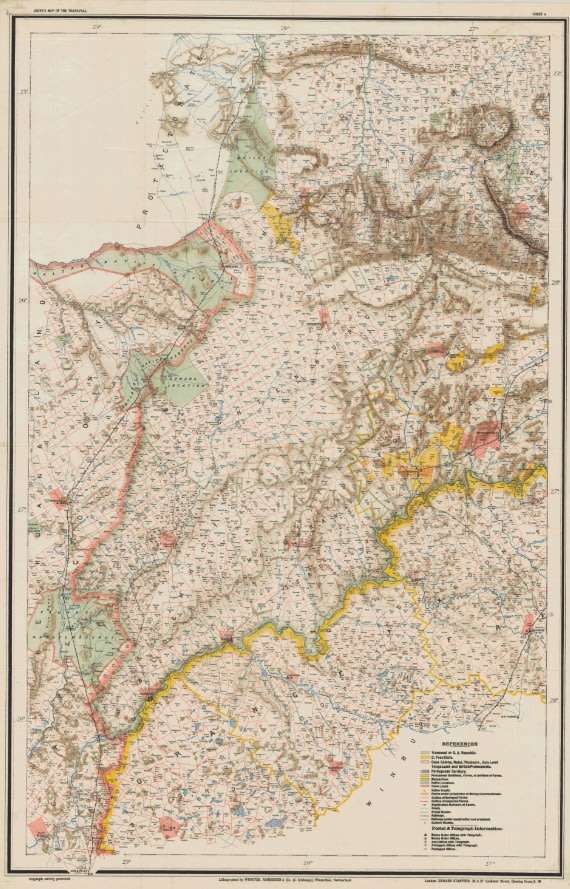
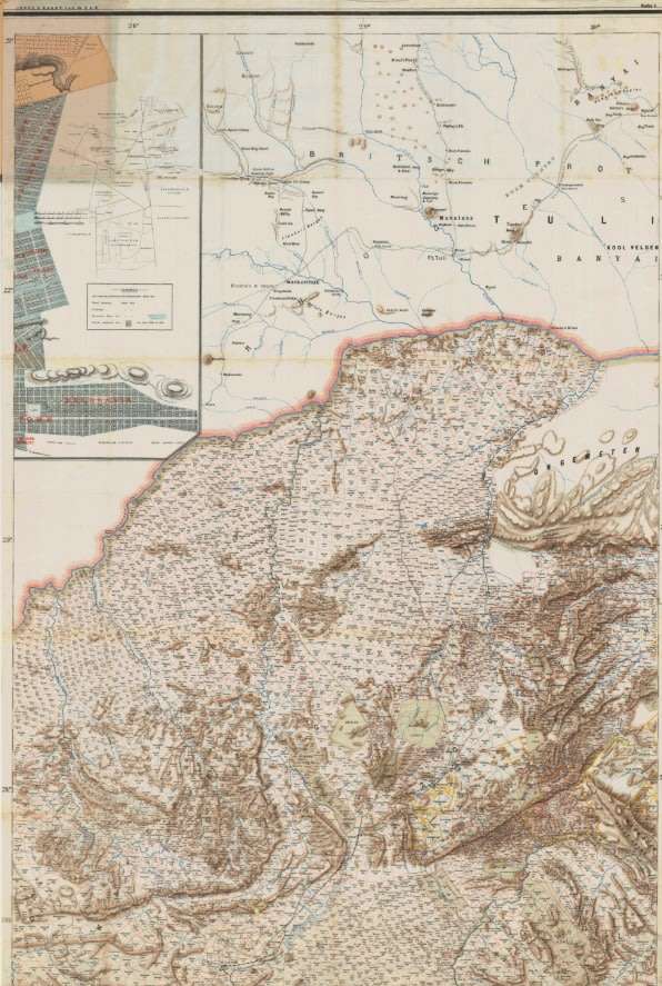
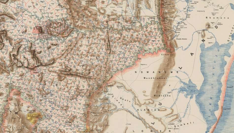
Info: Compiled from Surveys filed in the Survey Generals Office by Fred Jeppe Hon C.M.R.G.S of The Survey Generals Department and CFW Jeppe of the Mining Department.
Johan Rissik ESQ, Surveyor General of the SAR for Information and Advice.
One of a series of maps completed by the Jeppe Brothers of the South African Boer Republic of the Transvaal,
in the 1890's, prior to the Boer War. Contains Railways, Rivers, Roads, Towns and Cities with Erfs and Farm information of the whole of the Transvaal in 1899.
Scale: 1: 476 000
On completion of the order and receipt of payment a Dropbox link will be forwarded to your e-mail address for downloading of the files.
Condition: Digital Download.
Price: R 425.00 Inc Vat.
Please Note: When purchasing this item please select the "Collection" option for delivery.
This will ensure that there is no delivery cost involved on the transaction as it is a digital download.