| Main centres: | 1-3 business days |
| Regional areas: | 3-4 business days |
| Remote areas: | 3-5 business days |
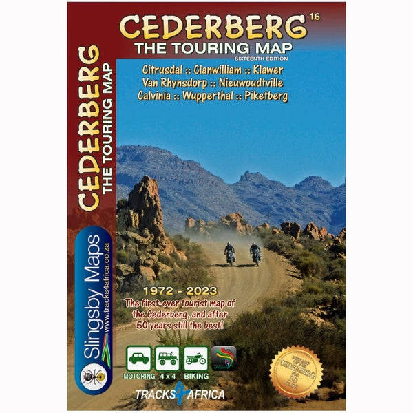
This map is designed to help you explore the Okavango and Zambesi region with confidence. Whether you travel on asphalt, gravel roads, or a combination of the two, this map is both a navigation tool and a tool to plan your trip.
Tracks4Africa, a company based in South Africa is known for its maps with GPS references. From Cape Town to Timbuktu these maps are valued for their reliability. The data on the map has been recorded by a large group of travelers across the country and this creates a continuous update and verification. Tracks4Africa therefore stands for high-quality cartography.
These maps have a large scale of 1:1,000,000. Characteristic of these maps is the combination of geographical information and GPS references, ideal for 4WD routes. Furthermore, each map contains a place name index, separate maps of the National Parks and city maps of the most important cities in the region.
These maps provide you with the perfect tool to plan your next trip to Southern Africa. You know exactly the travel time and distance over the entire road network, be it on asphalt, gravel or sand. Furthermore, detailed information is provided about tourist destinations and sights. This also makes it easy to fold so that you only see the area you need.
The main features are:
Large scale 1/1,000,000
Travel times and distances are included on the map
Extensive network of roads and paths in the nature reserves
Detailed information about campsites and attractions
Border crossings indicated with opening and closing times
Recent tourist services are listed for each city
Printed on waterproof paper Publisher: Do you also like your good old fashioned paper maps when traveling through Africa? Tracks4Africa is well known for its GPS maps, but we know that you like to have a paper map as well.
These maps are huge, 1m wide and even longer than that at a scale of 1:1 000 000. They are cleverly engineered to be used inside your car by folding open only the sections you need.
Our maps are the first maps to provide travel times over and above the normal travel distances on paper maps.
The Tracks4Africa paper maps are printed on high quality PolyArt paper which is tear and water resistant, making it a perfect material for outdoor use.
Reviews