This item has closed with no items sold
View the relisted Item
View the relisted Item
View other items offered by CapeCollectables1033
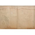
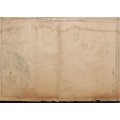
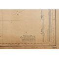
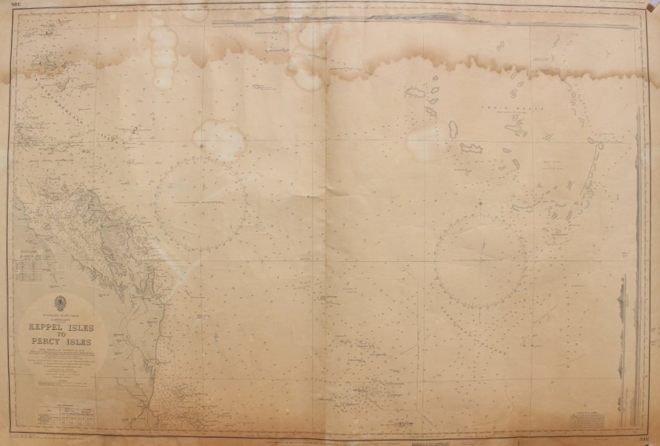
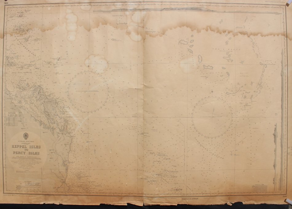
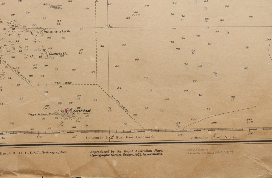
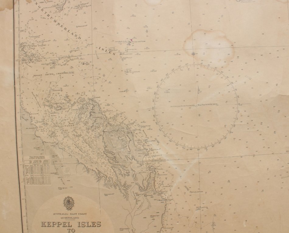
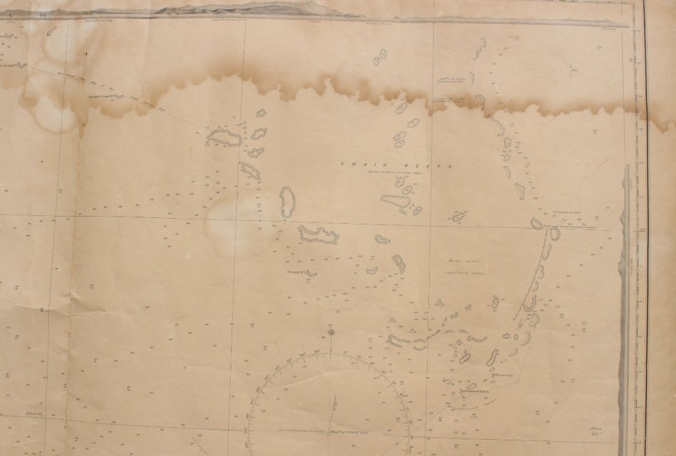
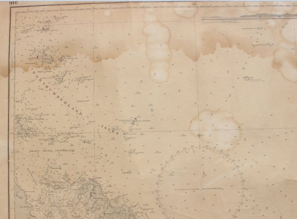
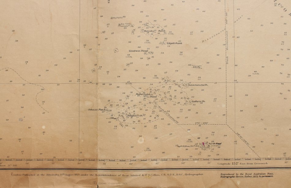
Keppel Isles to Percy Isles Australia Hydrographic Chart 1972.
Secondhand
R450.00
Closed
29 Apr 24 12:16
Shipping
Standard courier shipping from R30
R30 Standard shipping using one of our trusted couriers applies to most areas in South Africa. Some areas may attract a R30 surcharge. This will be calculated at checkout if applicable.
Check my rate
Check my rate
Free collection from
Kuils River, Cape Town
The seller allows collection for this item and will be in contact with the full collection address once the order is ready.
Ready for collection by Monday, 20 May.
Ready to ship in
The seller has indicated that they will usually have this item
ready to ship within 3 business days. Shipping time depends on your delivery address. The most
accurate delivery time will be calculated at checkout, but in
general, the following shipping times apply:
Standard Delivery
| Main centres: | 1-3 business days |
| Regional areas: | 3-4 business days |
| Remote areas: | 3-5 business days |
Returns
Get it now, pay later
Seller
Buyer Protection
Product details
Condition
Secondhand
Location
South Africa
Area
Australasia
Time Period
Post-1950
Type
Nautical Charts
Bob Shop ID
611443778
Title: Keppel Isles to Percy Isles Australia Hydrographic Chart 1972.
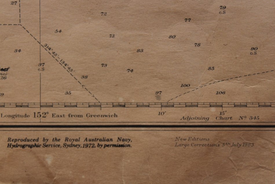
Publisher: Printed by Royal Australian Survey Corps, 1 March 1974. New Editions Large Corrections 5th July 1963. Reproduced by the Royal Australian Navy, Hydrographic Service, Sydney 1972. Crown Copyright 1963 Reserved.
Cartographer: Rear Admiral K St B Collins OBE DSC Hydrographer.
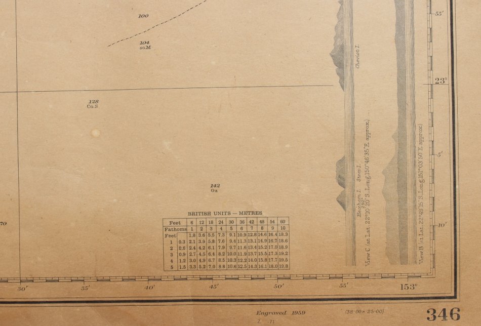
Production Date: Engraved 1959, printed 1 March 1974.
Scale: 1 to 300 000.
Info: Hydrographic Chart Number 346. Australia East Coast - Queensland. From Admiralty Surveys to 1878. North Reef to Moresby Bank from a Survey HMAS "Moresby" 1929. From Clinton to Pine Peak I from an Australian Government Chart of 1961. With additions and corrections to 1962.
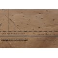
From Percy Isles in the North to Keppel Islands in the south, with Great Barrier Reef Shoals onm the Chart.
This would be a wonderful antique style map, suitable for a Nautical theme bar or office.
Format: Original release Print from 1974.
Condition: Fair, with some edges deteriorating, some wear and tear on folds. With course plotting previously on the chart.
The Chart has one fold down the centre but has been stored rolled up.
Price: R 450.00 Inc Vat.
This would be a wonderful antique style map, suitable for framing and placed in a Nautical theme bar or office.
![]()