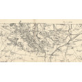
Major Jackson Series Vintage Maps of the Transvaal 1901 on 1 x 16GB USB
Secondhand
Shipping
Standard courier shipping from R30
R30 Standard shipping using one of our trusted couriers applies to most areas in South Africa. Some areas may attract a R30 surcharge. This will be calculated at checkout if applicable.
Check my rate
Check my rate
Free collection from
Kuils River, Cape Town
The seller allows collection for this item and will be in contact with the full collection address once the order is ready.
Ready for collection by Wednesday, 22 May.
Ready to ship in
The seller has indicated that they will usually have this item
ready to ship within 3 business days. Shipping time depends on your delivery address. The most
accurate delivery time will be calculated at checkout, but in
general, the following shipping times apply:
Standard Delivery
| Main centres: | 1-3 business days |
| Regional areas: | 3-4 business days |
| Remote areas: | 3-5 business days |
Returns
Get it now, pay later
Seller
Buyer Protection
Product details
Condition
Secondhand
Location
South Africa
Area
Africa
Time Period
1900-1950
Type
Political Map
Bob Shop ID
612634677
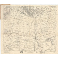
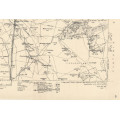
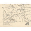
Title: Major Jackson Series Vintage Maps of the Transvaal 1901 on 1 x 16GB USB.
Publisher: Mapping Section, Field Intelligence Dept Army Headquarters 1901.
Format: Vintage Printed Maps that have been scanned and saved as Tiff images.
Printed Size on a large format printer would be as follows:-
Height: @ 90cm.
Width: 75cm.
Can print up to A0 Size on a large format printer.
Total Number of Files: 69 x Tiff images @ 9.06GB.
Info: Field Maps of the Transvaal published during the Boer War.
Compiled in the Surveyor General's Office-Pretoria under the direction of Major H.M.Jackson. Revised September 1901. From Transvaal & Natal Government Farm Surveys, as well as from the Boundary Survey of Zululand.
The Maps cover the whole of the Transvaal Republic, Northern Natal, Zululand and Swaziland, and the western part of British Bechuanaland.
Cartographically it is a fine example of a compilation map executed for military purposes under conditions of extreme urgency in a foreign area devoid of a trigonometrical base. The compilation was done from available farm and mining surveys as corrected and supplemented by information gathered by the No 1. Survey Section which was sent to South Africa by the War Office, and various officers in the field. The
method of reproduction used was lithography, and subsequently photolithography. By December 1900 the whole series was completed and during the ensuing months most of the sheets were repeatedly revised, many as much as up to six or seven times. Initiated to
serve urgent military demands, the publication of the series was discontinued after the cessation of hostilities.
Scanned and digitised.
Scale: 1000 Cape roods or about 2.35 English Miles to 1 Inch.
With Grid Reference.
Condition: Digital Files on a USB Flash Drive.
Price: R 495.00 Inc Vat.
