Title: Malawi, Rhodesia & Zambia 1966 & Southern Africa National Geographic 1962 2 x Maps Digital Download.
Publisher: AA Rhodesia Road Map from 1966.
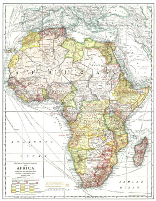
National Geographic Southern Africa 1962.
Format: Digital images of Maps.
Printed Size on a large format printer would be as follows:-
Height: @ 90cm.
Width: 75cm.
File Size: Total of 7.6MB
Total Number of Files: 2 x JPG images - Rhodesia's @ 1.2MB and National Geographic @ 6.4MB
Info: Rhodesia Map by the AA of Rhodesia and National Geographic map of Southern Rhodesia with Federation of Rhodesia and Nyasaland from November 1962. Of interest to historians to see the changes in Southern Africa in the last 50 years.
On completion of the order and receipt of payment a Dropbox link will be forwarded to your e-mail address for downloading of the files.
Scale: 1: 1 792 000 (National Geographic)
2.5" = 100 miles (Malawi, Rhodesia & Zambia)
Condition: Digital Download.
Price: R 195.00 Inc Vat.
Please Note: When purchasing this item please select the "Collection" option for delivery.
This will ensure that there is no delivery cost involved on the transaction as it is a digital download.