


| Main centres: | 1-3 business days |
| Regional areas: | 3-4 business days |
| Remote areas: | 3-5 business days |
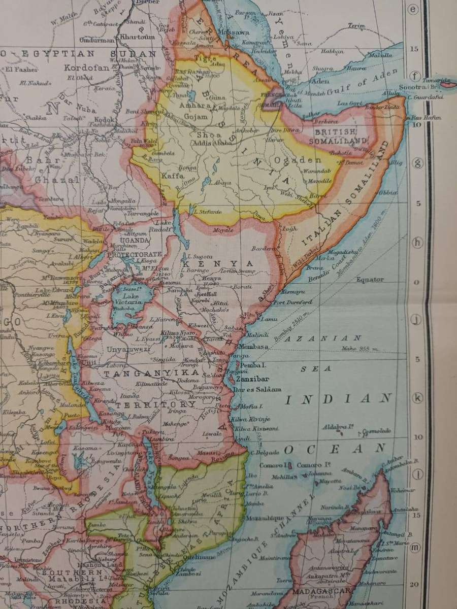
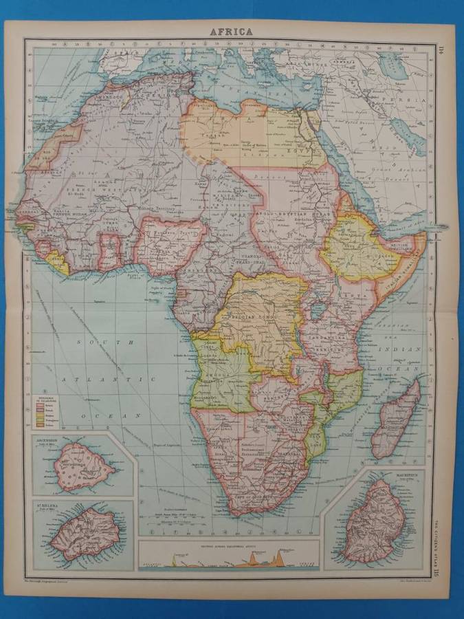
Map of Africa, 1924, showing geopolitical borders. The pink areas mark British 'possessions': an almost unbroken string of countries from Cape to Cairo. There are also small insets of Ascension, St. Helena, and Mauritius.
The map was printed just six years after the First World War. Some of the territories shown on it were ravaged by the war.
Central fold, light foxing in the margins. Very good condition.
Large map, measuring 45 x 36 cm, including narrow margins.
Extracted from The Citizen's Atlas of the World, published in Edinburgh by John Bartholemew & Son, in 1924.
A real time capsule from the early post-World-War-One period.
Framed, this detailed map would look great in a study or man-cave. It could be personalized with some vintage travel ephemera, such as baggage labels, train tickets, etc.