This item has closed 1 buyer bought 1 item
View other items offered by CapeCollectables1236

Similar products

Jeppes Map Of The Transvaal 1899, Reproduction Print Wall Map Northern Tvl
R295.00
1801 Map of Cape of Good Hope Colony, Good Condition, Original Arrowsmith Map
R1,950.00
Map of the Eastern Frontier of the Cape Colony 1856, Reproduction Print
R295.00
Western Cape Provincial Map - Printed Map
R195.00
Map of Cape Colony 1901 Wall Map, Reproduction Print Map of Cape Colony 1901 Wall Map, Reproduction Print Map of Cape Colony 1901 Wall Map, Reproduction Print Map of Cape Colony 1901 Wall Map, Reproduction Print Map of Cape Colony 1901 Wall Map, Reproduction Print
Sold

Map of Cape Colony 1901 Wall Map, Reproduction Print

1 was available / secondhand
R295.00
Shipping
Free shipping is available from CapeCollectables for all orders above R1,500.00, using one of our trusted couriers.
Check my rate
The seller allows collection for this item. Buyers will receive the collection address and time once the order is ready.
The seller has indicated that they will usually have this item ready to ship within 3 business days. Shipping time depends on your delivery address. The most accurate delivery time will be calculated at checkout, but in general, the following shipping times apply:
 
Standard Delivery
Main centres:  1-3 business days
Regional areas: 3-4 business days
Remote areas: 3-5 business days
Buyer protection
Returns
Money-Back Guarantee: 7 Days: Refund if returned, excluding Postage.
Get it now, pay later

Product details

Condition
Secondhand
Location
South Africa
Area
Africa
Time Period
1900-1950
Type
Political Map
Customer ratings:
Bob Shop ID
443598120

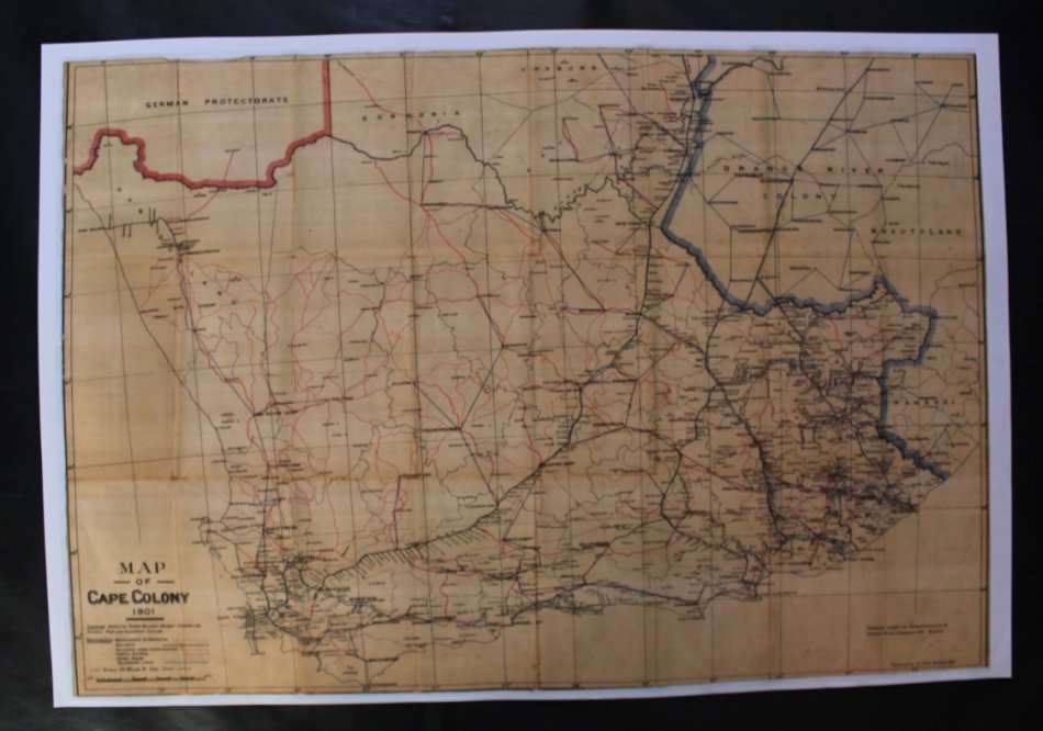
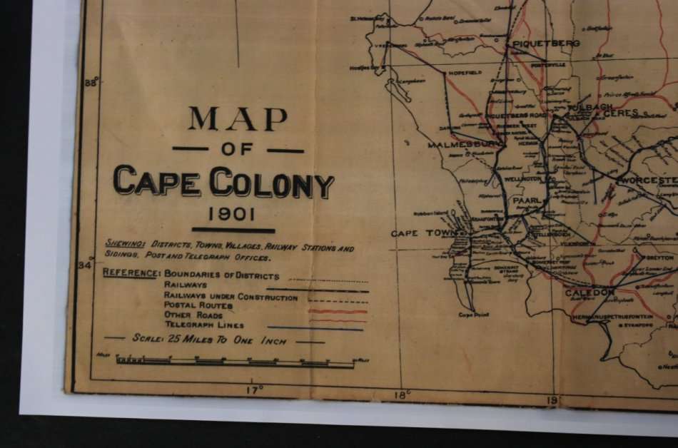
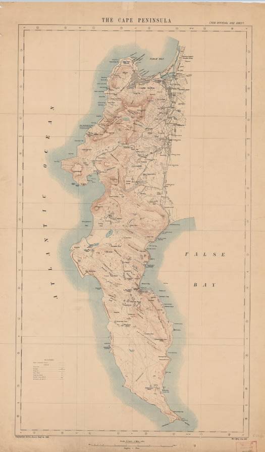
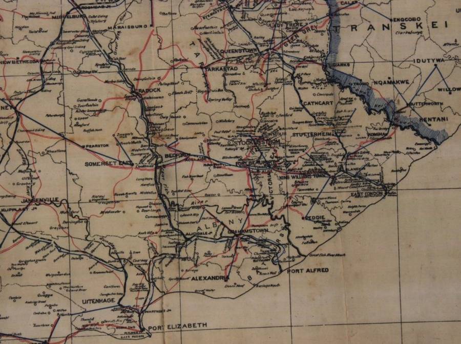
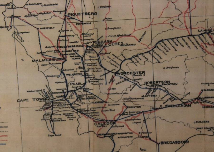
Title: Map of Cape Colony 1901 Wall Map, Reproduction Print.
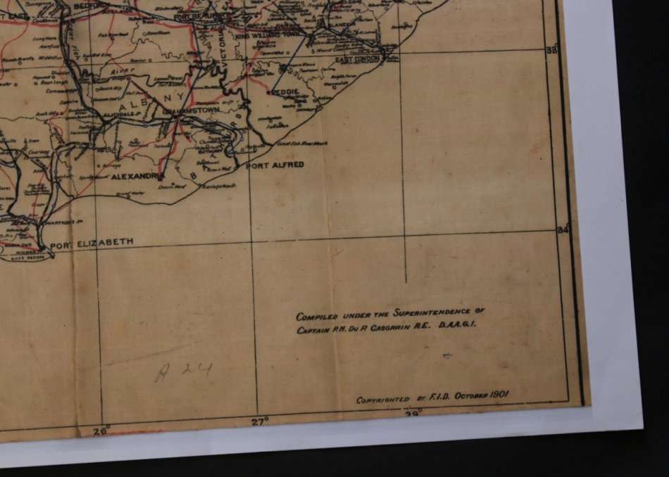
Publisher: F.I.D October 1901.
Height: 54cm.
Width: 79cm.
Info: Compiled under the Superintendence Of Capt P M Du P Casgrain R.E. D.A.A.G.I
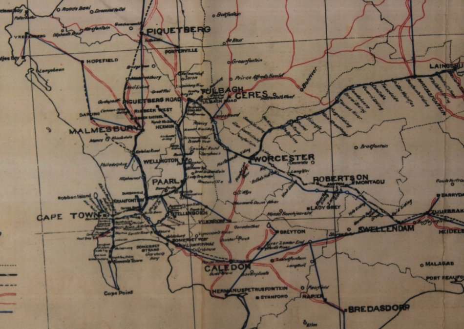
Released during the Boer War in 1901, showing Roads, Railways Stations and Sidings, Towns, Districts, Villages, Post and Telegraph Offices.
Scale: 25 Miles to One Inch.
Map Type: Reproduction Print, scanned from an Original and printed on poster paper.
Condition: Very Good.
Price: R 295.00 Inc Vat.
 

Recently viewed

See more
For Samsung Galaxy A14 Astronaut Pattern Silicone Straight Edge Phone Case(Mars Astronaut-Black)
R167.00
Die Universalisme in die Psalms (Afrikaans) | Petrus Johannes Nicolaas Smal
R57.00
50% OFF
Rugged Laser Distance Meter - 40m
R750.00 R1,500.00
AS SY WEER KOM LESBIAN COMING OUT - HOBBS,M
R230.00

Customer ratings: 1 ratings

great service
26 Nov 2019