Map Of Cape Town 1884, Revised, Glossy Photo Paper Print
New
Shipping
Standard courier shipping from R30
R30 Standard shipping using one of our trusted couriers applies to most areas in South Africa. Some areas may attract a R30 surcharge. This will be calculated at checkout if applicable.
Check my rate
Check my rate
Free collection from
Somerset West, Cape Town
The seller allows collection for this item and will be in contact with the full collection address once the order is ready.
Ready for collection by Thursday, 20 June.
Ready to ship in
The seller has indicated that they will usually have this item
ready to ship within 3 business days. Shipping time depends on your delivery address. The most
accurate delivery time will be calculated at checkout, but in
general, the following shipping times apply:
Standard Delivery
| Main centres: | 1-3 business days |
| Regional areas: | 3-4 business days |
| Remote areas: | 3-5 business days |
Returns
Get it now, pay later
Seller
Buyer Protection
Product details
Condition
New
Location
South Africa
Area
Africa
Time Period
Post-1950
Type
Road Map
Bob Shop ID
615622379
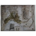
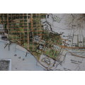
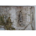
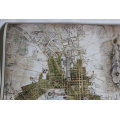
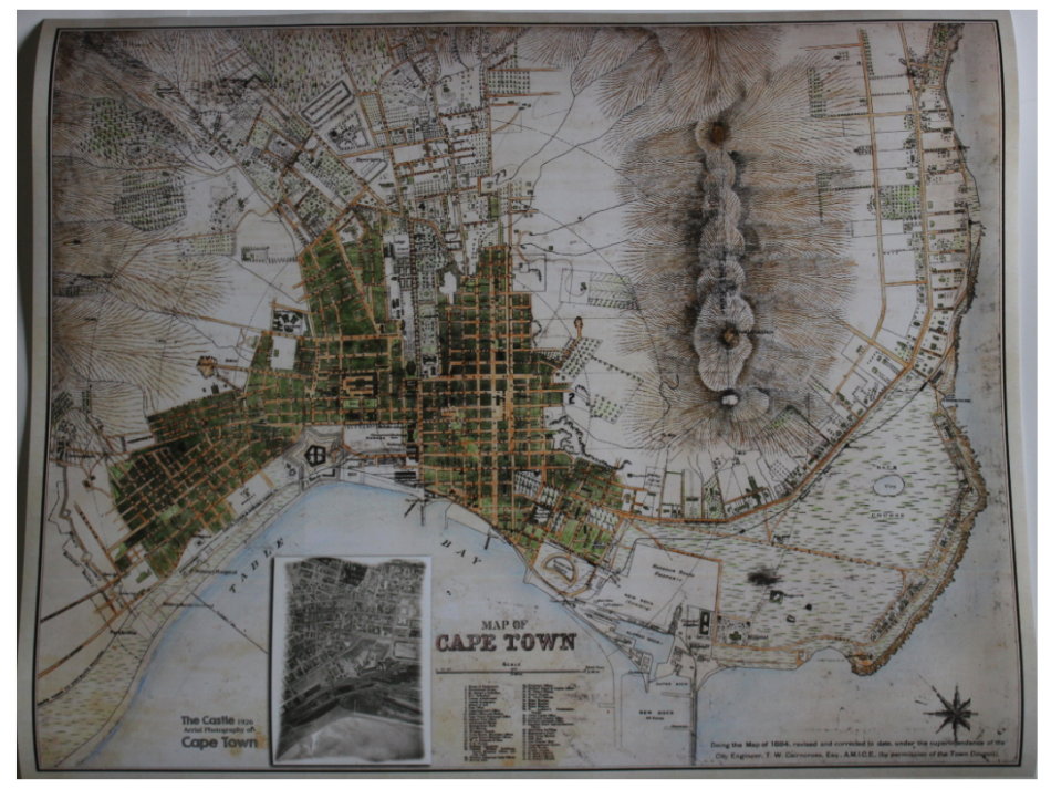
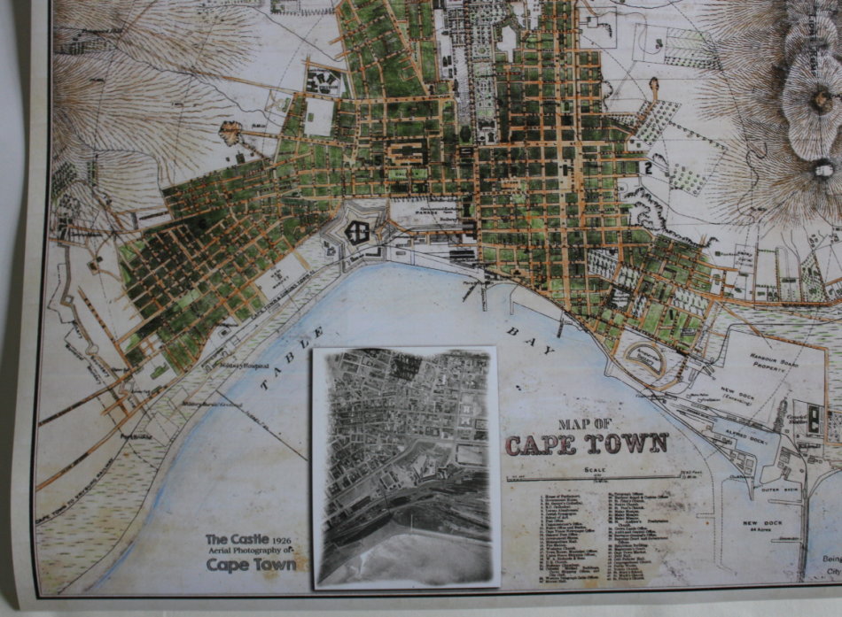
Title: Map Of Cape Town 1884, Revised, Glossy Photo Paper Print.
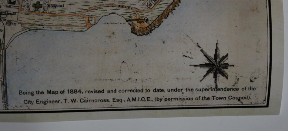
Publisher: W A Richards and Sons, Castle St, Cape Town.
Scale: 4 inch = 1/2 mile.
Year: 1884 revised to date 1891.
Format: Scanned and Printed on Glossy Photo Paper.
Height: 53cm.
Width: 66cm.
Info: Striking map of Cape Town, South Africa, by W.A. Richards & Sons, circa 1884.
Updated 2019 production with an inset of an overhead photo from 1926 of the Castle.
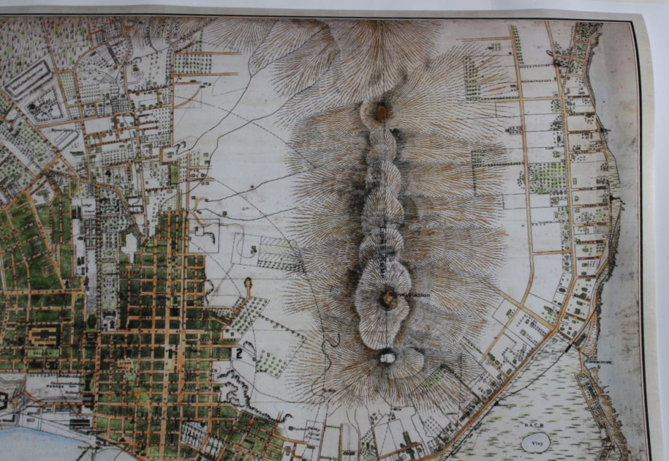
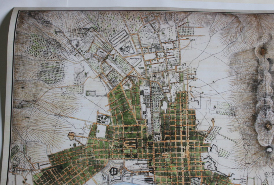
The map is oriented with south southwest at the top. Some of the major features of the map include:
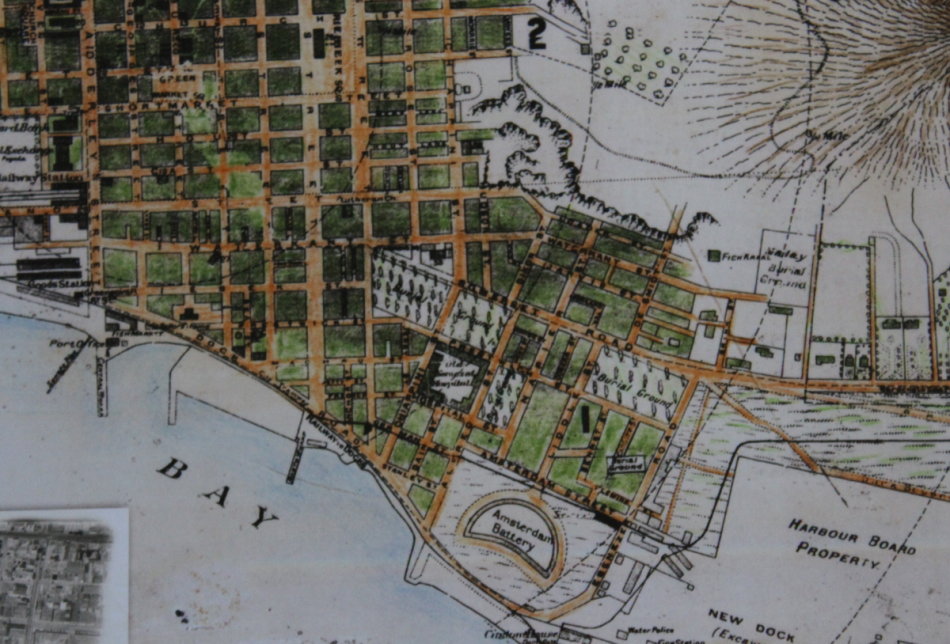
Cape Town Station
The Sea Point Railway
The tramway from the Amsterdam Battery to the Standard Bank in Adderly Street.
The Cape Town Station used to stand where one now finds the Golden Acre Shopping center, while the Goods Station was where today's Cape Town Station is located.
Late 19th-century Cape Town was a city in rapid transition, enjoying a sudden economic boom after the discovery of diamond fields to the north of it. In this 1884 map of the capital of the British Cape Colonywhich is usually oriented with southwest at the topthe grid plan of the original Dutch settlement is still clearly visible.
The shoreline as it was prior to land reclamation which began in the 1930's and 1940's shows the Castle in relation to the coast when originally constructed.
Map Type: Reproduction Print.
Condition: Excellent, as new. Printed on very good quality Glossy Photo paper.
Price: R 395.00 Inc Vat.
![]()