This item has closed with no items sold
View other items offered by blankbooks5958

Similar products

Map of Cape Town Central and Neighbouring Suburbs Map of Cape Town Central and Neighbouring Suburbs
Closed

Map of Cape Town Central and Neighbouring Suburbs

Secondhand 1 was available
R1,460.00
Shipping
R35.00 Standard shipping using one of our trusted couriers applies to most areas in South Africa. Some areas may attract a R30.00 surcharge. This will be calculated at checkout if applicable.
Check my rate
The seller allows collection for this item. Buyers will receive the collection address and time once the order is ready.
The seller has indicated that they will usually have this item ready to ship within 3 business days. Shipping time depends on your delivery address. The most accurate delivery time will be calculated at checkout, but in general, the following shipping times apply:
 
Standard Delivery
Main centres:  1-3 business days
Regional areas: 3-4 business days
Remote areas: 3-5 business days
Buyer protection
Get it now, pay later

Product details

Condition
Secondhand
Location
South Africa
Product code
Id-2503722
Bob Shop ID
533241920

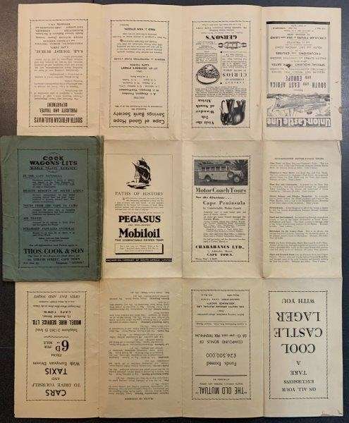
Detailed plan of Cape Town, South Africa, published for tourists and visitors. The map focuses on travel opportunities and shows the distances from Cape Town to other population centres, and the best means of transit. Issued by the South African Railways Administration English. Produced by the Cape Peninsula Publicity Association. No date, printed by Galvin & Sales, circa 1939. 630 x 495 mm, coloured, commercial advertisements on the verso, folds into light card covers. Book No: 2503722