This item has closed with no items sold
View the relisted Item
View the relisted Item
View other items offered by CapeCollectables1033
Similar products
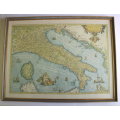
Map of Italiae Novissima Descriptio Iacobo Castaldo Pedemontano By Ortelius Reproduction
Secondhand
R695.00
Closed
29 Apr 24 12:16
Shipping
Standard courier shipping from R30
R30 Standard shipping using one of our trusted couriers applies to most areas in South Africa. Some areas may attract a R30 surcharge. This will be calculated at checkout if applicable.
Check my rate
Check my rate
Free collection from
Kuils River, Cape Town
The seller allows collection for this item and will be in contact with the full collection address once the order is ready.
Ready for collection by Wednesday, 15 May.
Ready to ship in
The seller has indicated that they will usually have this item
ready to ship within 3 business days. Shipping time depends on your delivery address. The most
accurate delivery time will be calculated at checkout, but in
general, the following shipping times apply:
Standard Delivery
| Main centres: | 1-3 business days |
| Regional areas: | 3-4 business days |
| Remote areas: | 3-5 business days |
Buyer Protection
How you're covered
Get it now, pay later
Returns
Product information
Condition:
Secondhand
Location:
South Africa
Area:
Europe
Time Period:
Pre-1800s
Type:
Political Map
Bob Shop ID:
611443786
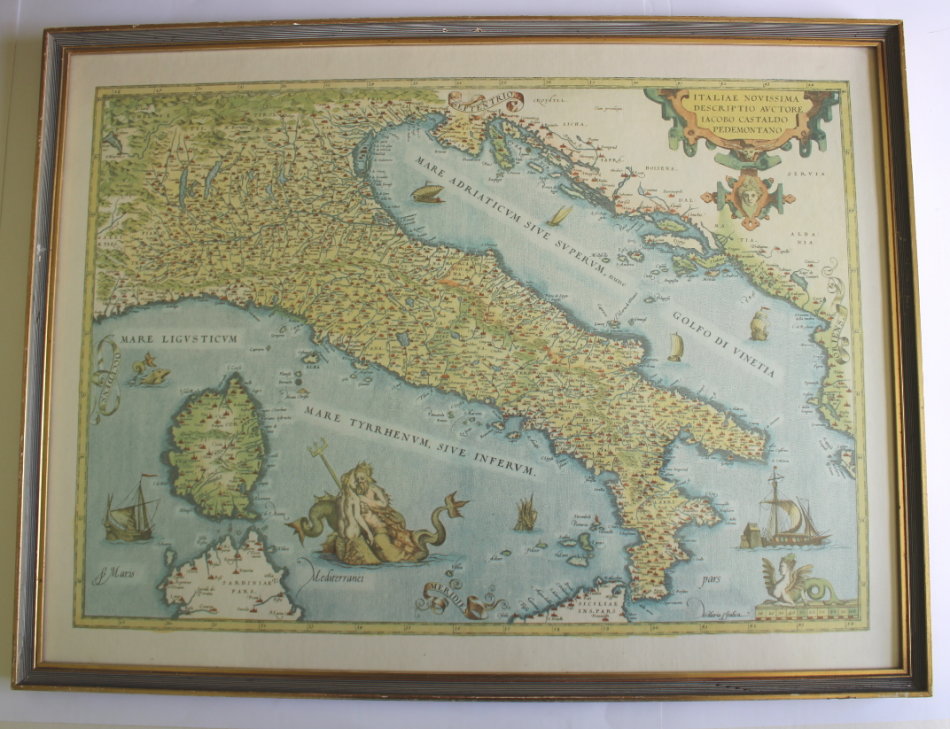
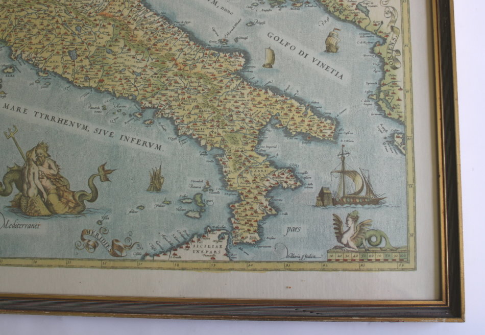
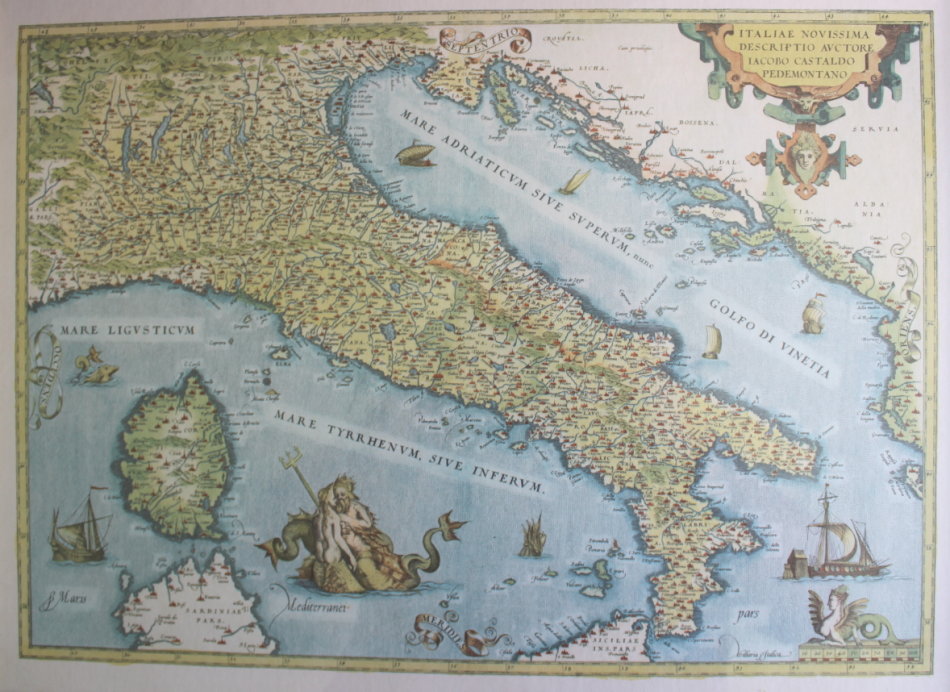
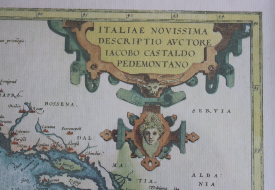
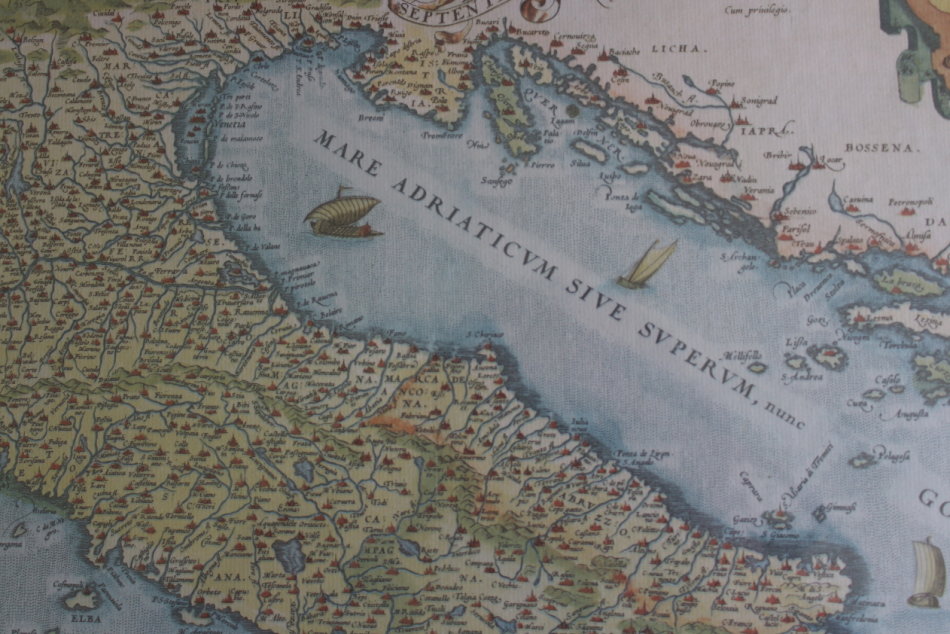
Title: Map of Italiae Novissima Descriptio Auctore Lacobo Castaldo Pedemontano By Abraham Ortelius Reproduction Print.
Format: Fine Printed Reproduction of an Original release.
Publisher: Abraham Ortelius .
Type: Copper Engraving, Print.
Atlas: Théâtre de l'Univers. Antwerp, Chr. Plantin, 1581. (Van der Krogt 3, 1:321)
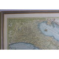
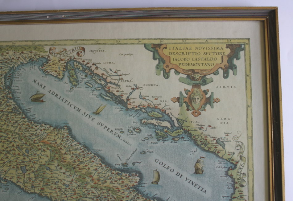
Title in cartouche at top right, scale of distance, bottom right.
Abraham Ortelius also Ortels, Orthellius, Wortels; 14 April 1527 28 June 1598 was a Brabantian cartographer and geographer, conventionally recognized as the creator of the first modern atlas, the Theatrum Orbis Terrarum (Theatre of the World). Ortelius is often considered one of the founders of the Netherlandish school of cartography and one of the most notable figures of the school in its golden age (approximately 1570s1670s). The publication of his atlas in 1570 is often considered as the official beginning of the Golden Age of Netherlandish cartography. He is also believed to be the first person to imagine that the continents were joined before drifting to their present positions
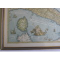
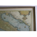
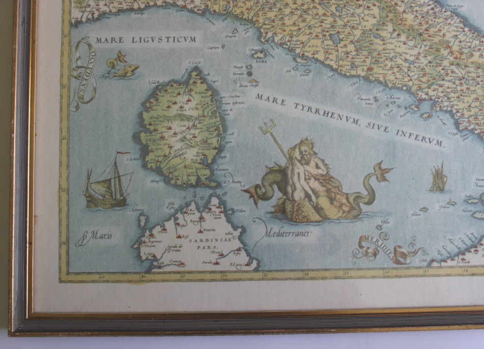
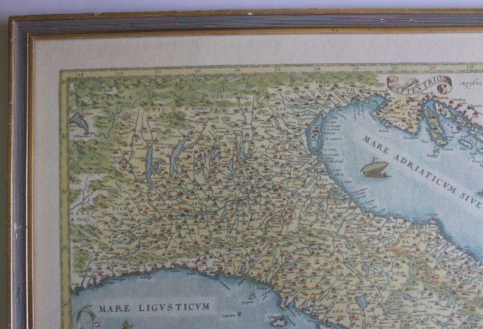
Superb map of Italy based on the cartography of Giacomo Gastaldi. It extends to include Corsica, with parts of Sardinia and Sicily, and shows the western coast of the Balkans to Corfu. The map is filled with detail of the topography and cities and features a vignette of Neptune and a mermaid companion, sea monsters, a variety of ships and decorative cartouches. Latin text on verso marked page 32. This is from the first plate of this map as the word "Servia" appears in the upper right corner.
Year: First Published in 1570's.
Scale 1: 2 500 000
Framed - Glass, Very Good Condition.
Height: 44 cm.
Width: 57 cm.
Price: R 695.00 Inc Vat.
![]()
![]()