This item has closed with no items sold
View the relisted Item
View the relisted Item
View other items offered by CapeCollectables1033
Similar products
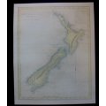
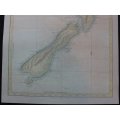
Map of New Zealand - Captain Cook voyage by J Bayly.
Secondhand
R595.00
Closed
4 May 24 17:16
Shipping
Standard courier shipping from R30
R30 Standard shipping using one of our trusted couriers applies to most areas in South Africa. Some areas may attract a R30 surcharge. This will be calculated at checkout if applicable.
Check my rate
Check my rate
Free collection from
Kuils River, Cape Town
The seller allows collection for this item and will be in contact with the full collection address once the order is ready.
Ready for collection by Friday, 17 May.
Ready to ship in
The seller has indicated that they will usually have this item
ready to ship within 3 business days. Shipping time depends on your delivery address. The most
accurate delivery time will be calculated at checkout, but in
general, the following shipping times apply:
Standard Delivery
| Main centres: | 1-3 business days |
| Regional areas: | 3-4 business days |
| Remote areas: | 3-5 business days |
Returns
Get it now, pay later
Seller
Buyer Protection
Product details
Condition
Secondhand
Location
South Africa
Area
Australasia
Time Period
Pre-1800s
Type
Political Map
Bob Shop ID
611752348
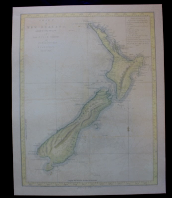
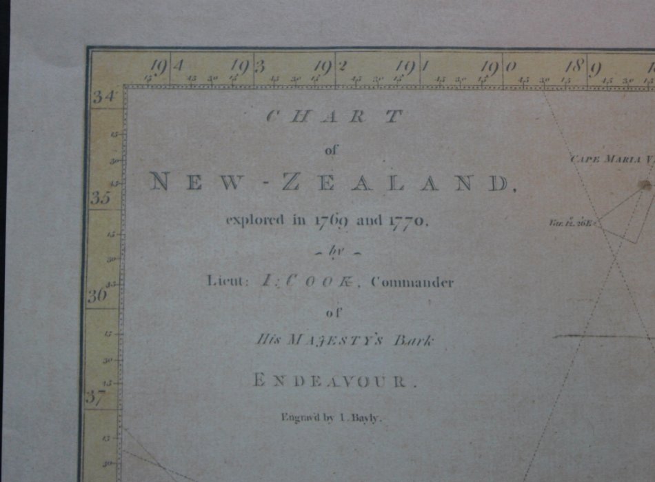
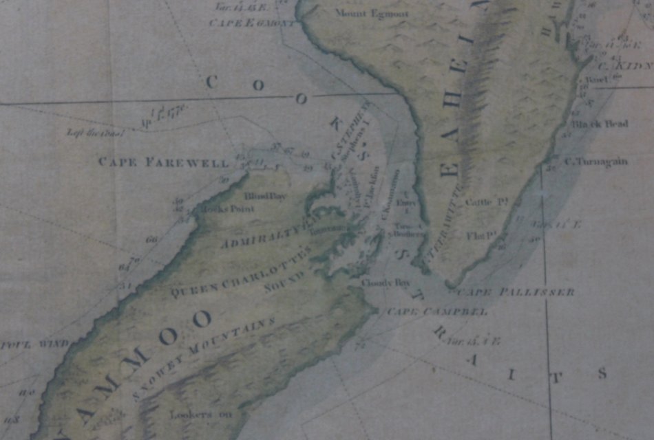
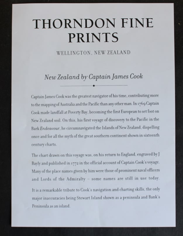
Title: Map of New Zealand by Captain James Cook, Published By Thorndon Fine Prints.
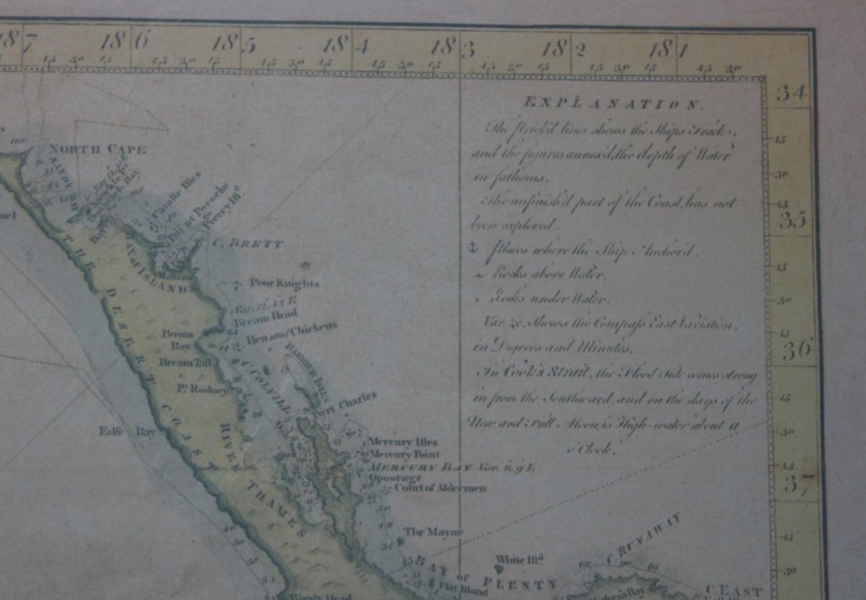
Chart of New Zealand Explored in 1769 and 1770 by Lieut. J Cook, Commander of His Majesty's bark Endeavour.
Publisher: Thorndon Fine Prints.
Format: Print.
Size: 43cm x 54cm.
Engraving: By J Bayly.
Info:
Beautifully engraved by J. Bayly in England from Cooks charts made in 1769 and 1770.
This map was originally published in the official account of Captain Cooks voyage.
Superbly republished in a small edition by Thorndon Fine Prints.
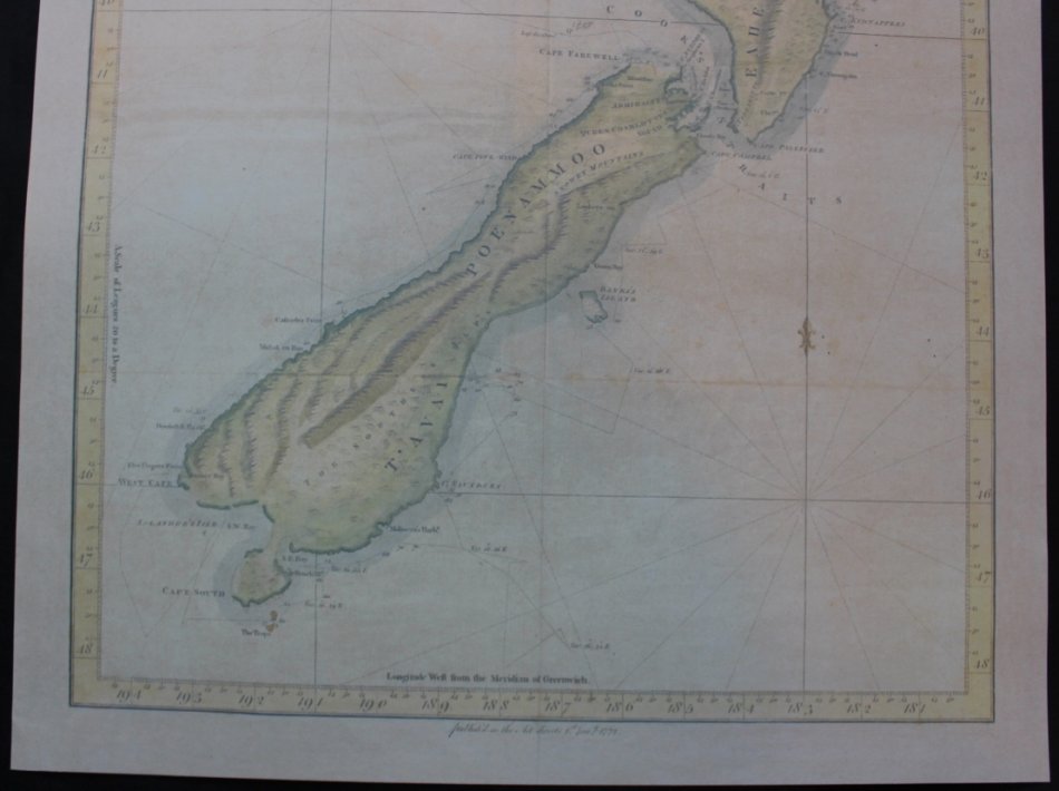
It is a remarkable tribute to Cooks navigation and charting skills, the only major inaccuracies being
Stewart Island shown as a peninsula and Banks Peninsula as an island.
Condition: Excellent.
Map: Fine Printed Reproduction of an Original release.
Price: R 595.00 Inc Vat.
![]()
![]()