This item has closed 1 buyer bought 1 item
View other items offered by Heritage Trades1037

Similar products

British Empire Colonies, Dependencies and Trade Routes Digital Map Digital Download
R195.00
ORIGINAL 1856 MAP of Part of Central Africa ( includes Lake Chad, part of Nigeria)
R295.00
1801 Map of Cape of Good Hope Colony, Good Condition, Original Arrowsmith Map
R1,950.00
Harrismith map - Geographical Section, General Staff, Orange Free State Reconnaissance series 1912
R350.00
Map of the  Orange River Colony - 2 parts (1902) Map of the  Orange River Colony - 2 parts (1902)
Sold

Map of the Orange River Colony - 2 parts (1902)

1 was available / secondhand
R1,250.00
Shipping
R35.00 Standard shipping using one of our trusted couriers applies to most areas in South Africa. Some areas may attract a R30.00 surcharge. This will be calculated at checkout if applicable.
Check my rate
The seller allows collection for this item. Buyers will receive the collection address and time once the order is ready.
The seller has indicated that they will usually have this item ready to ship within 2 business days. Shipping time depends on your delivery address. The most accurate delivery time will be calculated at checkout, but in general, the following shipping times apply:
 
Standard Delivery
Main centres:  1-3 business days
Regional areas: 3-4 business days
Remote areas: 3-5 business days
Buyer protection
Get it now, pay later

Product details

Condition
Secondhand
Location
South Africa
Customer ratings:
Product code
bhd2
Bob Shop ID
617525379

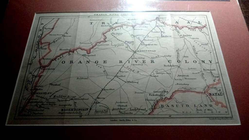
Map(s) of the Orange River Colony (Northern Part & Southern Part), 1902, originals, mounted ready for framing, 43.2 cms x 31.4 cms & 31.5 cms x, 31.5 cms,  condition: very good.

The map(s) are from Arthur Conan Doyle's " The Great Boer War" and are produced by offset lithography by stanford's geographical establishment, London.

Stanfords is a specialist bookshop of maps and travel books in London, established in 1853 by Edward Stanford. Its collection of maps, globes, and maritime charts is considered the world's largest. It has also supplied cartography for the British Army and for James Bond films.}

                                                                                       THE MAPS ARE IMAGED UNDER PROTECTIVE PLASTIC SO SOME REFLECTION.

Recently viewed

See more
Alanger - `Potemkin` Russian Navy Battleship - Scale 1:400 Scale - Plastic Model 40011 Kit (NOS)
R249.00
Clear Motorcycle Windshield Windscreen Wind Screens Deflectors for F650gs F 650 Gs 1999-2003
R714.00
Hare Krishna Silicone Bracelet
R79.00
For ZTE Nubia Red Magic 6s Pro Cooling Fan
R251.36

Customer ratings: 1 ratings

AAAseller. Quick delivery. Happy
12 Jun 2024