This item has closed 1 buyer bought 1 item
View other items offered by gregsact1913

Similar products

Map Plan of Cape Town, 1760. Original Engraving by Jacques-Nicolas Bellin (1703-1772) Map Plan of Cape Town, 1760. Original Engraving by Jacques-Nicolas Bellin (1703-1772) Map Plan of Cape Town, 1760. Original Engraving by Jacques-Nicolas Bellin (1703-1772) Map Plan of Cape Town, 1760. Original Engraving by Jacques-Nicolas Bellin (1703-1772) Map Plan of Cape Town, 1760. Original Engraving by Jacques-Nicolas Bellin (1703-1772) Map Plan of Cape Town, 1760. Original Engraving by Jacques-Nicolas Bellin (1703-1772) Map Plan of Cape Town, 1760. Original Engraving by Jacques-Nicolas Bellin (1703-1772) Map Plan of Cape Town, 1760. Original Engraving by Jacques-Nicolas Bellin (1703-1772)
Map Plan of Cape Town, 1760. Original Engraving by Jacques-Nicolas Bellin (1703-1772) Map Plan of Cape Town, 1760. Original Engraving by Jacques-Nicolas Bellin (1703-1772) Map Plan of Cape Town, 1760. Original Engraving by Jacques-Nicolas Bellin (1703-1772) Map Plan of Cape Town, 1760. Original Engraving by Jacques-Nicolas Bellin (1703-1772)
Map Plan of Cape Town, 1760. Original Engraving by Jacques-Nicolas Bellin (1703-1772)
+4
Sold

Map Plan of Cape Town, 1760. Original Engraving by Jacques-Nicolas Bellin (1703-1772)

Secondhand 1 was available
R2,100.00
Shipping
R35.00 Standard shipping using one of our trusted couriers applies to most areas in South Africa. Some areas may attract a R30.00 surcharge. This will be calculated at checkout if applicable.
Check my rate
The seller has indicated that they will usually have this item ready to ship within 3 business days. Shipping time depends on your delivery address. The most accurate delivery time will be calculated at checkout, but in general, the following shipping times apply:
 
Standard Delivery
Main centres:  1-3 business days
Regional areas: 3-4 business days
Remote areas: 3-5 business days
Buyer protection
Get it now, pay later

Product details

Condition
Secondhand
Location
South Africa
Area
Africa
Time Period
Pre-1800s
Type
Physical Map
Customer ratings:
Bob Shop ID
638609114

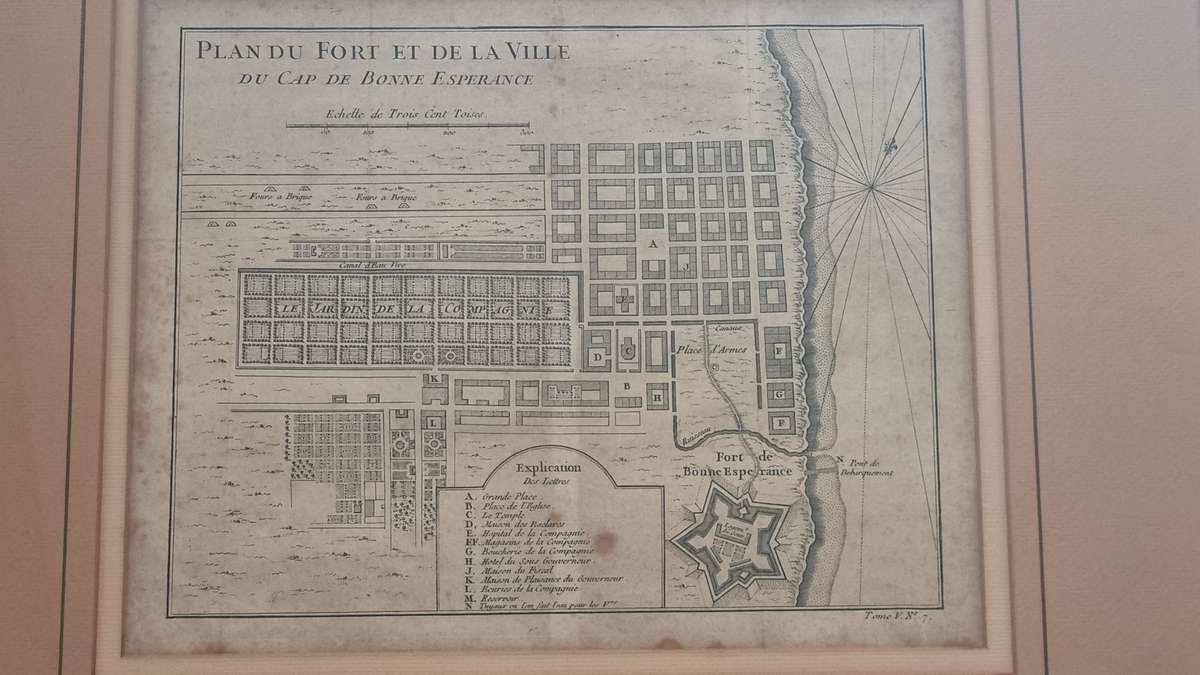
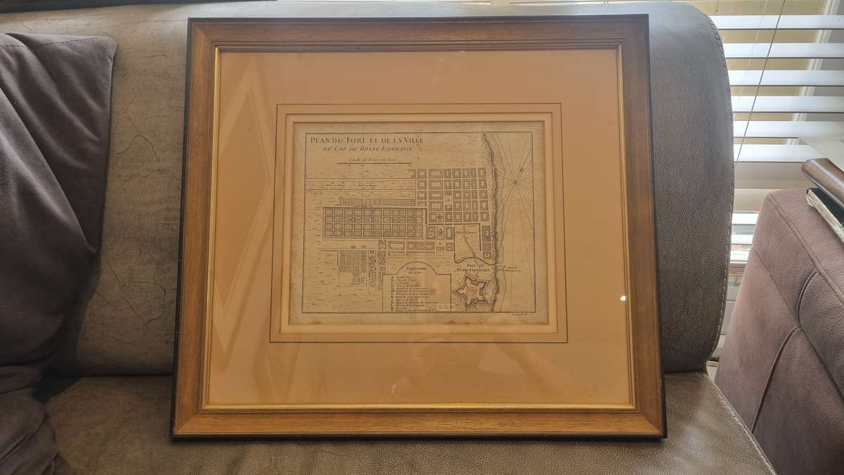
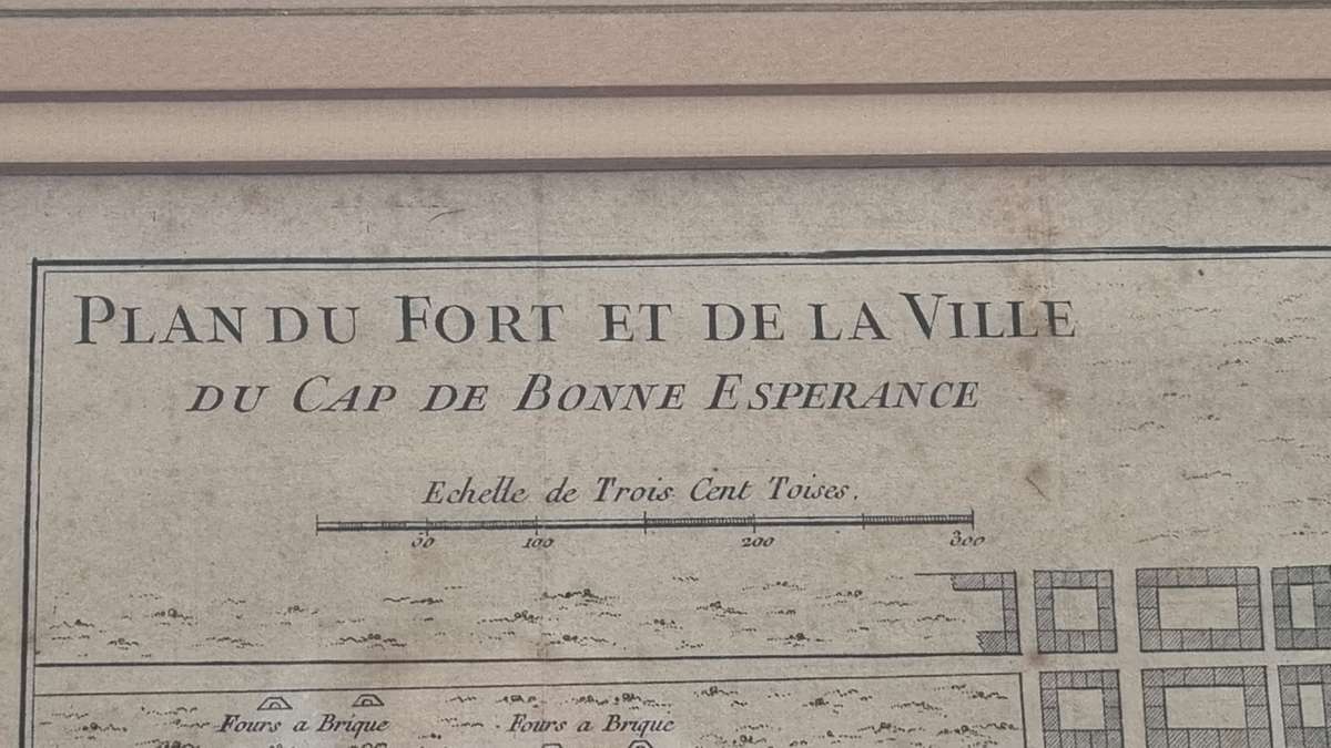
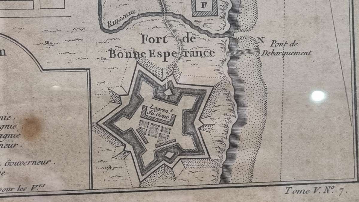
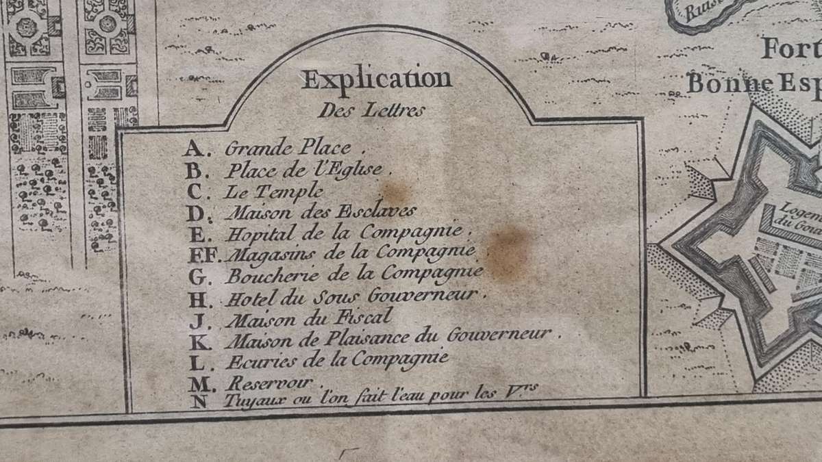
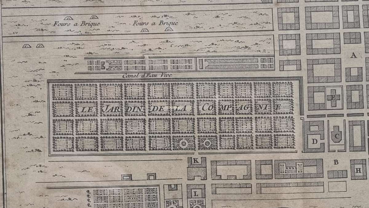
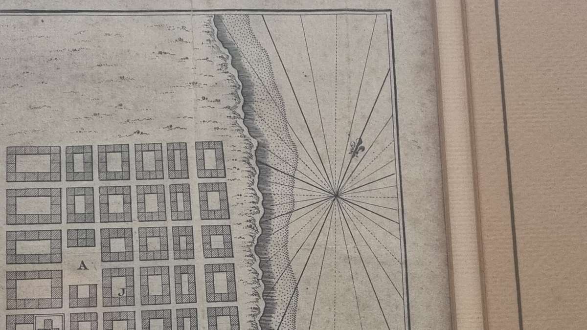
Title: Plan du Fort et de la Ville du Cap de Bonne Esperance.

Drawn by Jacques-Nicolas Bellin , the foremost cartographer of his day, around 1760, before French soldiers arrived in Cape Town to support the Batavian government.

Plan is 29 cm x 23.5 cm . Frame and mount in excellent condition, 53 cm x 47 cm . 

Customer ratings: 1 ratings

Top!
22 Apr 2025