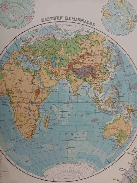
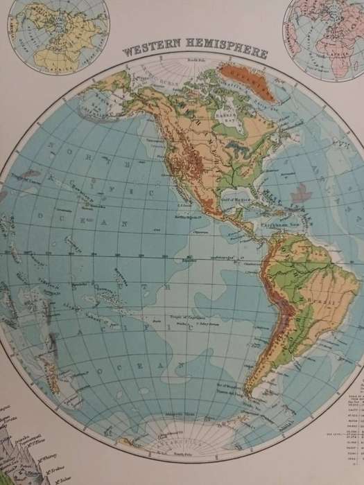
Map: World - Physical, 1924 Map: World - Physical, 1924 Map: World - Physical, 1924

Map: World - Physical, 1924

Secondhand 1 available
R100.00
Shipping
R35.00 Standard shipping using one of our trusted couriers applies to most areas in South Africa. Some areas may attract a R30.00 surcharge. This will be calculated at checkout if applicable.
Check my rate
The seller allows collection for this item. Buyers will receive the collection address and time once the order is ready.
The seller has indicated that they will usually have this item ready to ship within 3 business days. Shipping time depends on your delivery address. The most accurate delivery time will be calculated at checkout, but in general, the following shipping times apply:
 
Standard Delivery
Main centres:  1-3 business days
Regional areas: 3-4 business days
Remote areas: 3-5 business days
Seller
Buyer protection
Get it now, pay later

Product details

Condition
Secondhand
Location
South Africa
Area
Multiple Regions
Time Period
1900-1950
Type
Physical Map
Bob Shop ID
654394879

Physical map of the world, 1924, showing the Eastern and Western Hemispheres in separate circular frames.

Central fold. In very good condition.

In 1924, the environmental condition of the planet was relatively stable compared to modern times, with lower levels of industrial pollution and greenhouse gas emissions, though early signs of environmental degradation were emerging. Industrialization had accelerated in Europe and North America, leading to localized air and water pollution in major cities, while deforestation was increasing to meet growing demands for timber and agricultural land. Wildlife populations were already being impacted by hunting, habitat loss, and the absence of conservation regulations. However, global awareness of environmental issues was minimal, and large-scale ecological impacts such as climate change had not yet become apparent or widely understood.

Large sheet, measuring 45 x 36 cm, including narrow margins.
Extracted from The Citizen's Atlas of the World, published in Edinburgh by John Bartholemew & Son, in 1924.
A real time capsule from the early post-World-War-One period. 
Framed, this sheet would look great in a study or man-cave. It could be personalized with some vintage travel ephemera, such as baggage labels, train tickets, etc.

Add to cart

Recently viewed

See more
Lever Press Sausage Maker Vertical Fast Manual Sausage Stuffer Tool With 5 Nozzles
New
R430.52
61% OFF
USSR 1972, 27 Dec. SPACE EXPLORATION, minisheet, UNH, CV +/-R 180.00 view scans
Secondhand
R70.00 R180.00
OEM 55567050 For GM 1.6L 1.8L Oil Control Variable Valve Timing VVT Solenoid
New
R1,636.00
Aries (18-3518-10) IC & Component Socket, 18 Contacts, DIP, 2.54 mm
New
R229.00

Similar products

Map: Denmark, Poland and Baltic States, 1924
Secondhand
R100.00
South Africa Provincial Political and Physical Wall Map Centenary Edition 2020 Digital Download
New
R245.00
Map: Australia, 1924
Secondhand
R100.00
National Geographic Folded Map Physical Earth May 1998
Secondhand
R175.00