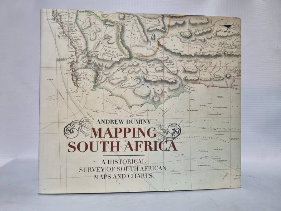
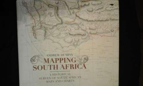
Mapping South Africa - A historical survey of South African maps and charts - Andrew Duminy
Secondhand
1 was available
R245.00
0% off
Shipping
R35.00 Standard shipping using one of our trusted couriers applies to most areas in South Africa. Some areas may attract a R30.00 surcharge. This will be calculated at checkout if applicable. Check my rate
The seller has indicated that they will usually have this item
ready to ship within 3 business days.
Shipping time depends on your delivery address.
The most accurate delivery time will be calculated at checkout,
but in general, the following shipping times apply:
South Africa - A historical survey of South African maps and charts - Andrew Duminy - Jacana - 2011 - Hard cover with dust cover , small tear on first two pages, rest very good.
Mapping South Africa will be welcomed as a landmark in providing the first survey of the fascinating story of maps and mapmaking in the subcontinent. Beginning with the Portuguese voyages of exploration in the late 15th century, the book explores the attempts of the Dutch and then of the British to chart and lay claim to the vast and expanding landscape of the Cape Colony. A subsequent chapter deals in particular with maps of the Eastern Cape, where a series of frontier wars over almost a hundred years led to an outpouring of cartography. In colonial Natal and the Boer Republics of the Transvaal and Free State, cartography was driven, on the other hand, by the dictates of colonisation and land exploitation. New heights in the mapping of South Africa were reached as a result of the AngloBoer War and of laborious trigonometrical survey work that began at this time. It set new standards that would be extended and consolidated after Union in 1910. Throughout the book the author reveals an appreciation of the close relation between science, exploration and cartography and gives due prominence to the role played by individuals as well as institutions in producing maps of increasing accuracy and detail. Mapping South Africa will long remain a standard work of its kind, appreciated for its informative text and for the beautiful reproductions it contains of some 85 maps.