


| Main centres: | 1-3 business days |
| Regional areas: | 3-4 business days |
| Remote areas: | 3-5 business days |
This item is sold brand new. It is ordered on demand from our supplier and is usually dispatched within 5 - 10 working days
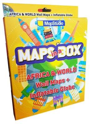
World Map
- Size 1000W X 690H mm
- updated maps from our reliable map database
- clear easy-to-read mapping on a large format sheet
- bright colours with clear legible text
- all countries of the world & their capitals listed
- disputed international boundaries
- bright colours highlighting each country
Africa Map
- Size 1000H X 690W mm
- New updated maps from our reliable map database
- clear easy-to-read mapping on a large format sheet
- all countries of africa and their capitals
- bright colours highlighting each country
- clear legible text
- locator map showing position of african continent
- flags of all african countries shown
- map legend, north point & scale bar
- major connecting roads
Inflatable Globe
- Size 300 mm, 30cm (Inflated)
- Learner-friendly type
- great educational tool
- colour coded countries
- capital cities
- latitude & longitude
- international boundaries
- elevation
- international time zones
- international date line
- physical features
- oceans & seas
- drainage
| Summary | World map, Africa map and inflatable globe included in this box set. |
| Contributors | Map Studio |
| Release date | 20170801 |
| ISBN | 1-77026-941-X |
| ISBN 13 | 978-1-77026-941-5 |


