This item has closed with no items sold
View the relisted Item
View the relisted Item
View other items offered by CapeCollectables1035
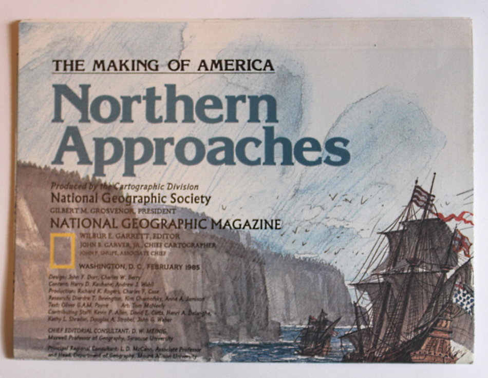
National Geographic Folded Map of Northern Approaches February 1985
Secondhand
R195.00
Closed
16 May 24 09:16
Shipping
Standard courier shipping from R30
R30 Standard shipping using one of our trusted couriers applies to most areas in South Africa. Some areas may attract a R30 surcharge. This will be calculated at checkout if applicable.
Check my rate
Check my rate
Free collection from
Kuils River, Cape Town
The seller allows collection for this item and will be in contact with the full collection address once the order is ready.
Ready for collection by Wednesday, 22 May.
Ready to ship in
The seller has indicated that they will usually have this item
ready to ship within 3 business days. Shipping time depends on your delivery address. The most
accurate delivery time will be calculated at checkout, but in
general, the following shipping times apply:
Standard Delivery
| Main centres: | 1-3 business days |
| Regional areas: | 3-4 business days |
| Remote areas: | 3-5 business days |
Returns
Get it now, pay later
Seller
Buyer Protection
Product details
Condition
Secondhand
Location
South Africa
Area
The Americas
Time Period
Post-1950
Type
Political Map
Bob Shop ID
612591028
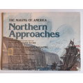
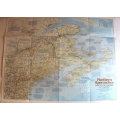
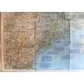
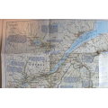
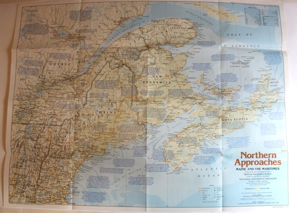
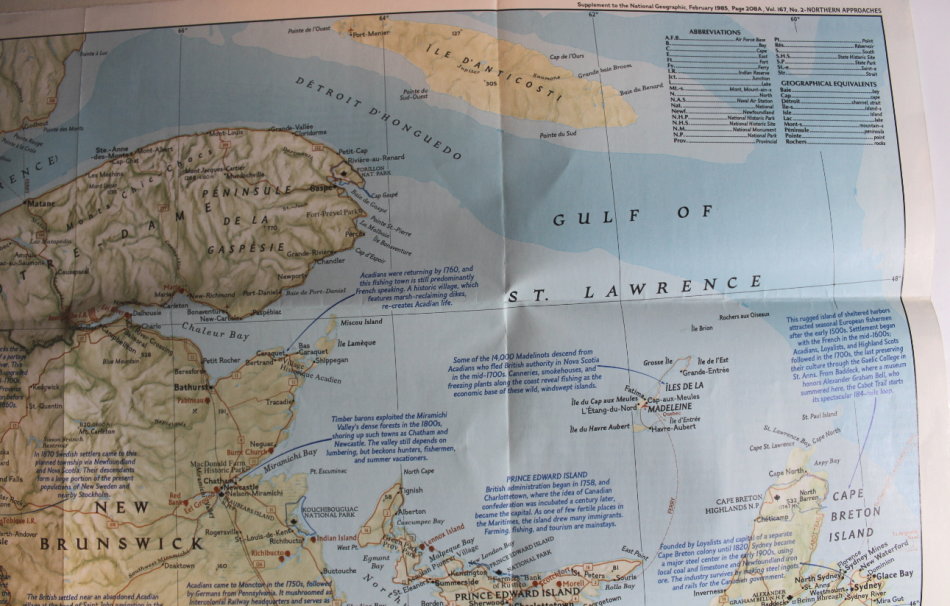
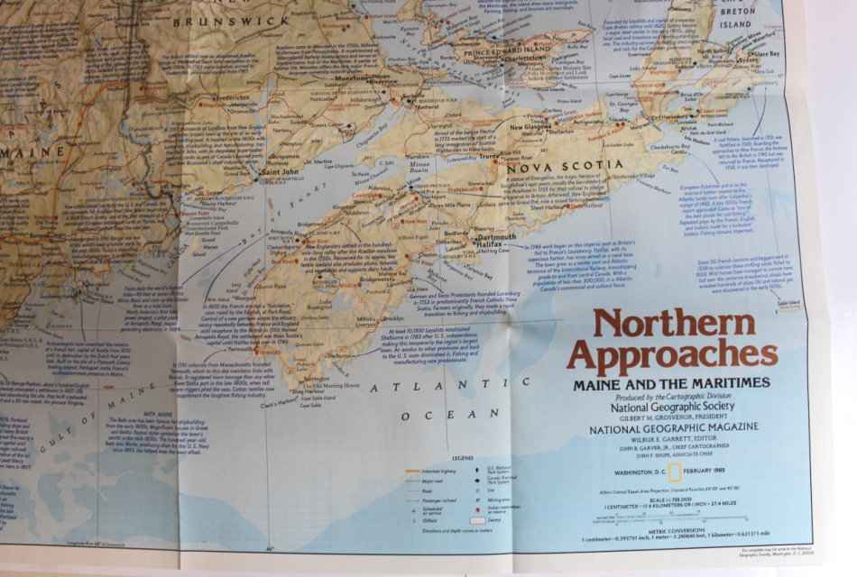
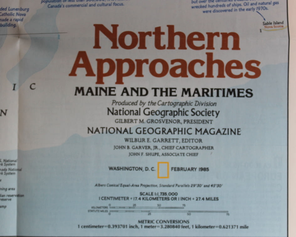
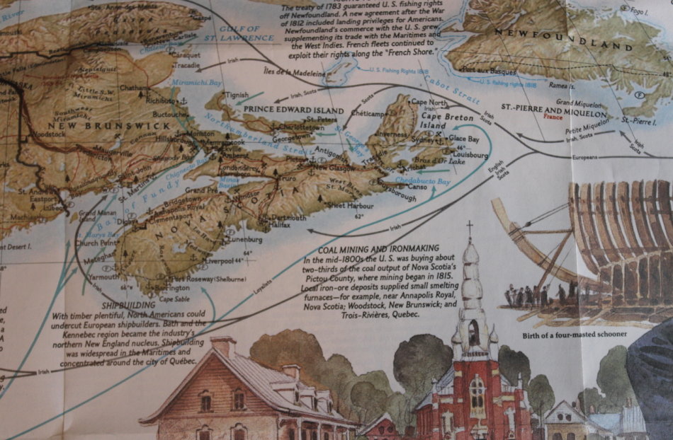
Title: National Geographic Folded Map of Northern Approaches February 1985.
Publisher: National Geographic Society, February 1985.
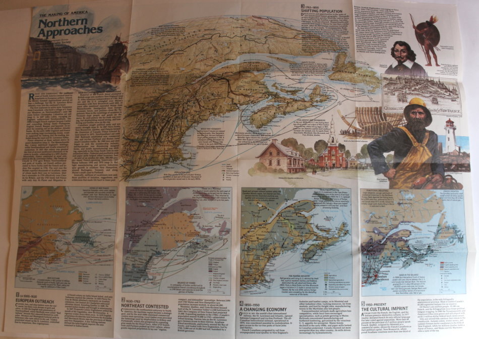
Series: The Making Of America.
Format: Folded Map.
Height: 51 cm.
Width: 69 cm.
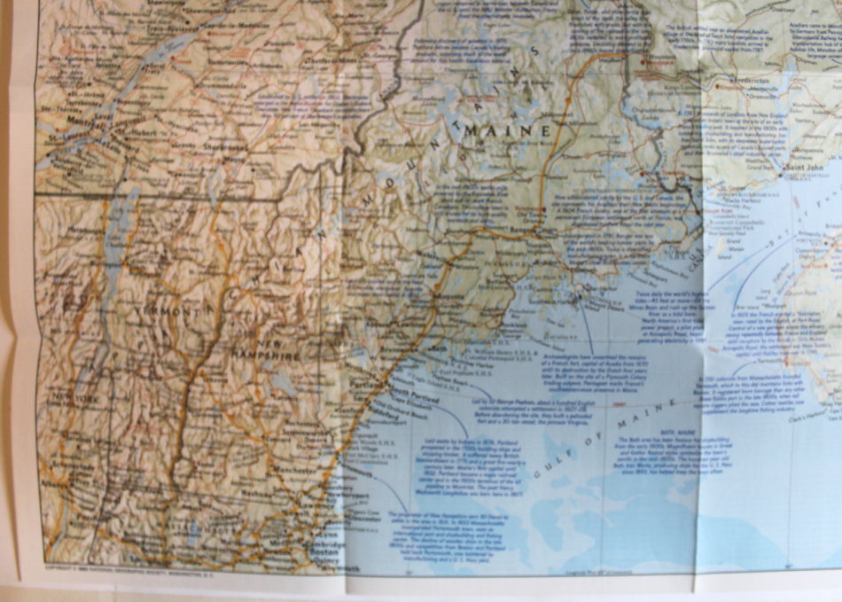
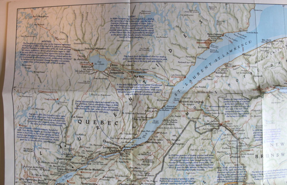
Info: Classic National Geographic map of part of the East Coast of North America with "Maine and the Maritimes" theme around the Gulf of St Lawrence and the Gulf of Main with Nova Scotia, New Brunswick and Quebec of Canada also featured. The reverse of the map features the changes and developments over the years.
Scale: 1: 1 735 000 / 1 Inch = 27.4 Miles.
Condition: Very Good, As New, a clean unused Map in excellent condition.
Price: R 195.00 Inc Vat.
![]()
![]()