This item has closed with no items sold
View the relisted Item
View the relisted Item
View other items offered by CapeCollectables1033
Similar products
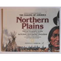
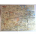
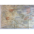
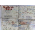
National Geographic Folded Map of the Northern Plains of the USA December 1986
Secondhand
R195.00
Closed
29 Apr 24 12:16
Shipping
Standard courier shipping from R30
R30 Standard shipping using one of our trusted couriers applies to most areas in South Africa. Some areas may attract a R30 surcharge. This will be calculated at checkout if applicable.
Check my rate
Check my rate
Free collection from
Kuils River, Cape Town
The seller allows collection for this item and will be in contact with the full collection address once the order is ready.
Ready for collection by Wednesday, 15 May.
Ready to ship in
The seller has indicated that they will usually have this item
ready to ship within 3 business days. Shipping time depends on your delivery address. The most
accurate delivery time will be calculated at checkout, but in
general, the following shipping times apply:
Standard Delivery
| Main centres: | 1-3 business days |
| Regional areas: | 3-4 business days |
| Remote areas: | 3-5 business days |
Buyer Protection
How you're covered
Get it now, pay later
Returns
Product information
Condition:
Secondhand
Location:
South Africa
Area:
The Americas
Time Period:
Post-1950
Type:
Political Map
Bob Shop ID:
611443682
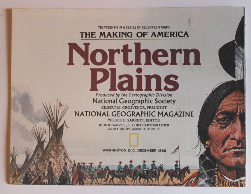
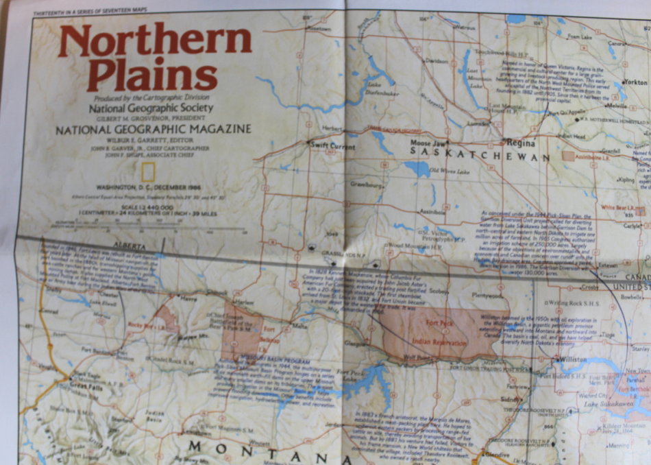
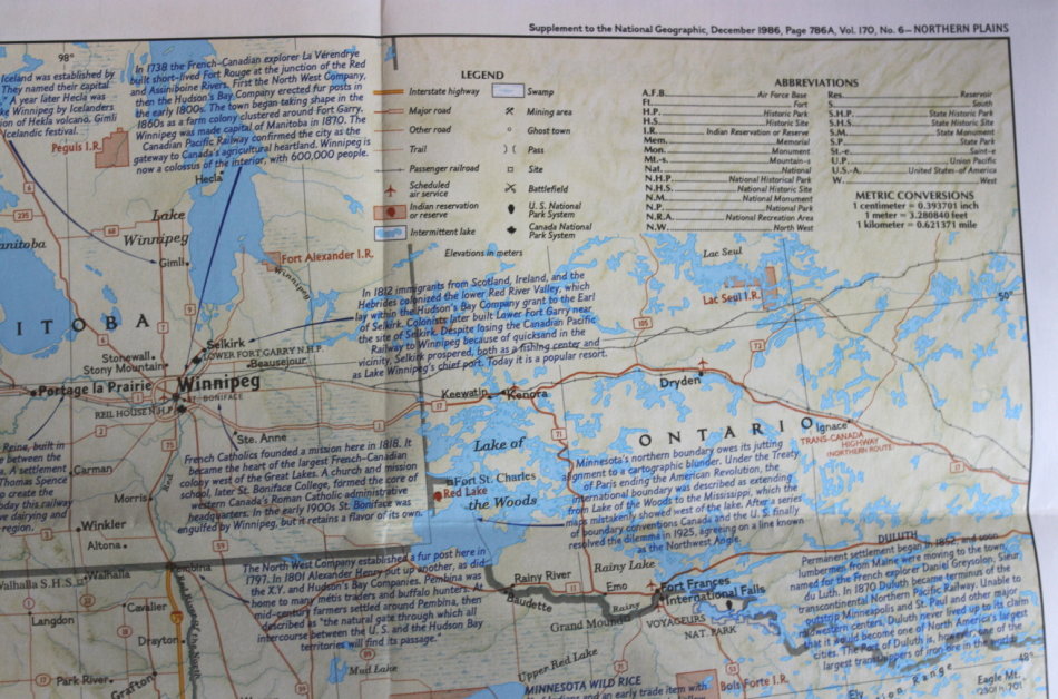
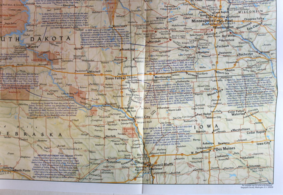
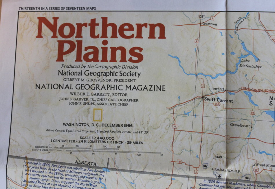
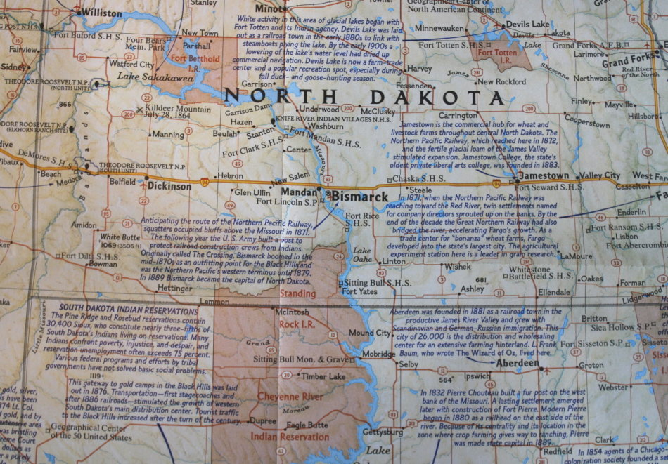
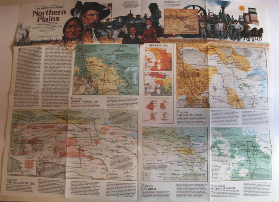
Title: National Geographic Folded Map of the Northern Plains of the USA December 1986.
Publisher: National Geographic Society, December 1986.
Series: The Making Of America.
Format: Folded Map.
Height: 52 cm.
Width: 68 cm.
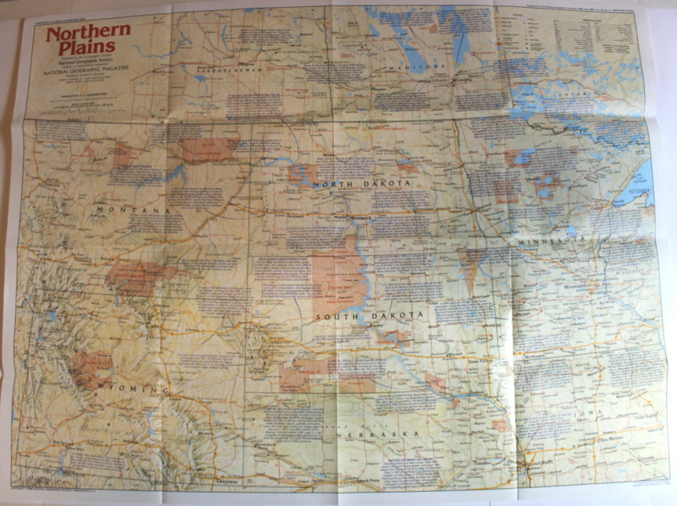
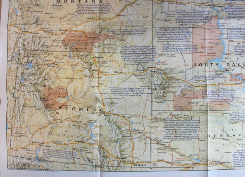
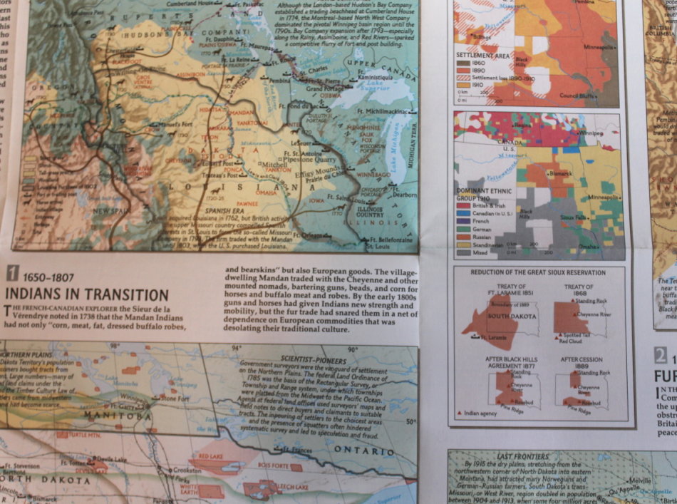
Info: Includes part of Saskatchewan, Manitoba and Ontario provinces of Canada across the US border to the Northern Plains States of Minnesota, North Dakota, South Dakota, Wyoming and Montana with parts of Nebraska and Iowa in the south. The reverse has the history and development of the region.
Scale: 1: 2 440 000 / 1 Inch = 39 Miles.
Condition: Very Good, As New, a clean unused Map in excellent condition.
Price: R 195.00 Inc Vat.
![]()
![]()