
National Geographic Folded Map of The South Central States of the USA, Oct 1974
Secondhand
Shipping
Standard courier shipping from R30
R30 Standard shipping using one of our trusted couriers applies to most areas in South Africa. Some areas may attract a R30 surcharge. This will be calculated at checkout if applicable.
Check my rate
Check my rate
Free collection from
Kuils River, Cape Town
The seller allows collection for this item and will be in contact with the full collection address once the order is ready.
Ready for collection by Monday, 20 May.
Ready to ship in
The seller has indicated that they will usually have this item
ready to ship within 3 business days. Shipping time depends on your delivery address. The most
accurate delivery time will be calculated at checkout, but in
general, the following shipping times apply:
Standard Delivery
| Main centres: | 1-3 business days |
| Regional areas: | 3-4 business days |
| Remote areas: | 3-5 business days |
Returns
Get it now, pay later
Seller
Buyer Protection
Product details
Condition
Secondhand
Location
South Africa
Area
The Americas
Time Period
Post-1950
Type
Political Map
Bob Shop ID
612633842
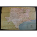
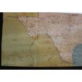
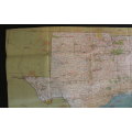
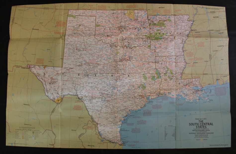
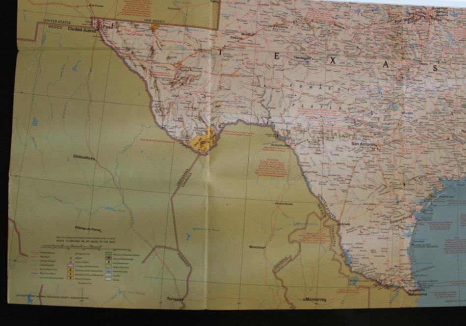
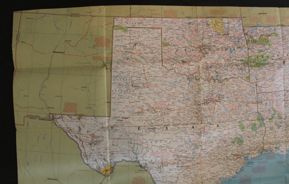
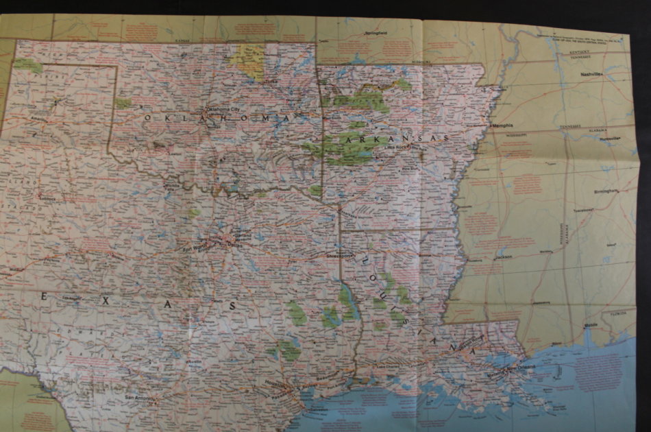
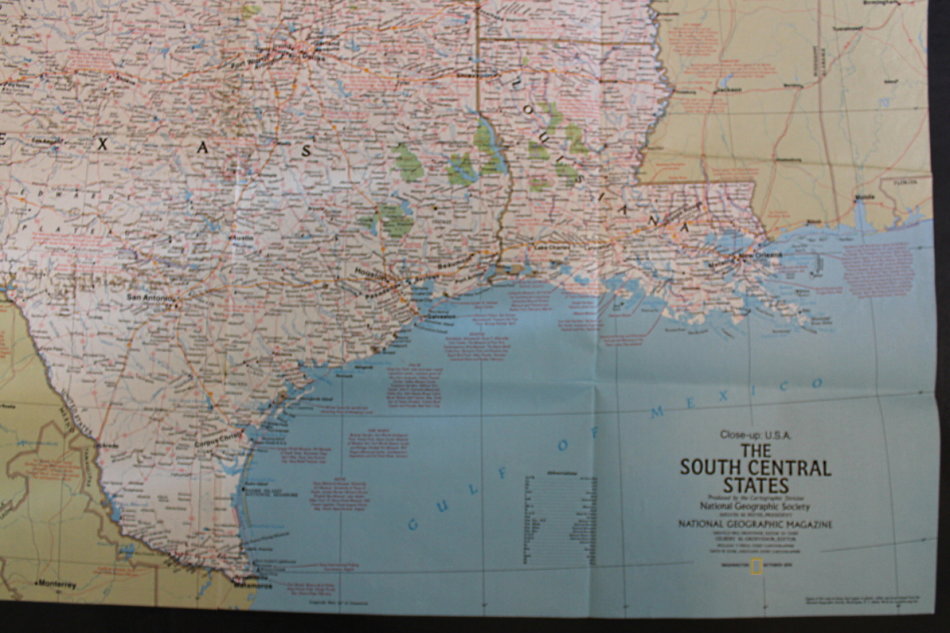
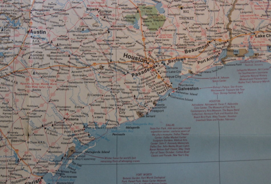
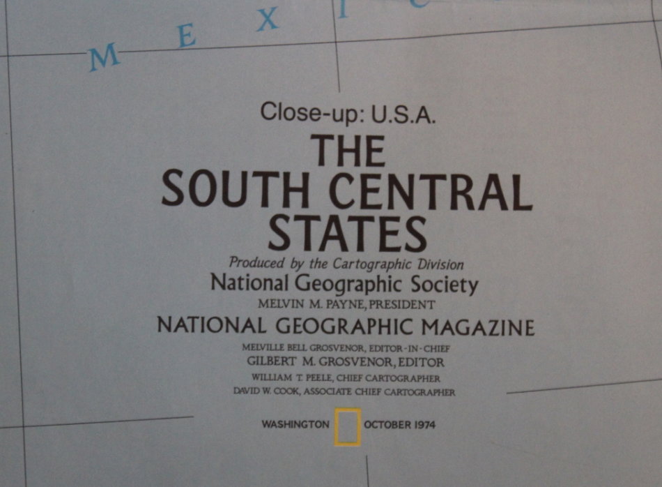
Title: National Geographic Folded Map of The South Central States of the USA, Oct 1974.
Publisher: National Geographic Society, October 1974.
Series: Close Up USA Series.
Format: Folded Map.
Height: 58 cm.
Width: 89 cm.
Info: A large detailed map of the rich land of the Southern Frontier States of America, including the States of Arkansas, Oklahoma, Louisiana and Texas.
The reverse has the history and development of the region.
Scale: 1: 2 350 000 / 1 Inch = 37.1 Miles.
Condition: Very Good, an old map with some small pinholes on the folds, otherwise in very good condition, unmarked and unused.
Price: R 195.00 Inc Vat.
![]()