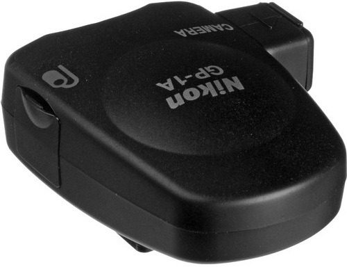
Nikon GP-1A 6 Camera GPS Unit
Check my rate
| Main centres: | 1-3 business days |
| Regional areas: | 3-4 business days |
| Remote areas: | 3-5 business days |
Product information
Nikon GP-1A GPS Unit
The GPS Unit enables the photographers to geotag images captured with camera, to record latitude, longitude, altitude and time information. The correlation between pictures and maps is supported by a combination of GPS functionality, ViewNX version 1.2 software available via a free download, and the my Picturetown online photo storage and sharing service.
The reference coordinate system of the GPS unit utilizes the WGS84 version of the World Geodetic System, which is the standard for navigation. The GPS unit facilitate to easily locate and manage images by location or time. Two accessory cables and a camera strap clip are included with the GPS unit. The GP-1A is compatible with select cameras of Nikon mentioned in the specification portion.