Ordnance Survey Folded Street Map Of Dublin 1984 Ordnance Survey Folded Street Map Of Dublin 1984 Ordnance Survey Folded Street Map Of Dublin 1984 Ordnance Survey Folded Street Map Of Dublin 1984 Ordnance Survey Folded Street Map Of Dublin 1984 Ordnance Survey Folded Street Map Of Dublin 1984 Ordnance Survey Folded Street Map Of Dublin 1984 Ordnance Survey Folded Street Map Of Dublin 1984 Ordnance Survey Folded Street Map Of Dublin 1984 Ordnance Survey Folded Street Map Of Dublin 1984 Ordnance Survey Folded Street Map Of Dublin 1984 Ordnance Survey Folded Street Map Of Dublin 1984
Ordnance Survey Folded Street Map Of Dublin 1984 Ordnance Survey Folded Street Map Of Dublin 1984 Ordnance Survey Folded Street Map Of Dublin 1984 Ordnance Survey Folded Street Map Of Dublin 1984
Ordnance Survey Folded Street Map Of Dublin 1984
+8

Ordnance Survey Folded Street Map Of Dublin 1984

Secondhand 1 available
R195.00
Shipping
Free shipping is available from CapeCollectables for all orders above R1,500.00, using one of our trusted couriers.
Check my rate
The seller allows collection for this item. Buyers will receive the collection address and time once the order is ready.
The seller has indicated that they will usually have this item ready to ship within 3 business days. Shipping time depends on your delivery address. The most accurate delivery time will be calculated at checkout, but in general, the following shipping times apply:
 
Standard Delivery
Main centres:  1-3 business days
Regional areas: 3-4 business days
Remote areas: 3-5 business days
Seller
Buyer protection
Get it now, pay later

Product details

Condition
Secondhand
Location
South Africa
Area
Europe
Time Period
Post-1950
Type
Road Map
Product code
8325487
Bob Shop ID
629708232

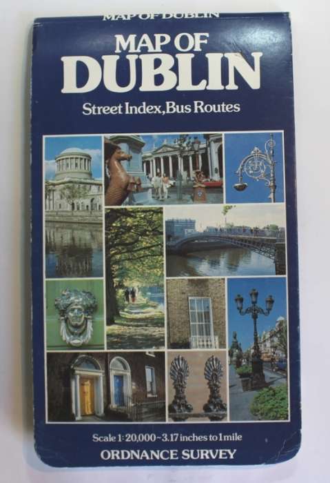
Title: Ordnance Survey Folded Street Map Of Dublin 1984.
Publisher: Compiled, Printed, and Published by the Director at the Ordnance Survey Office, Dublin, 1984.
Format: Folded Street Level Map, 13th popular edition.
Height: 100 cm.
Width: 69 cm.
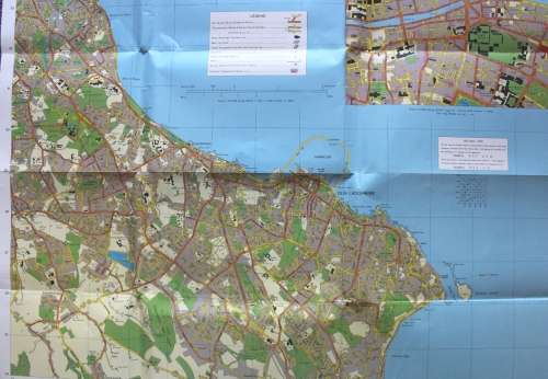
Info: Large street level fold out map of Dublin, one side has the Eastern half of the City and the other has the Western half of the city. Very good detail of Dublin in the 1980's.
With an index to streets Booklet including a list of Hospitals, Churches, and places of general public interest.
Scale: 1: 20 000  // 50 mm = 1 Km // 3.16 Inches = 1 Mile
Condition: Very good, the map itself has hardly been used, no tears or markings on the map.
Price: R 195.00 Inc Vat.


Add to cart

Recently viewed

See more
Leatherman PST 2 Multitool manufacture date 03/98 With Thick Leather Pouch Good Condition
Secondhand
R1,800.00 No bids
Temmers van die Woestyn -- No 29
Secondhand
R15.00 No bids
Three Quarter Sleeve Blazer
New
R402.00
For Samsung Galaxy Z Flip3 5G GKK Magnetic Full Coverage Phone Flip Case with Pen(Black)
New
R475.00

Similar products

New Zealand Automobile Association Folded Map South Island 1984
Secondhand
R195.00
Landmarks of Mapmaking: Illustrated Survey of Maps & Mapmakers / Tooley
Secondhand
R690.00
Vintage Ordnance survey map for England and Wales. 1942 Barnsley & Sheffield.
Secondhand
R1,045.00
National Geographic Folded Map A Travelers Map of Spain and Portugal Oct 1984
Secondhand
R145.00