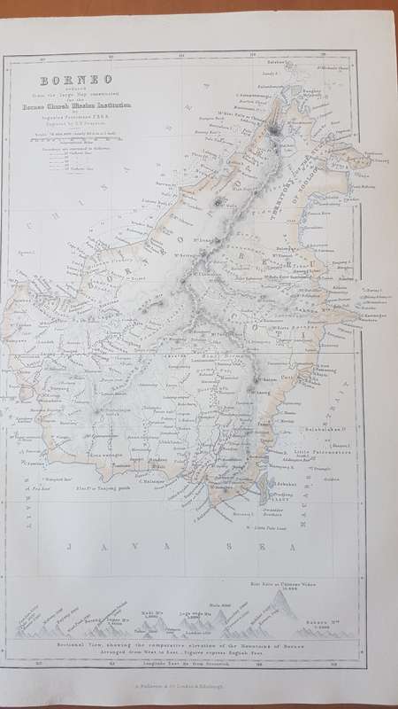
ORIGINAL 1856 MAP: Borneo by August Petermann and Swanston, G.H. ( engraver )

ORIGINAL 1856 MAP: Borneo by August Petermann and Swanston, G.H. ( engraver )

1 available / secondhand
R395.00
Shipping
R35.00 Standard shipping using one of our trusted couriers applies to most areas in South Africa. Some areas may attract a R30.00 surcharge. This will be calculated at checkout if applicable.
Check my rate
The seller allows collection for this item. Buyers will receive the collection address and time once the order is ready.
The seller has indicated that they will usually have this item ready to ship within 3 business days. Shipping time depends on your delivery address. The most accurate delivery time will be calculated at checkout, but in general, the following shipping times apply:
 
Standard Delivery
Main centres:  1-3 business days
Regional areas: 3-4 business days
Remote areas: 3-5 business days
Seller
Buyer protection
Get it now, pay later

Product details

Condition
Secondhand
Location
South Africa
Area
Australasia
Time Period
1800s
Type
Physical Map
Bob Shop ID
644979483

Title: ORIGINAL 1856 MAP: Borneo by August Petermann

Publisher: London and Edinburgh, A. Fullerton and Co., 1856


About this Item

Map is in very clean attractive condition. map was removed from a disbound Gazetteer of the World published in 1856 by Fullarton. Would frame well. The map itself is 23 cm x 14 cm withn the border, and sheet is 17 cm x 26 cm. Steel engraving, very fine work, with three lithographic colours: black outline, light blue, light brown. Looks to have been cleaned at some point. Would display beautifully. Has an interesting sectional view at the bottom showing the comparitive elevations of the principal mountains and places of Borneo, serving as an index to the letters in the map.


Add to cart

Recently viewed

See more
MAC AFRIC 770 MM T-bar Clamp
R630.00
Southern Rhodesia 1964 QEII 10s sheet no block with tail flaw very fine unmounted mint
R1,000.00
100 PCS Charging Port Screws for iPhone 13(Blue)
R173.00
50% OFF
Auto Face Tracking Selfie Stick Tripod
R510.00 R1,020.00

Similar products

ORIGINAL 1856 MAP: Cape Verd Islands, From the Admiralty Survey ( Cape Verde Islands )
R695.00
ORIGINAL MAP BY THOMAS MOULE ENGRAVED ON STEEL 1836 39cmx34cm
R1,500.00
Free shipping
1859 The Islands Of Borneo and Celebes, And the Molucca Islands Map by Edward Weller
R4,999.99
Map of the Eastern Frontier of the Cape Colony 1856, Reproduction Print
R295.00