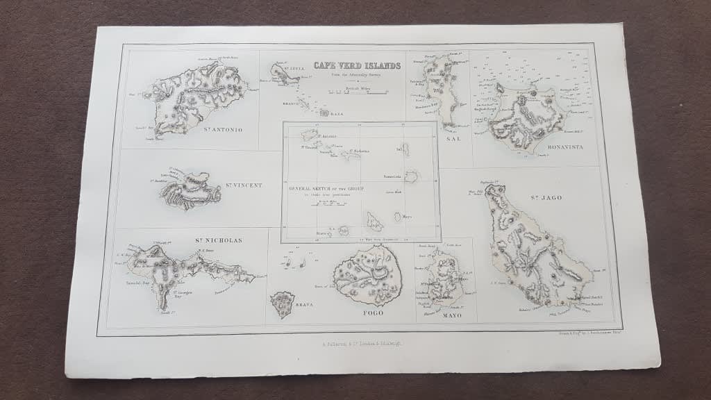
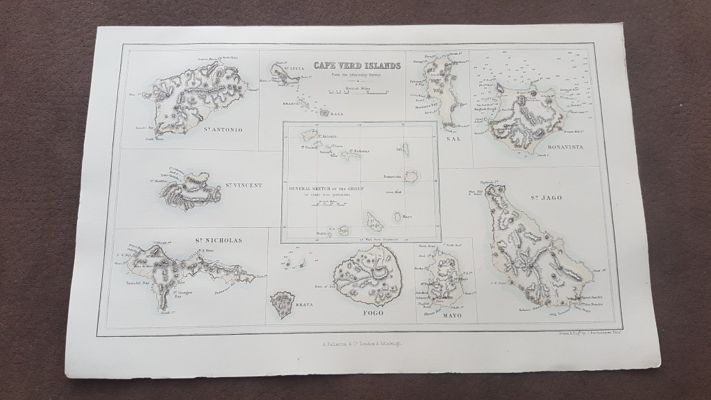
ORIGINAL 1856 MAP: Cape Verd Islands, From the Admiralty Survey ( Cape Verde Islands )
Secondhand
Shipping
Standard courier shipping from R30
R30 Standard shipping using one of our trusted couriers applies to most areas in South Africa. Some areas may attract a R30 surcharge. This will be calculated at checkout if applicable.
Check my rate
Check my rate
Free collection from
Newlands, Cape Town
The seller allows collection for this item and will be in contact with the full collection address once the order is ready.
Ready for collection by Wednesday, 15 May.
Ready to ship in
The seller has indicated that they will usually have this item
ready to ship within 3 business days. Shipping time depends on your delivery address. The most
accurate delivery time will be calculated at checkout, but in
general, the following shipping times apply:
Standard Delivery
| Main centres: | 1-3 business days |
| Regional areas: | 3-4 business days |
| Remote areas: | 3-5 business days |
Buyer Protection
How you're covered
Get it now, pay later
Product information
Condition:
Secondhand
Location:
South Africa
Area:
Africa
Time Period:
1800s
Type:
Physical Map
Bob Shop ID:
612613060
Publisher: London and Edinburgh, A. Fullarton and Co., 1856
About this Item
Map itself is in very clean attractive condition within border. Map is from a Gazzetteer of the World published in 1856 by Fullarton. Drawn and Engraved by J. Bartholomew of Edinburgh. The map itself is 23 cm x 14 cm withn the border, and sheet is 16.5 cm x 26 cm. Comprises 9 separate maps of the various islands and a General Sketch of the Group in their true position in the middle. Steel engraving with three lithographic colours: black outline, light blue, light brown. Would display beautifully.