This item has closed with no items sold
View the relisted Item
View the relisted Item
View other items offered by gregsact1874
Similar products
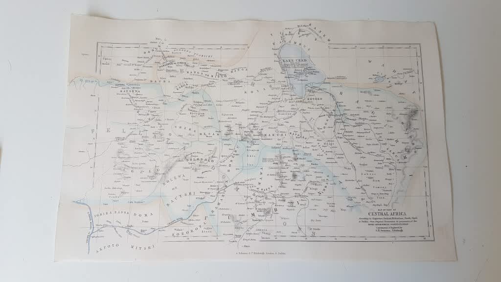
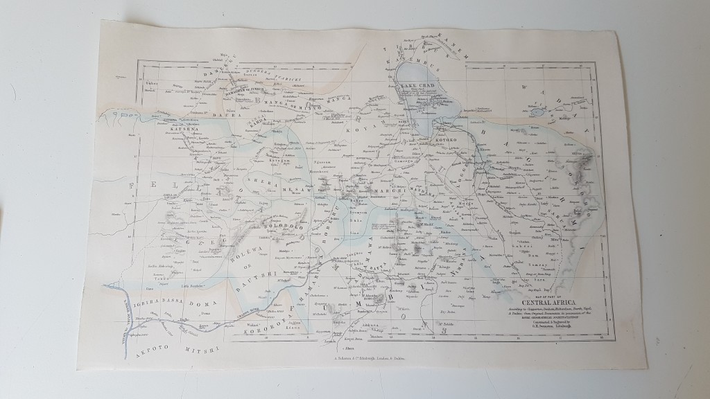
ORIGINAL 1856 MAP of Part of Central Africa ( includes Lake Chad, part of Nigeria)
Secondhand
R295.00
Closed
16 May 24 10:46
Shipping
Standard courier shipping from R30
R30 Standard shipping using one of our trusted couriers applies to most areas in South Africa. Some areas may attract a R30 surcharge. This will be calculated at checkout if applicable.
Check my rate
Check my rate
Free collection from
Newlands, Cape Town
The seller allows collection for this item and will be in contact with the full collection address once the order is ready.
Ready for collection by Tuesday, 21 May.
Ready to ship in
The seller has indicated that they will usually have this item
ready to ship within 3 business days. Shipping time depends on your delivery address. The most
accurate delivery time will be calculated at checkout, but in
general, the following shipping times apply:
Standard Delivery
| Main centres: | 1-3 business days |
| Regional areas: | 3-4 business days |
| Remote areas: | 3-5 business days |
Get it now, pay later
Seller
Buyer Protection
Product details
Condition
Secondhand
Location
South Africa
Area
Africa
Time Period
1800s
Type
Physical Map
Bob Shop ID
612637390
About this Item
Map itself is in very clean attractive condition within border. Included Lake Chad at the top and parts of what are today mainly the countries of Nigeria and Chad. Based on the discoveries of the explorers Clapperton, Denham, Richardson, Barth, Vogel and Baikie. Removed from a disbound Gazzetteer of the World published in 1856 by Fullarton. Drawn and Engraved by G. H. Swanston Edinburgh. The map itself is 23 cm x 14 cm within the border, and sheet is 17 cm x 26 cm . Steel engraving with three lithographic colours: black outline, light blue, light brown. Looks to have been cleaned at some point. Would display beautifully. Enquiries and comments welcome. Can be sent overseas via DHL Express.