This item has closed 1 buyer bought 1 item
View other items offered by CapeCollectables1227

Similar products

Jeppes Map Of The Transvaal 1899, Reproduction Print Wall Map Northern Tvl
R295.00
Map of the Eastern Frontier of the Cape Colony 1856, Reproduction Print
R295.00
Cape Peninsula 1934 - 80th Anniversary Surveys and Mapping, Set of 4 Maps, Reproduction Prints
R550.00
Vintage Africa / Afrika Wall Map 1951 Reproduction print.
R195.00
Plan of Pretoria and Johannesburg From Jeppes Map of the Transvaal 1899, Reproduction Print Plan of Pretoria and Johannesburg From Jeppes Map of the Transvaal 1899, Reproduction Print Plan of Pretoria and Johannesburg From Jeppes Map of the Transvaal 1899, Reproduction Print Plan of Pretoria and Johannesburg From Jeppes Map of the Transvaal 1899, Reproduction Print Plan of Pretoria and Johannesburg From Jeppes Map of the Transvaal 1899, Reproduction Print
Sold

Plan of Pretoria and Johannesburg From Jeppes Map of the Transvaal 1899, Reproduction Print

1 was available / secondhand
R295.00
Shipping
Free shipping is available from CapeCollectables for all orders above R1,500.00, using one of our trusted couriers.
Check my rate
The seller allows collection for this item. Buyers will receive the collection address and time once the order is ready.
The seller has indicated that they will usually have this item ready to ship within 3 business days. Shipping time depends on your delivery address. The most accurate delivery time will be calculated at checkout, but in general, the following shipping times apply:
 
Standard Delivery
Main centres:  1-3 business days
Regional areas: 3-4 business days
Remote areas: 3-5 business days
Buyer protection
Returns
Money-Back Guarantee: 7 Days: Refund if returned, excluding Postage.
Get it now, pay later

Product details

Condition
Secondhand
Location
South Africa
Area
Africa
Time Period
1800s
Type
Political Map
Customer ratings:
Bob Shop ID
416244827

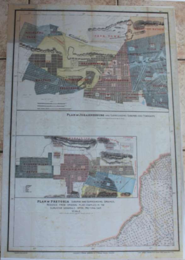
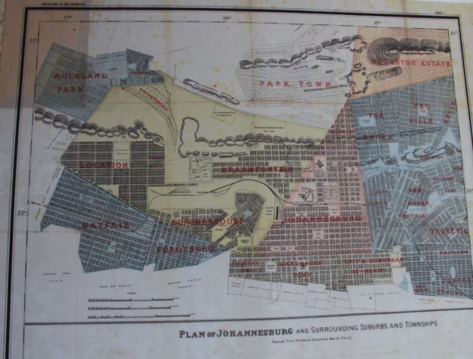
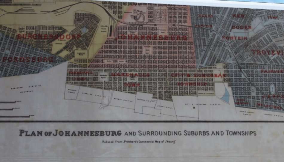
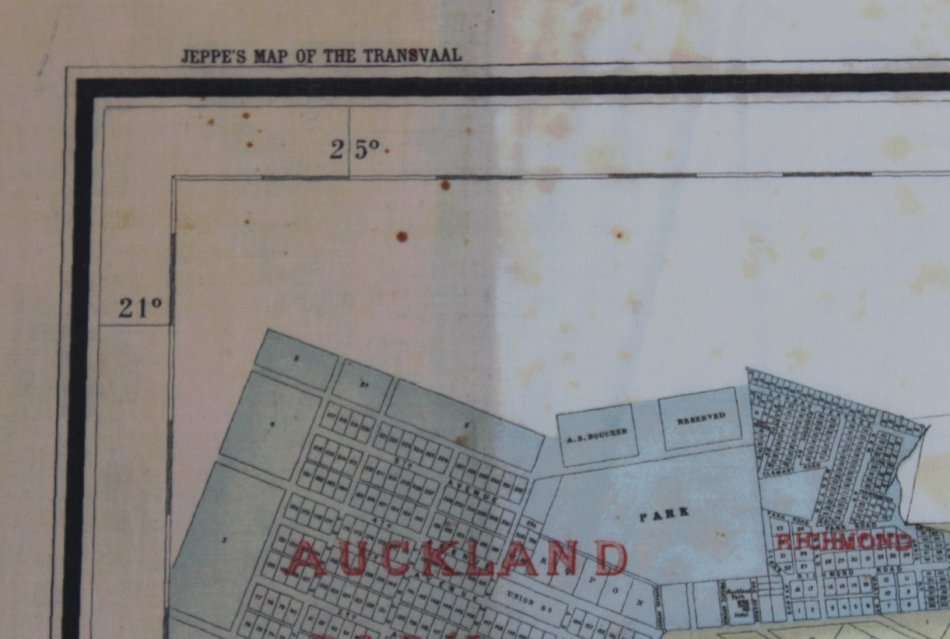
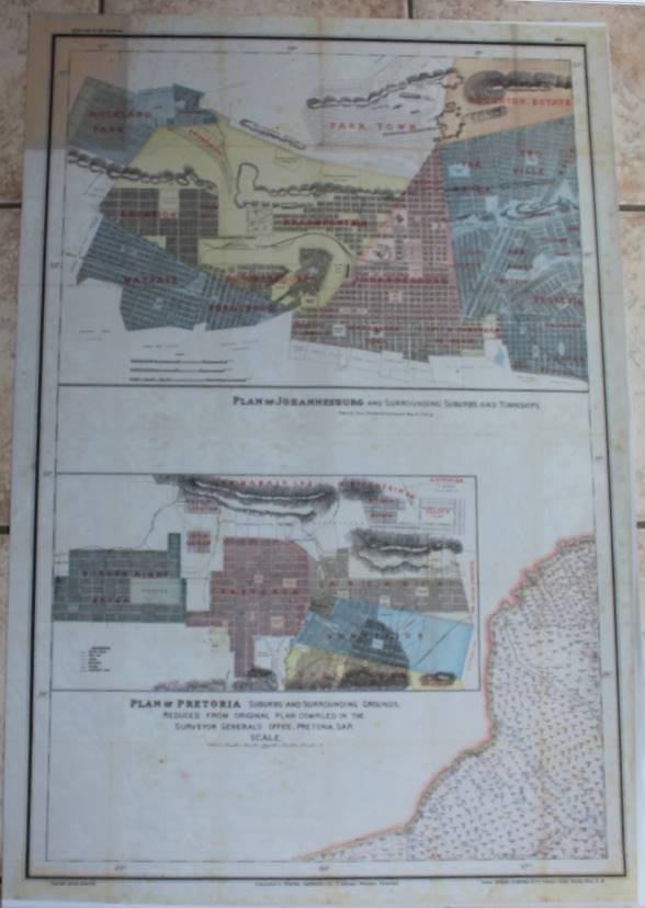
Title: Plan of Pretoria and Johannesburg From Jeppes Map of the Transvaal 1899, Reproduction Print.
Publisher: Surveyor Generals Office, Pretoria, SA Republic, 1899.
Height: 100cm.
Width: 77cm.
Info: Compiled from Surveys filed in the Survey Generals Office by Fred Jeppe Hon C.M.R.G.S of The Survey Generals Department and CFW Jeppe of the Mining Department.
Johan Rissik ESQ, Surveyor General of the SAR for Information and Advice.
One of a series of maps completed by the Jeppe Brothers of the South African Boer Republic of the Transvaal,
in the 1890's, prior to the Boer War.
Contains Johanneburg and Pretoria Street Layout with Suburbs and places of interest in the 1890's.
Scale: 1: 476 000
Format: Scanned and Printed on Poster Paper from the original, can be shipped in a Poster Tube.
Condition: .
Price: R 295.00 Inc Vat.

Please Note: it is possible to purchase the whole set of copies of the Jeppe's Maps of the Transvaal in Printed and Digital format, please enquire for further information.

Recently viewed

See more
for Hyundai IX35 Passenger side electric Power Window Lifter regulator Control Switch button
R575.00
50% OFF
For OPPO Reno6 Pro+ OEM Power Button Flex Cable
R153.00 R305.00
Wilderness Cap - 6 Panel
R56.50
The Death of Ahasuerus (First Edition) | Par Lagerkvist
R150.00

Customer ratings: 1 ratings

Great!
09 Jul 2019