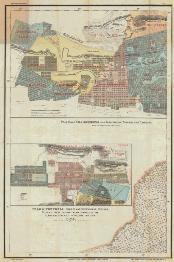
Plan of Pretoria and Johannesburg From Jeppes Map of the Transvaal 1899, Reproduction Print
Secondhand
Shipping
Standard courier shipping from R30
R30 Standard shipping using one of our trusted couriers applies to most areas in South Africa. Some areas may attract a R30 surcharge. This will be calculated at checkout if applicable.
Check my rate
Check my rate
Free collection from
Somerset West, Cape Town
The seller allows collection for this item and will be in contact with the full collection address once the order is ready.
Ready for collection by Thursday, 6 June.
Ready to ship in
The seller has indicated that they will usually have this item
ready to ship within 3 business days. Shipping time depends on your delivery address. The most
accurate delivery time will be calculated at checkout, but in
general, the following shipping times apply:
Standard Delivery
| Main centres: | 1-3 business days |
| Regional areas: | 3-4 business days |
| Remote areas: | 3-5 business days |
Returns
Get it now, pay later
Seller
Buyer Protection
Product details
Condition
Secondhand
Location
South Africa
Area
Africa
Time Period
1800s
Type
Political Map
Bob Shop ID
615822311
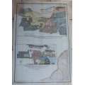
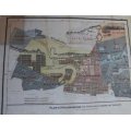
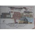
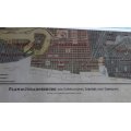
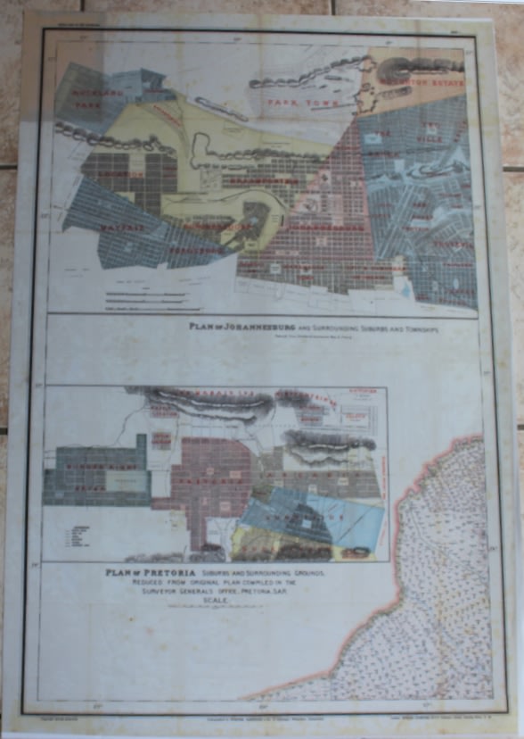
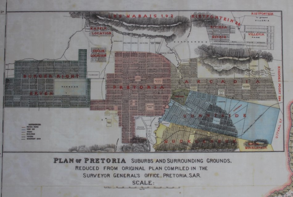
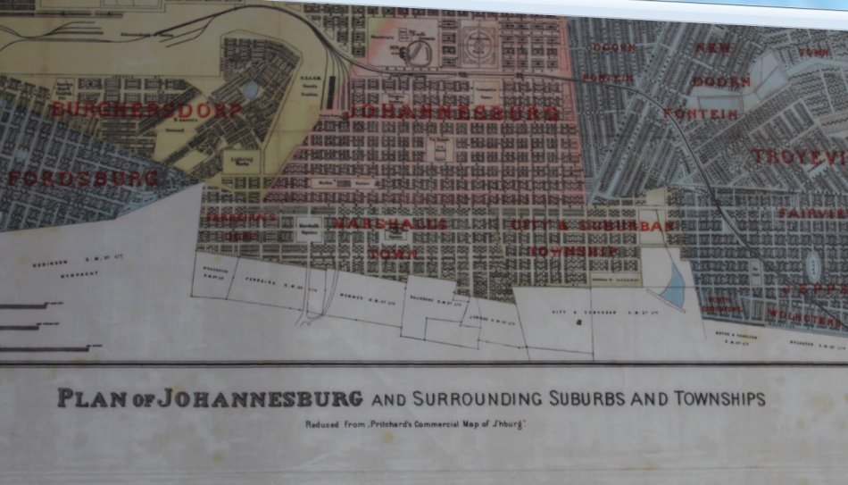
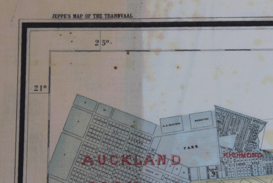
Title: Plan of Pretoria and Johannesburg From Jeppes Map of the Transvaal 1899, Reproduction Print.
Publisher: Surveyor Generals Office, Pretoria, SA Republic, 1899.
Height: 100cm.
Width: 77cm.
Info: Compiled from Surveys filed in the Survey Generals Office by Fred Jeppe Hon C.M.R.G.S of The Survey Generals Department and CFW Jeppe of the Mining Department.
Johan Rissik ESQ, Surveyor General of the SAR for Information and Advice.
One of a series of maps completed by the Jeppe Brothers of the South African Boer Republic of the Transvaal,
in the 1890's, prior to the Boer War.
Contains Johanneburg and Pretoria Street Layout with Suburbs and places of interest in the 1890's.
Scale: 1: 476 000
Format: Scanned and Printed on Poster Paper from the original, can be shipped in a Poster Tube.
Condition: .
Price: R 295.00 Inc Vat.
Please Note: it is possible to purchase the whole set of copies of the Jeppe's Maps of the Transvaal in Printed and Digital format, please enquire for further information.
![]()