This auction has been won.
View other items offered by ErnRex15453172
Leading
ivan2007954 1 × R1,605.00
6 Dec 22:33
Runners-up
SA Collect Invest1415 1 × R1,575.00
6 Dec 22:32
Blue Stone Antiques460 1 × R1,000.00
6 Dec 22:24
Bid2Win191 1 × R345.00
6 Dec 20:43
123 weg4276 1 × R185.00
5 Dec 20:19
naaskop114 1 × R121.00
5 Dec 15:59
AliHar51632750 1 × R105.00
5 Dec 12:05
nieldivvie964 1 × R31.00
5 Dec 12:05

Similar products

R30 shipping
1892 Map of South America, Good condition, Original Chambers Map
R145
R30 shipping
Antique Map of Holland by John Tallis 1851
R950
R30 shipping
ANTIQUE MAPS OF EUROPE, THE AMERICAS, WEST INDIES, AUSTRALASIA, AFRICA, THE ORIENT BY DOUGLAS GOHM
R250
R30 shipping
Antique Maps by Douglas Gohm, First Edition
R200

RARE ANTIQUE MAP AMERICAE NOVA TABULA WITH ELDORADO WILLEM BLAEU (1571-1638) HAND COLOURED ENGRAVING

1 was available / secondhand
R1,605.00 auction closed
Shipping
Standard courier shipping from R30
R30 Standard shipping using one of our trusted couriers applies to most areas in South Africa. Some areas may attract a R30 surcharge. This will be calculated at checkout if applicable.
Check my rate
Free collection from Doornpoort, Pretoria
The seller allows collection for this item and will be in contact with the full collection address once the order is ready. Ready for collection by Friday, 10 May.
Ready to ship in
The seller has indicated that they will usually have this item ready to ship within 7 business days. Shipping time depends on your delivery address. The most accurate delivery time will be calculated at checkout, but in general, the following shipping times apply:
 
Standard Delivery
Main centres:  1-3 business days
Regional areas: 3-4 business days
Remote areas: 3-5 business days
Buyer Protection How you're covered

Product information

Condition:
Secondhand
Location:
South Africa
Area:
The Americas
Time Period:
Pre-1800s
Customer ratings:
Bob Shop ID:
601069821

AMERICAE NOVA TABULA WILLEM BLAEU (1571-1638) HAND COLOURED LINE ENGRAVED PRINT (CIRCA 1621-1642)

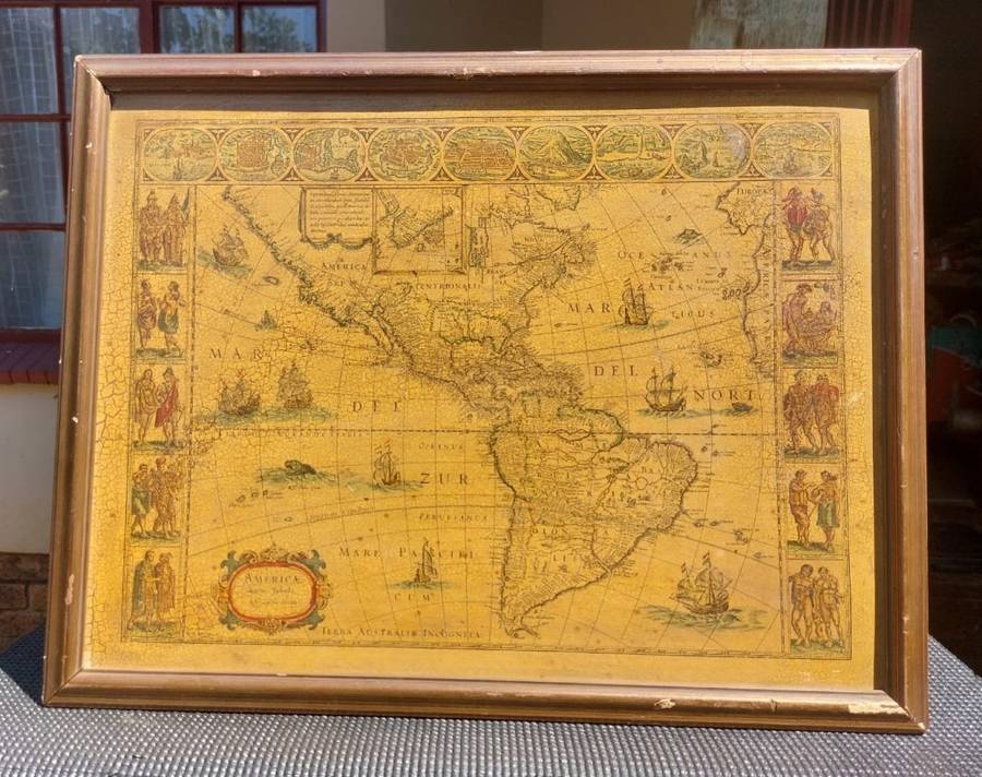
ON AUCTION IS A RARE UNIQUELY HAND COLOURED LINE ENGRAVED PRINT OF AN EARLY MAP OF THE AMERICAS TITLED AMERICAE NOVA TABULA (NEW MAP OF AMERICA) FROM THE EARLY 17TH CENTURY PRODUCED BY WLLEM BLAEU A FAMOUS DUTCH CARTOGRAPHER.
 
Willem Janszoon Blaeu (1571-1638) Americae Nova Tabula (New Map of America) Hand Coloured Line Engraved Print
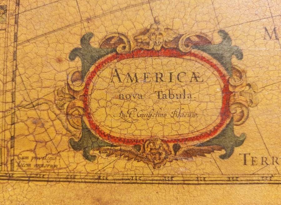
Title verso: Americae nova Tabula Auct. Guiljelmo Blaeuw
Edition: Its is a state 3 Edition (confirmed with the word surname Blaeuw in cartouche) most propably from a stand alone engraved print (no center folding mark visible) although it can be also from one of the Le Grand Atlas Unknown 3rd State Editions into which this map was published.
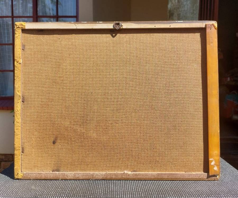
(Since the Map seem pasted onto a hardboard the language edition that was usually printed on the back is obscure.)
 
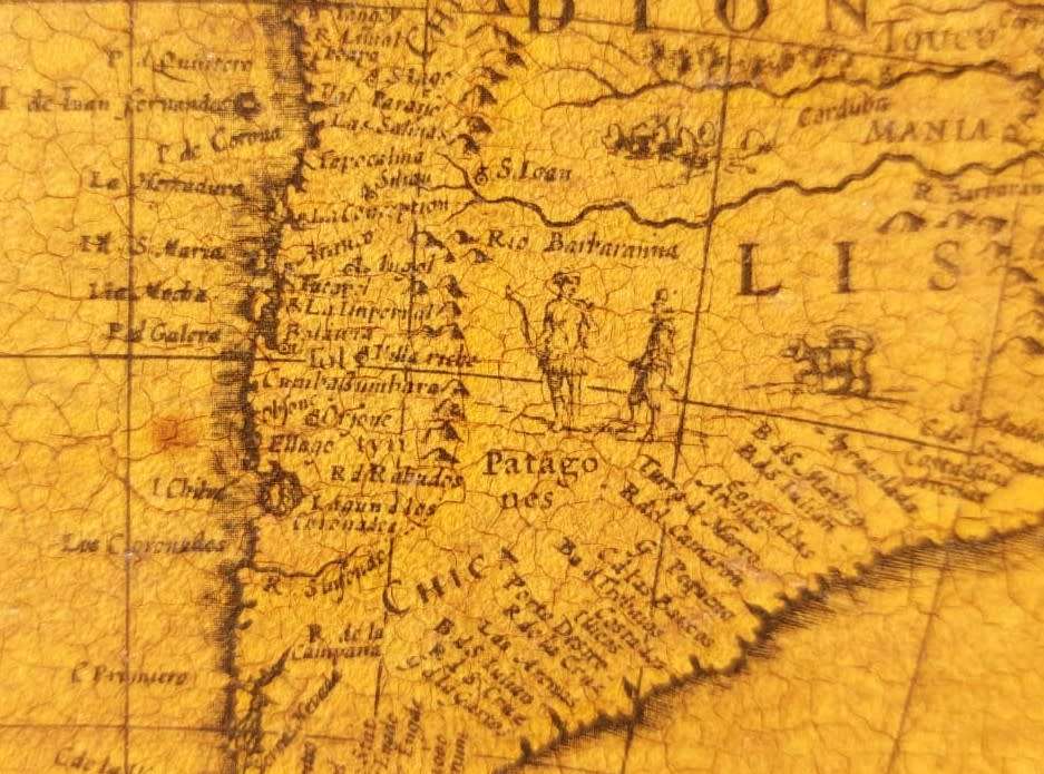
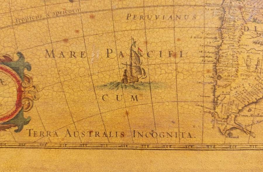
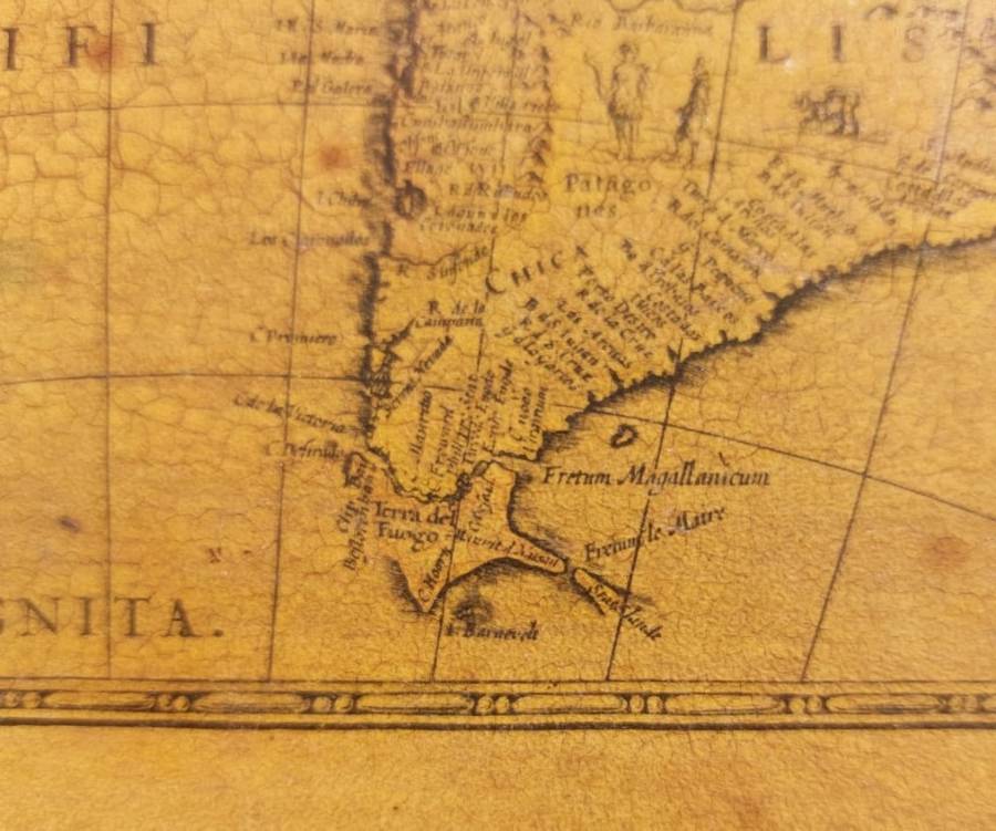
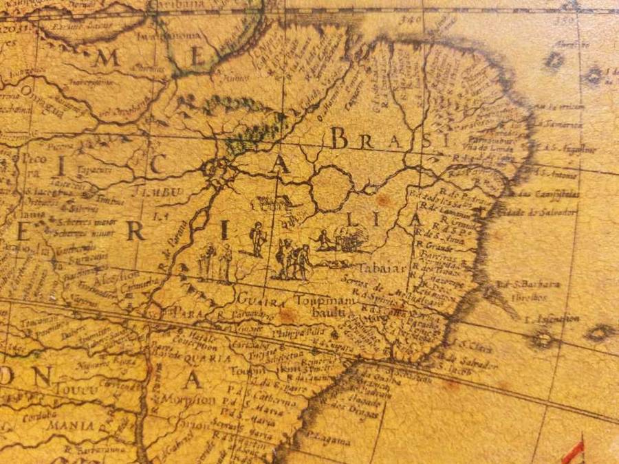
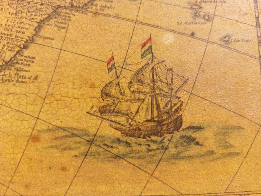
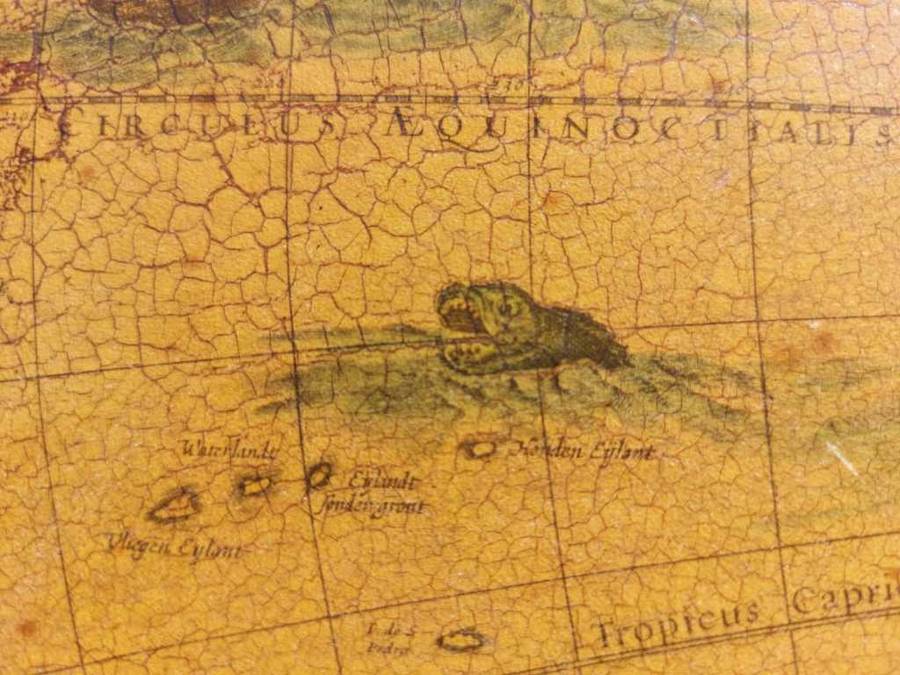
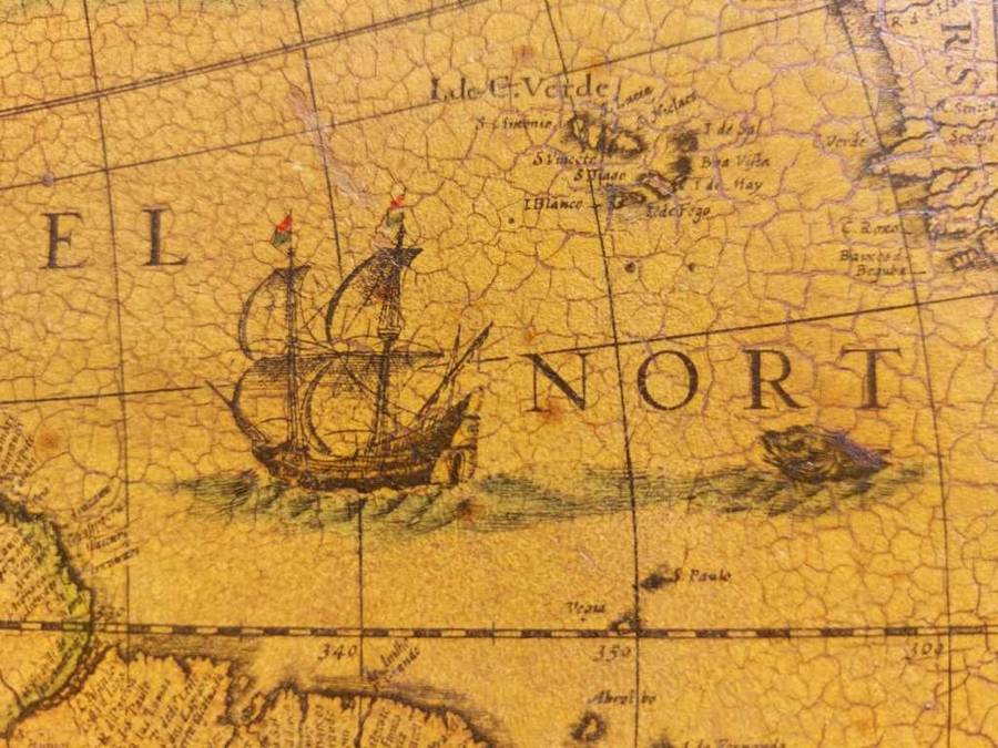
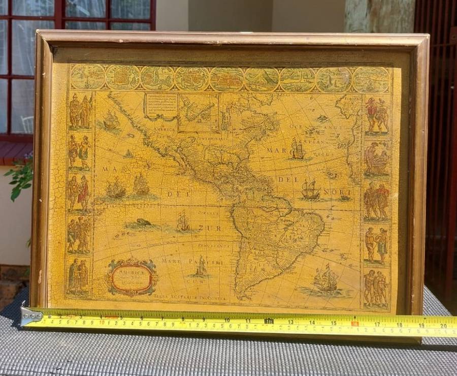
Willem Blaeus map of the Americas is one of the most sought-after maps of the era. The map is richly decorated with clipper ships and sea monsters in the oceans as well as cannibals depicted in Brasilia and giants in Patagonia. A sliver of the coast of Spain and Africa is included on the east side of the Atlantic Ocean.
 
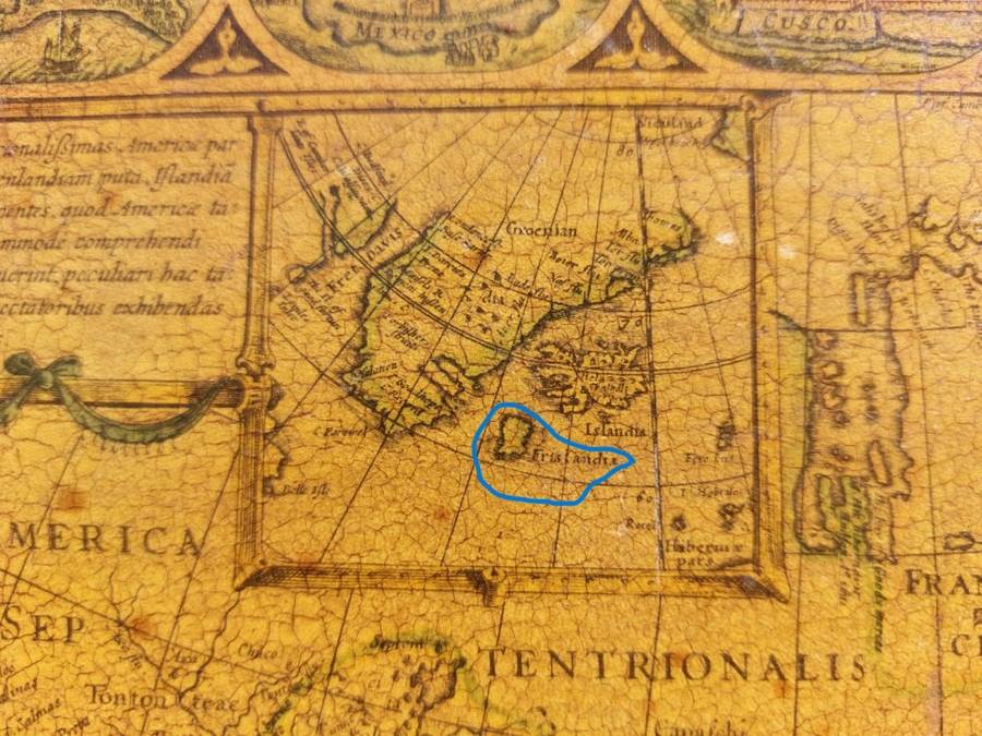
MYTHICAL ISLAND OF FRISLAND: Interestingly Blaeu uses an inset map of Groenlan (Greenland), Islandia (Iceland), and the mythical island of Frislandia. Frisland never existed, however, cartographers believed that the island was real because of a map published in 1558 known as the Zeno map.
 
THIS IS AN UNIQUELY HAND COLOURED LINE ENGRAVING: Each of these maps produced in the 17th century is a hand coloured engraving making each map unique. Looking at similar maps online you will notice each region coloured differently and sometimes in a different colour.
 
TOP AND FLANK ROWS: The row at the top consists of nine town views, depicting the most important cities in the New World (Havana, St Domingo, Cartagena, Mexico City, Cusco, Potosi, La Mocha, Rio de Janeiro, and Olinda in Pernambuco). Along either flank of the map, we find five depictions of the peoples of America. 
 
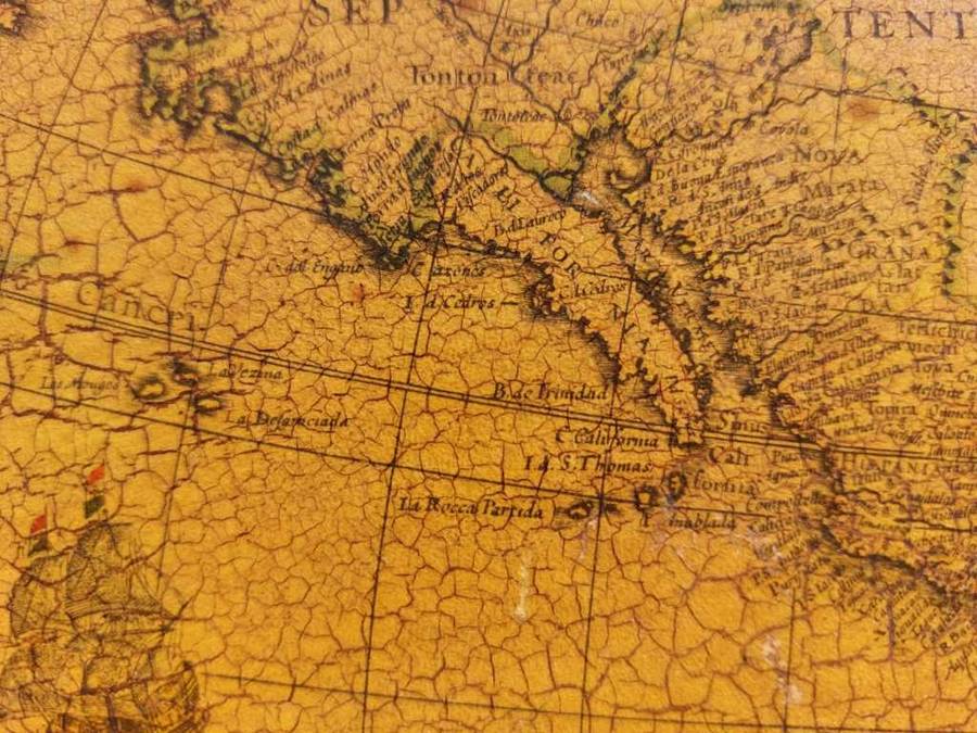
CALIFORNIA: Among this maps unusual features is that California is represented in its correct peninsular form rather than as an island (the notion of an island had taken a firm hold with most European cartographers in the 17th century).Their is also an complete absence of the Great Lakes and the Mississippi River.
 
FIVE (5) VERSIONS OF THESE MAPS:
Willem Blaeus hugely influential map of the Americas was published in five distinct states, of which only the latest three can still be obtained. Our example is the 3rd state, published in 1621 with Name of author revised to Guiljelmo: Blaeuw in cartouche. 
 
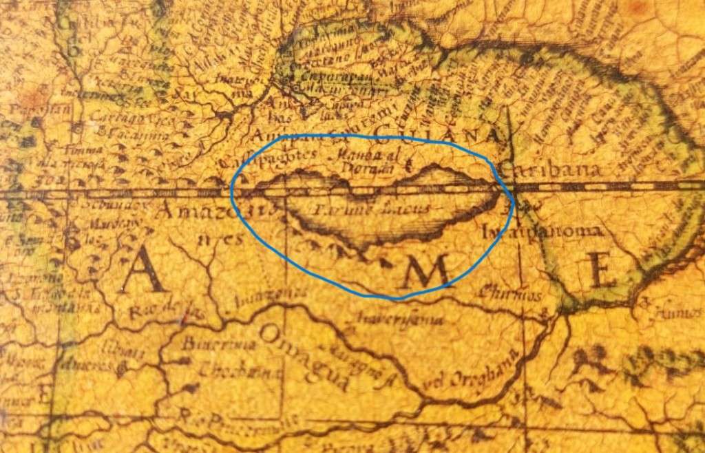
EL DORADO ON MAP: El Dorado is commonly associated with the legend of a gold city, kingdom, or empire purportedly located somewhere in the Americas. In the early 1500s, Spanish conquistadores heard tales of an Amazonian king who regularly coated his body with gold dust, then plunged into a nearby lake to wash it off while being showered with gold and jewels thrown by his subjects. The Spaniards called the city ruled by this flamboyant monarch El Dorado Spanish for "gilded one," and the story of the gold-covered king eventually grew into a legend of a whole country paved with gold.  This 1621 map by Willem Blaeu still shows the mythical lake Lake Parime straddling the equator, with the fabled golden city  "Manoa al Dorada" on the north shore.
 
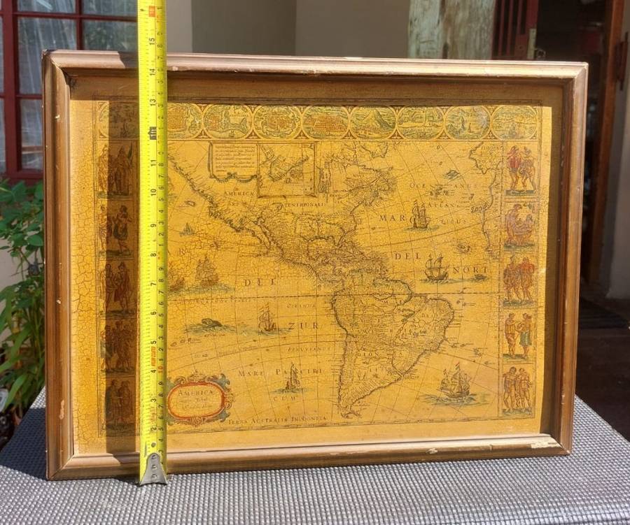
SIZE: LINE ENGRAVING 44CM WIDE 33CM HIGH
FRAME 48CM WIDE 37CM HIGH
CONDITION: PAPER IS DISCOLORED AND CRACKLED BUT TEXT STILL READABLE AND ARTWORK STILL CLEAR WITH HAND COLOURING STILL BEAUTIFUL. HAND COLOURED LINE ENGRAVING WAS MOUNTED OR PASTED ONTO A HARDBOARD. FEW CHIPS TO FRAME.
 
MARKINGS: Americae nova Tabula Auct. Guiljelmo Blaeuw in cartouche
 
WILLEM BLAEU (1571-1638):

Willem Janszoon Blaeu (1571-1638) was a prominent Dutch geographer and publisher. Blaeu set up shop in Amsterdam. In 1635, he released his atlas in Latin, Theatrum Orbis Terranum, ("Theatre of the Lands of the World"), sive (or), Atlas Novus (new atlas). German, Dutch and French versions of this atlas were published through about 1667. Willem died in 1638. He had two sons, Cornelis (1610-1648) and Joan (1596-1673). Later in life, Joan would modify and greatly expand his fathers Atlas Novus eventually releasing his masterpiece, the Atlas Major between 1662 and 1672 which reached 12 volumes. The Blaeus' atlas production came to an abrupt end with the fire in their workshop and the resulting destruction of many printing plates in 1672.
 
PLEASE ALSO SEE MY OTHER ITEMS LISTED. I HAVE ANOTHER OLD MAP OF EUROPE BY BLAEU ON AUCTION THIS WEEK. COPY THE URL UNDERNEATH AND PASTE INTO GOOGLE AND IT WILL TAKE YOU DIRECTLY TO ALL MY LISTINGS THIS WEEK. https://www.bidorbuy.co.za/seller/3685641/ErnRex1545

Customer ratings: 1 ratings

Excellent service
13 Dec 2023