San Francisco Bay Area Transportation System Folded Map 1987 San Francisco Bay Area Transportation System Folded Map 1987 San Francisco Bay Area Transportation System Folded Map 1987 San Francisco Bay Area Transportation System Folded Map 1987 San Francisco Bay Area Transportation System Folded Map 1987 San Francisco Bay Area Transportation System Folded Map 1987 San Francisco Bay Area Transportation System Folded Map 1987
San Francisco Bay Area Transportation System Folded Map 1987 San Francisco Bay Area Transportation System Folded Map 1987 San Francisco Bay Area Transportation System Folded Map 1987 San Francisco Bay Area Transportation System Folded Map 1987
San Francisco Bay Area Transportation System Folded Map 1987
+3

San Francisco Bay Area Transportation System Folded Map 1987

Secondhand 1 available
R125.00
Shipping
Free shipping is available from CapeCollectables for all orders above R1,500.00, using one of our trusted couriers.
Check my rate
The seller allows collection for this item. Buyers will receive the collection address and time once the order is ready.
The seller has indicated that they will usually have this item ready to ship within 3 business days. Shipping time depends on your delivery address. The most accurate delivery time will be calculated at checkout, but in general, the following shipping times apply:
 
Standard Delivery
Main centres:  1-3 business days
Regional areas: 3-4 business days
Remote areas: 3-5 business days
Seller
Buyer protection
Get it now, pay later

Product details

Condition
Secondhand
Location
South Africa
Area
The Americas
Time Period
Post-1950
Product code
8326464
Bob Shop ID
630720570

 Title: San Francisco Bay Area Transportation System Folded Map 1987.
Publisher: Metropolitan Transportation Commission, San Francisco, California, 1987.
Format: Folded Map.
Height: 77 cm.
Width: 69 cm.
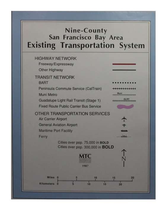
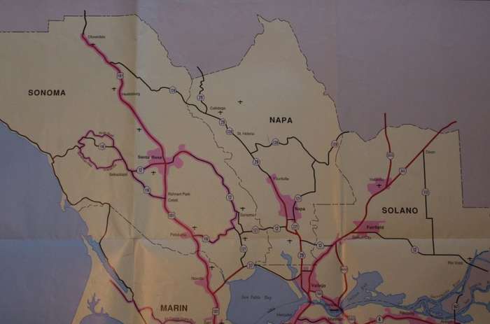
Info: Map showing 9 counties around San Francisco with the Road, Rail, and Ferry services around San Francisco.
With the Golden Gate Bridge and San Francisco Bay. Great for the railroad or transport collector.
Scale: 1 Inch = 5 Miles.
Condition: Very Good.
Price: R 125.00 Inc Vat.


Add to cart

Recently viewed

See more
Postcodes 1986
Secondhand
R150.00
Whitesnake - David Coverdale
Secondhand
R230.00
Antique Wilson`s Pure Tea silverplated caddy spoon
Secondhand
R400.00 No bids
Air Valve Spring For Sg H2000 Sprat Gun
New
R19.54

Similar products

Free shipping
Old Canvas Map of Upington Area
Secondhand
R750.00
German 1904 War Map of Caprivi area, Kriegskarte von Deutsch-Sudwestafrika. 1987 National Archives
Secondhand
R395.00
Map of Australia Wall Map - Folded - 1972
Secondhand
R195.00
Munich Transport Network Folded Map December 2003
Secondhand
R95.00