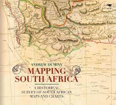
SCARCE! `MAPPING SOUTH AFRICA-A HISTORICAL SURVEY OF SOUTH AFRICAN MAPS AND CHARTS` ANDREW DUMINY
Check my rate
| Main centres: | 1-3 business days |
| Regional areas: | 3-4 business days |
| Remote areas: | 3-5 business days |
Product information
SCARCE! "MAPPING SOUTH AFRICA - A HISTORICAL SURVEY OF SOUTH AFRICAN MAPS AND CHARTS" BY ANDREW DUMINY, FIRST EDITION, 2011, HARDCOVER, COMPLETE INTACT DUSTJACKET, 134 PAGES. NO NAMES, INSCRIPTIONS, ETC. IN EXCELLENT CONDITION.
Beginning with the Portuguese voyages of exploration in the late 15th century, the book lays out the attempts of the Dutch and then the British to chart and lay claim to the vast and expanding landscape of the Cape Colony. Subsequent chapters deal with maps of the Eastern Cape, where a series of frontier wars over almost a hundred years led to an outpouring of cartography. In colonial Natal and the Boer Republics of the Transvaal and Free State, cartography was driven by the dictates of colonization and land exploitation. It was as a result of the Anglo-Boer War and of laborious trigonometrical survey work that the mapping of South Africa reached new heights and set new standards that would be extended and consolidated after Union in 1910.Throughout the book the author reveals an appreciation of the close relation between science, exploration and cartography and gives due prominence to the role played by individuals as well as institutions in producing maps of increasing accuracy and detail. Mapping South Africa will remain a standard work of its kind, appreciated for its informative text and the beautiful reproductions it contains of some 85 maps.
COURIER DELIVERY ANYWHERE IN SOUTH AFRICA ONLY