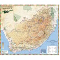
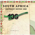
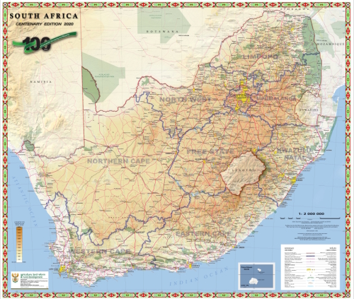
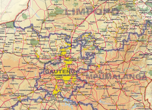
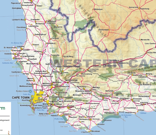
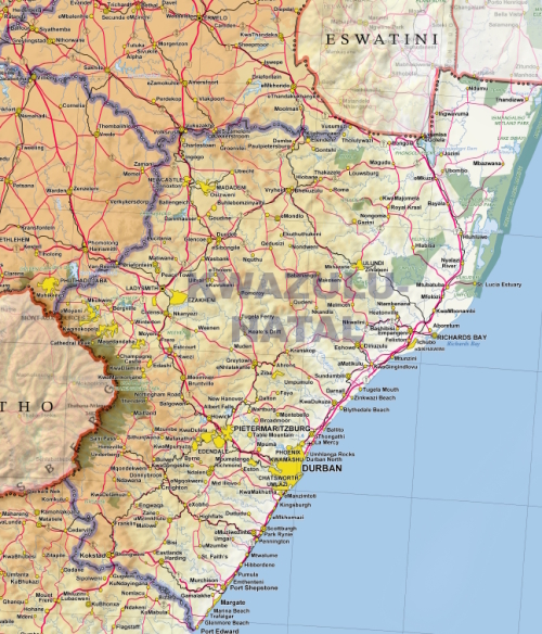
South Africa Provincial Political and Physical Wall Map Centenary Edition 2020 Printed and Laminated
New
Shipping
Standard courier shipping from R30
R30 Standard shipping using one of our trusted couriers applies to most areas in South Africa. Some areas may attract a R30 surcharge. This will be calculated at checkout if applicable.
Check my rate
Check my rate
Free collection from
Kuils River, Cape Town
The seller allows collection for this item and will be in contact with the full collection address once the order is ready.
Ready for collection by Friday, 24 May.
Ready to ship in
The seller has indicated that they will usually have this item
ready to ship within 3 business days. Shipping time depends on your delivery address. The most
accurate delivery time will be calculated at checkout, but in
general, the following shipping times apply:
Standard Delivery
| Main centres: | 1-3 business days |
| Regional areas: | 3-4 business days |
| Remote areas: | 3-5 business days |
Returns
Get it now, pay later
Seller
Buyer Protection
Product details
Condition
New
Location
South Africa
Area
Africa
Time Period
Post-1950
Type
Political Map
Bob Shop ID
613363695
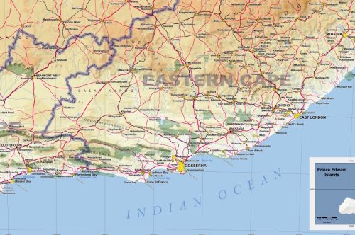
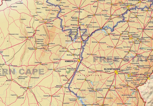
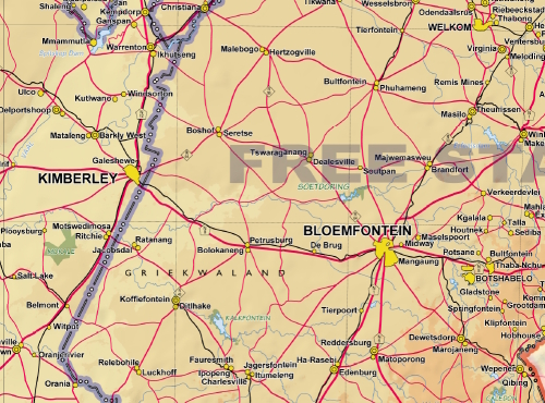
Title: South Africa Provincial Political and Physical Wall Map Centenary Edition 2020 Printed and Laminated
Printed Format.
Year: 2020 Edition.
Scale 1: 2 000 000.
Height: 77cm.
Width: 90cm.
Laminated.
100 Year Centenary Edition of Surveying and Mapping in South Africa, 2020.
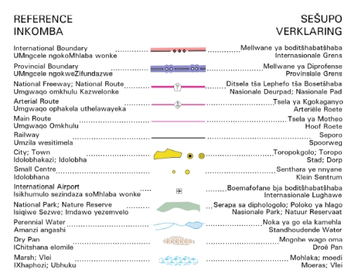
Decorative Border
Multilingual Reference Section
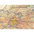
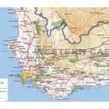
Includes International and Provincial Boundaries.
Cities, Towns, smaller centres.
Major and Arterial Roads.
Airports and Railway Lines.
Conservation Areas, Rivers, Pans and Vleis.
Condition: New, printed on Poster Paper.
Price for the 1 x Printed and Laminated Map: R 550.00 Inc Vat.
![]()