
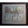
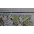
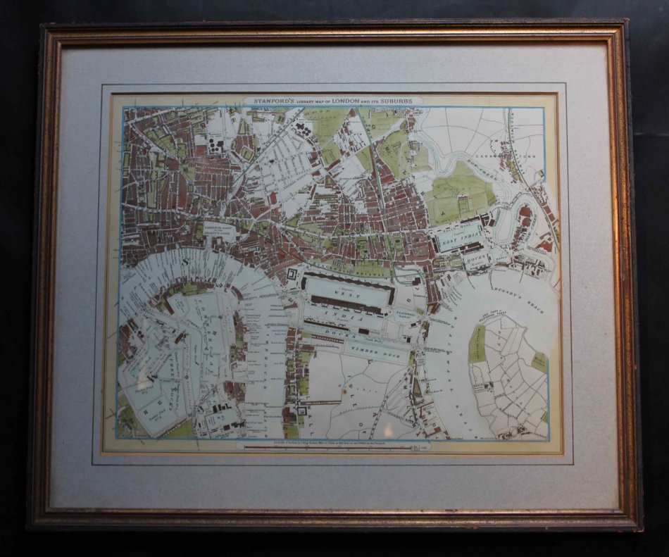
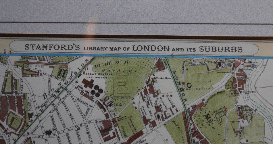
Stanfords Library Map of London and its Suburbs by Edward Stanford.
Secondhand
Shipping
Standard courier shipping from R30
R30 Standard shipping using one of our trusted couriers applies to most areas in South Africa. Some areas may attract a R30 surcharge. This will be calculated at checkout if applicable.
Check my rate
Check my rate
Free collection from
Kuils River, Cape Town
The seller allows collection for this item and will be in contact with the full collection address once the order is ready.
Ready for collection by Thursday, 30 May.
Ready to ship in
The seller has indicated that they will usually have this item
ready to ship within 3 business days. Shipping time depends on your delivery address. The most
accurate delivery time will be calculated at checkout, but in
general, the following shipping times apply:
Standard Delivery
| Main centres: | 1-3 business days |
| Regional areas: | 3-4 business days |
| Remote areas: | 3-5 business days |
Returns
Get it now, pay later
Seller
Buyer Protection
Product details
Condition
Secondhand
Location
South Africa
Area
Europe
Time Period
1800s
Type
Political Map
Bob Shop ID
614449150
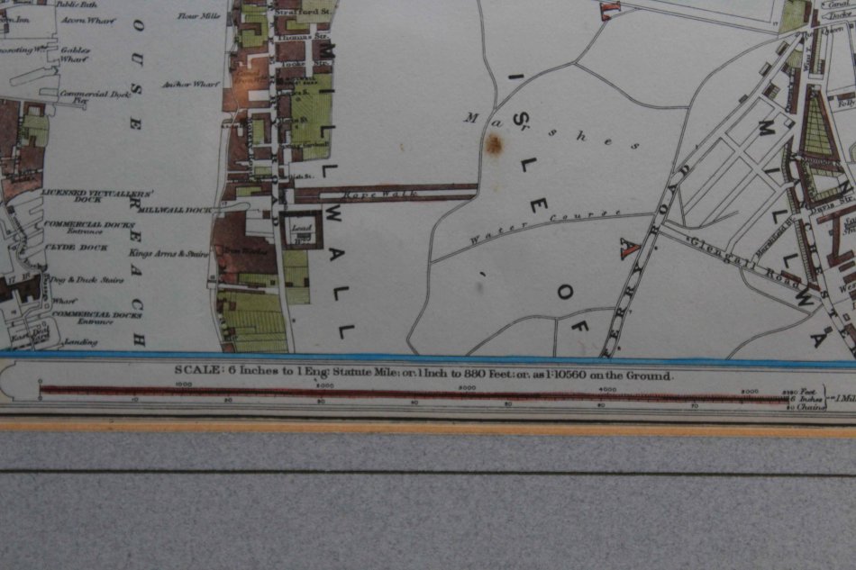
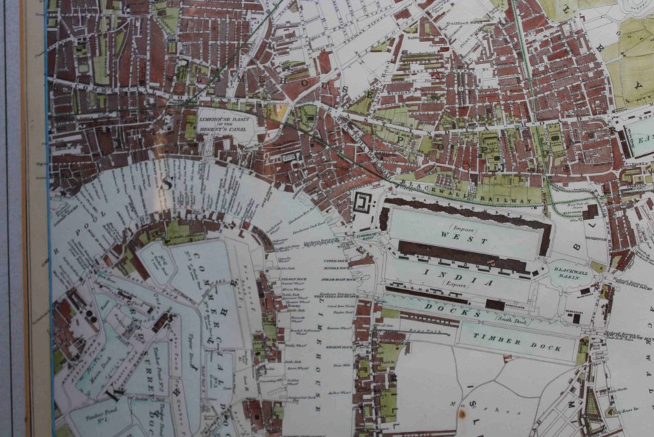
Title: Stanfords Library Map of London and its Suburbs.
Map By: Edward Stanford.
Published By: Edward Stanford, 1872.
Info: Covers the Thames River, the Grand Surrey Docks, Commercial Docks, West India Docks, Limehouse and Blackwell Reach with the East India docks.
Part of a set of 24 maps that mapped London in 1872.
Born in 1827, and educated at the City of London School, Edward Stanford got into maps after being employed by
Mr Trelawney Saunders at his map and stationers. He became a partner to Saunders in 1852 at the age of 25. In 1853,
the company was dissolved, and Stanford took over the remains of the business with the intent of turning it into a map specialist.
With British colonial expansion pushing the demand for maps worldwide, and being the sole specialist of maps in London, the move was both obvious and lucrative.
The name Stanfords became prominent in 1862 when his project to make the most accurate map of London possible was published.
Company ownership remained in the family until 1947, when it was absorbed into George Philip & Son.
However, in 2001 Stanfords separated from George Philip & Son and the name Stanfords is proudly displayed on both stores and on many lines of maps and books produced by the company.
Scale 1 inch = 1 mile.
Map size: 43cm w x 35cm h.
Frame size: 55cm w x 47cm h.
Condition: Excellent condition in very good frame.
Map: Original Release.
Price: R 1600.00 Inc Vat.
![]()
![]()