This item has closed 1 buyer bought 1 item
View other items offered by jjcoosner34

Similar products

Antique Map of Southern India by J Rapkin 1850
Secondhand
R985.00
1801 Map of Cape of Good Hope Colony, Good Condition, Original Arrowsmith Map
Secondhand
R1,950.00
66% OFF
Arabia . ORIGINAL 1851 MAP, ILLUSTRATED. Drawn and Engraved by Rapkin.
Secondhand
R2,395.00 R7,000.00
Antique Map of Jamaica by John Tallis 1851
Secondhand
R1,195.00
Tallis Map: Cape Colony by J Rapkin Tallis Map: Cape Colony by J Rapkin Tallis Map: Cape Colony by J Rapkin Tallis Map: Cape Colony by J Rapkin Tallis Map: Cape Colony by J Rapkin Tallis Map: Cape Colony by J Rapkin Tallis Map: Cape Colony by J Rapkin Tallis Map: Cape Colony by J Rapkin
Tallis Map: Cape Colony by J Rapkin Tallis Map: Cape Colony by J Rapkin Tallis Map: Cape Colony by J Rapkin Tallis Map: Cape Colony by J Rapkin
Tallis Map: Cape Colony by J Rapkin
+4
Sold

Tallis Map: Cape Colony by J Rapkin

Secondhand 1 was available
R1,250.00
Shipping
R35.00 Standard shipping using one of our trusted couriers applies to most areas in South Africa. Some areas may attract a R30.00 surcharge. This will be calculated at checkout if applicable.
Check my rate
The seller has indicated that they will usually have this item ready to ship within 3 business days. Shipping time depends on your delivery address. The most accurate delivery time will be calculated at checkout, but in general, the following shipping times apply:
 
Standard Delivery
Main centres:  1-3 business days
Regional areas: 3-4 business days
Remote areas: 3-5 business days
Buyer protection
Get it now, pay later

Product details

Condition
Secondhand
Location
South Africa
Area
Africa
Time Period
1800s
Bob Shop ID
422163890

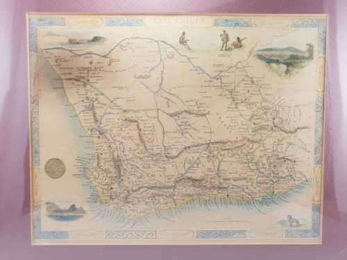
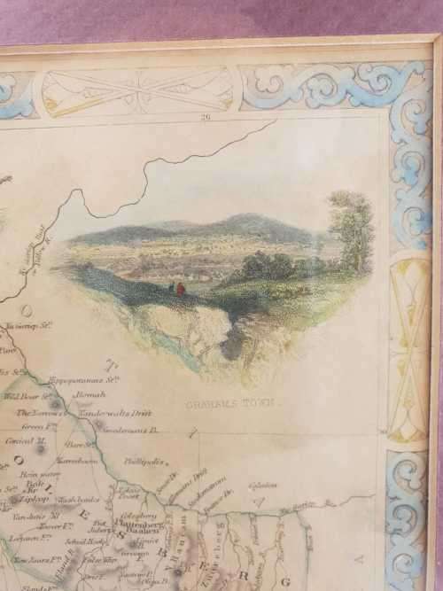
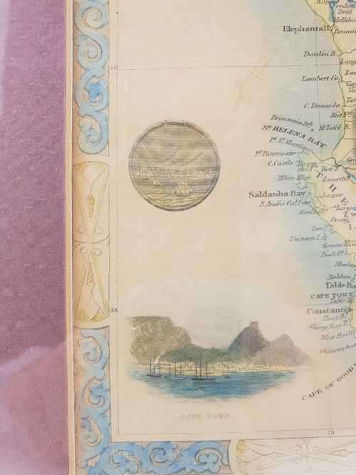
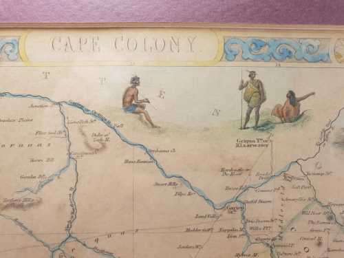
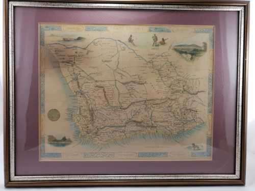
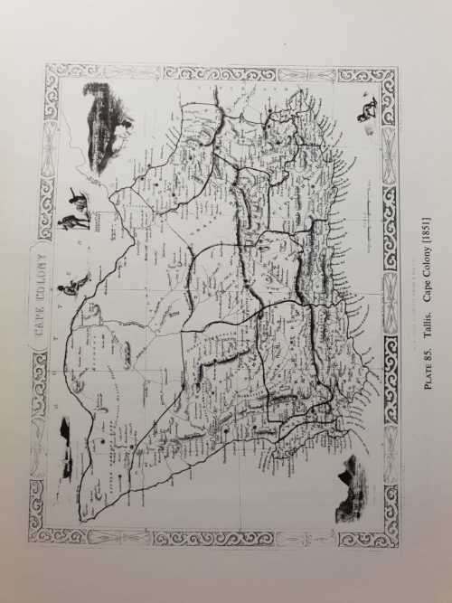
Map of the Cape Colony drawn and engraved by J Rapkin.

The illustrations by H. Warren and engraved by H. Bond. Produced by John Tallis & Company, London & New York.

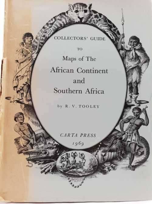
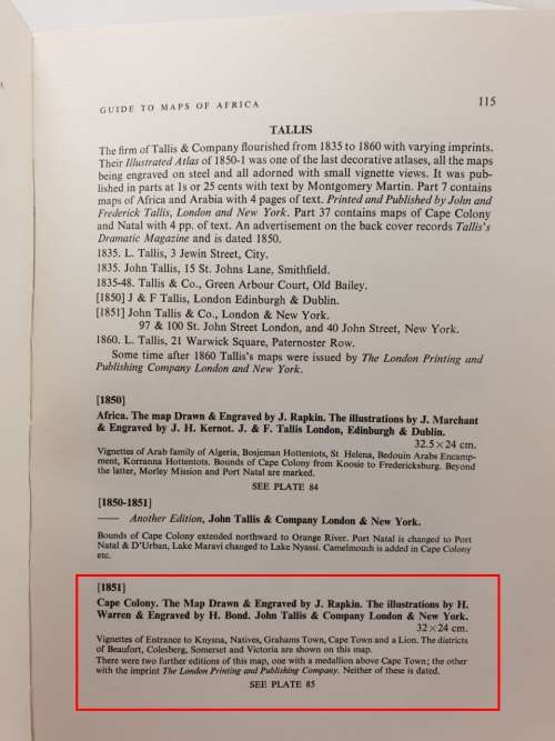
According to R V Tooley's "Collectors' Guide to Maps of the African Continent and Southern Africa" (p115), this is the undated edition of the 1851 map with the medallion above Cape Town. The guide describes the map as follows:

Vignettes of Entrance to Knysna, Natives, Grahams Town, Cape Town and a Lion. The districts of Beautfort, Coleberg, Somerset and Victoria are shown on this map.

It is 32 x 24cm, and framed behind glass. It is slightly discoloured in the top left hand corner and there is a tear on the right hand side near the bottom edge. 

If you are interested, more photos can be provided.


Recently viewed

See more
GARDENA Sprinkler Hose Connection Set
New
R259.00
Lock, Stock and Two Smoking Barrels DVD (Jason Flemyng, Dexter Fletcher )
Secondhand
R49.00
England, Scott #MH8,1967/69,MH,Block of 4 stamps,QEII,Machins
Secondhand
R10.00
Eureka 4 x Mirror Clips
New
R44.00