
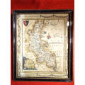
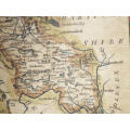
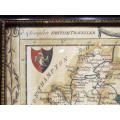
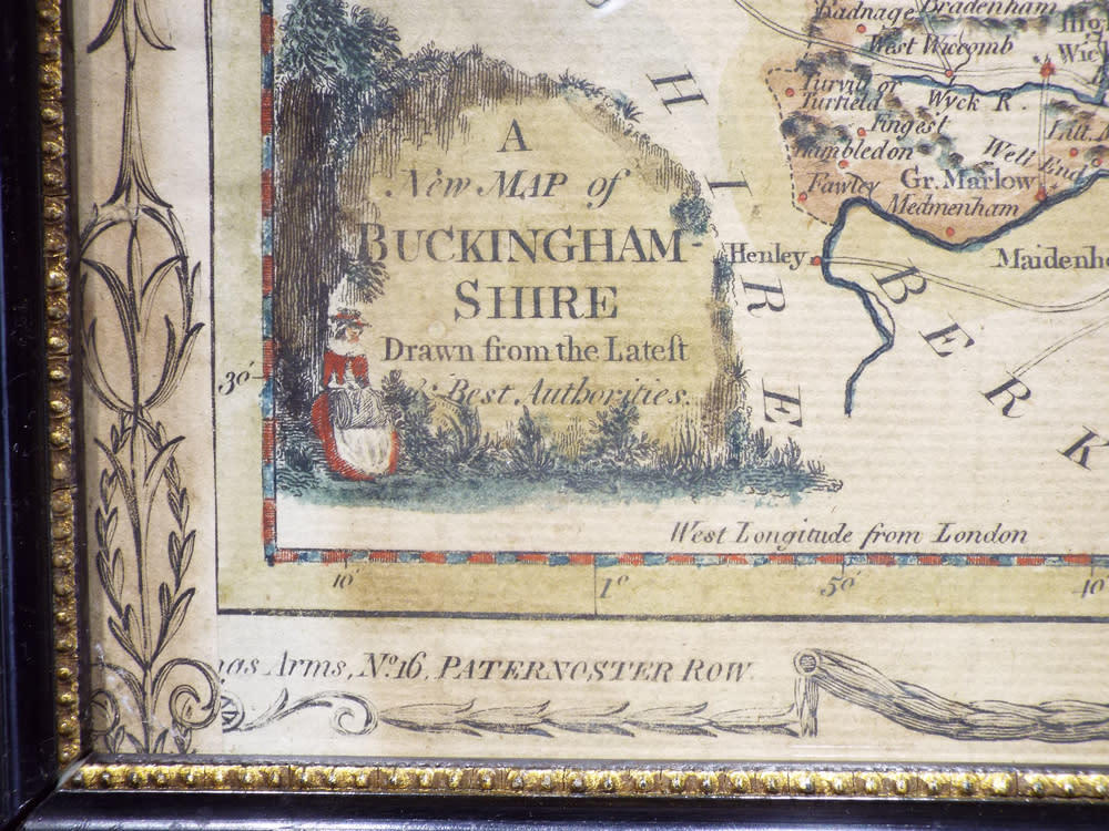
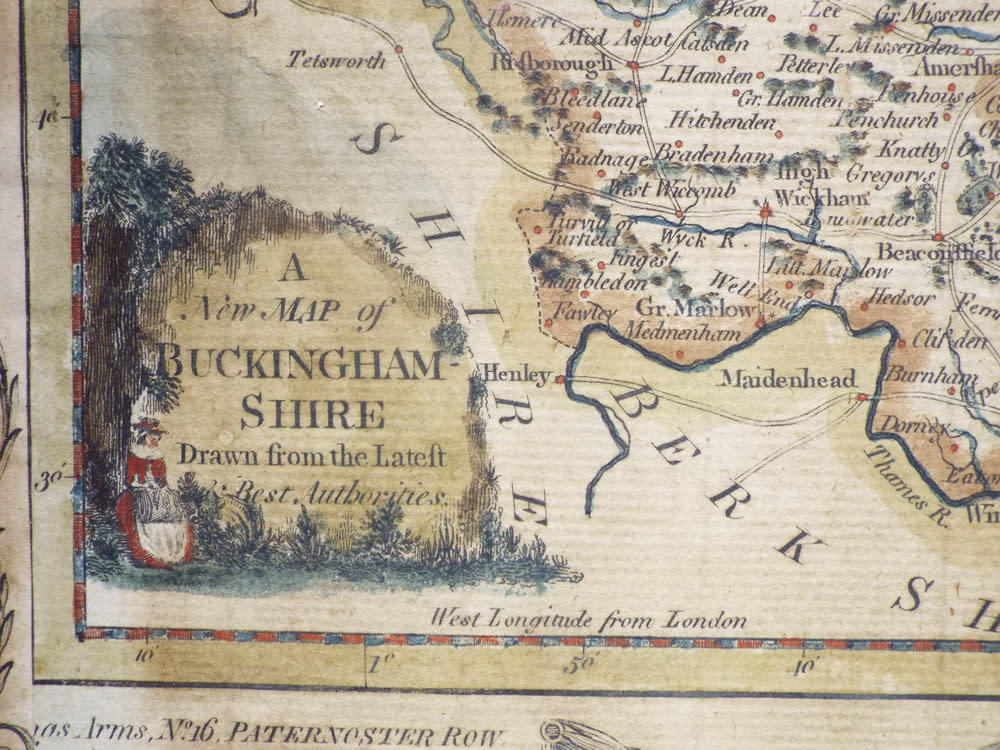
The British Traveller map of Buckinghamshire Circa 1784. Ref. No. AR/18
Check my rate
| Main centres: | 1-3 business days |
| Regional areas: | 3-4 business days |
| Remote areas: | 3-5 business days |
Product details
Description: The British Traveller map of Buckinghamshire Circa 1784. Ref. No. AR/18
Maker/Cartographer: George Augustus Walpole
Date: 1784
History: A typical English country map which appeared in the New British Traveller published by Alexander Hogg. Most of the maps in this series were engraved by Thomas Conder although a limited number were engraved by Thomas Bowen. The series were issued weekly and consisted of 60 parts and then could be bound into a book. The maps differed in their representation, some were issued with decorative borders (as the one on offer shows), some had blank areas and some were issued having two to four maps to a page. All in all, this was a rather confusing publication!
Description: The map on offer is a hand-coloured map of Buckinghamshire, showing the roads, rivers, towns and parks.
Condition: Overall in good condition, the map is mounted in a wooden, slightly gilded frame
Dimensions: 25 cm x 21cmn
Price: R600.00
Please note, I am NOT a qualified archaeologist/antiquarian and the description I have given is based on research of the subject.
This is a genuine antique. Please remember the classification of an 'antique' is that it should be 100 years old, OR MORE.
Terms: We offer a strict three-day approval period from the date the parcel reaches you. Refunds/credits are based on the cost of the article, NOT including delivery charges. Please advise us within this period whether you would like to return any article for a refund/credit. Although we pride ourselves in our packing, the buyer remains responsible for loss, non-arrival or damage to goods being sent to, or returned.