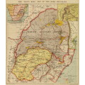
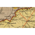
The Daily Mail Transvaal and Orange Free State Map 1899 Digital Download
Digital product
New
Shipping
Free digital delivery
This is a digital product (eg. voucher, product license, service, etc.) and does not require shipping.
The seller will be in contact to deliver this product to you electronically.
Ready to ship in
The seller has indicated that they will usually have this item
ready to ship within 3 business days. Shipping time depends on your delivery address. The most
accurate delivery time will be calculated at checkout, but in
general, the following shipping times apply:
Standard Delivery
| Main centres: | 1-3 business days |
| Regional areas: | 3-4 business days |
| Remote areas: | 3-5 business days |
Get it now, pay later
Seller
Buyer Protection
Product details
Condition
New
Location
South Africa
Area
Africa
Time Period
1800s
Type
Political Map
Bob Shop ID
614086740
Title: The Daily Mail Transvaal and Orange Free State Map 1899 Digital Download.
Map By: George Philip and Son.
Publisher: The Daily Mail, England.
Year Published: 1899.
Scale: @ 1: 1 000 000.
File Type and Size: TIF File 79MB and JPG 17MB File Images.
Printed Size: Can be printed up to A2 / A1 Size.
Info: With Insets of Northern Natal and South Africa.
A Map of the Republics prior to the Boer War or South African War, 1899-1902.
The map includes the Boer Republics of the Free State and the Transvaal.
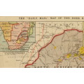
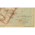
Areas of conflict such as Newcastle and Ladysmith, where battles and sieges occurred during the following year, are featured prominently on these maps. A larger-scale map of sub-equatorial Africa also appears in the upper left corner, putting into perspective the vast scale of British colonial rule. The goldfields, represented in a bold yellow, allude to the motivating factor behind the Scramble for Africa that led the European powers to compete for territory across the continent. One of the impacts had by these Europeans is shown by the thick red lines that run across all the maps, representing the expanding railway system developed during the latter half of the nineteenth century.
The Natal inset Map also includes engagements between the Boer Republic and The British during the First Boer War 16 Dec 1880 23 Mar 1881.
Condition: Digital Download.
Price: R 295.00.00 Inc Vat.
Please Note:
On completion of the order a link will be forwarded to your e-mail address for downloading of the file.
Large image files require sufficient processing power and memory capabilities to render efficiently on the screen.
Prior to printing please ensure that the printer has sufficient RAM for processing the image.
