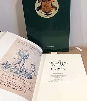
The Mercator Atlas of Europe by Gerardus Mercator , circa 1570- 1572 (reprint) The Mercator Atlas of Europe by Gerardus Mercator , circa 1570- 1572 (reprint)

The Mercator Atlas of Europe by Gerardus Mercator , circa 1570- 1572 (reprint)

1 available / new
Only 1 left – grab it before it’s gone!
R2,250.00
Want to pay less?
Shipping
R35.00 Standard shipping using one of our trusted couriers applies to most areas in South Africa. Some areas may attract a R30.00 surcharge. This will be calculated at checkout if applicable.
Check my rate
The seller allows collection for this item. Buyers will receive the collection address and time once the order is ready.
The seller has indicated that they will usually have this item ready to ship within 2 business days. Shipping time depends on your delivery address. The most accurate delivery time will be calculated at checkout, but in general, the following shipping times apply:
 
Standard Delivery
Main centres:  1-3 business days
Regional areas: 3-4 business days
Remote areas: 3-5 business days
Seller
Buyer protection
Get it now, pay later

Product details

Condition
New
Location
South Africa
Product code
bhs25
Bob Shop ID
644468104

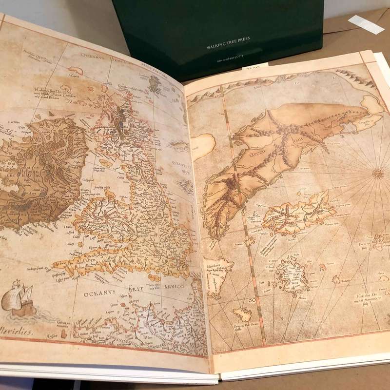
                    The Mercator Atlas of Europe Facsimile of the Maps by Gerardus Mercator in the Atlas of Europe, Circa 1570 - 1572


Published by Walking Tree Press, 1998, hardcover folio, book of 92 pages of text, maps and illustrations in fine color with stiff paper wraps and 16 folded color maps - potfolio bound in original green cloth covered boards in near fine condition and housed in original green paper covered slip case also near fine. 28.2 cms x 41.8 cms x 3.3 cms, Contents are facsimile maps in fine condition. 

The Mercator Atlas of Europe from Walking Tree Press represents a remarkable publishing achievement, combining the best of historical and cartographic scholarship with modern printing technology to produce a unique and elegant set of seventeen facsimile maps by one of history's greatest mapmakers. Completing the set and complementing the map facsimiles, the accompanying book contains essays contributed by an international team of distinguished map scholars.
With more than 100 original-color illustrations drawn from collections throughout Europe and the United States, the companion book places Mercator's first-known atlas in historical perspective and offers the reader a unique glimpse into the geography and cartography of sixteenth-century Europe.

The Marshall of Jülich approached Mercator and asked him to prepare a set of European regional maps which would serve for a grand tour by his patron's son, the crown prince Johannes, who became the last Duke of Jülich-Cleves-Berg (The United Duchies of Jülich-Cleves-Berg was a territory in the Holy Roman Empire between 1521 and 1614). This remarkable collection is now held in the British Library under the title, ' Atlas of Europe'.

The Mercator Atlas of Europe is truly a "feast for the eyes and mind, combining the high art of maps with first-rate scholarly pursuitsa marvelous union that Mercator would surely endorse."

Gerardus Mercator was a Flemish geographer, cosmographer and cartographer. He is most renowned for creating the 1569 world map based on a new projection which represented sailing courses of constant bearing (rhumb lines) as straight linesan innovation that is still employed in nautical charts.


Add to cart

Recently viewed

See more
Heracross
R6.00
Redisson 4x4 16Amp Single 3Pin Socket + Single Euro 3Pin Socket
R35.00
Bone Handle Cheese Knife
R250.00 No bids
Doctors of the Mines By: A. P. Cartwright *** Signed Limited Edition nbr 27/45***
R1,000.00 No bids

Similar products

Free shipping
1859 Europe Map by J. W. Lowry-Has tears in the top and bottom middle
R4,899.99
1961 Map of Europe, Excellent condition, Original McNally Map
R195.00
ANTIQUE MAPS OF EUROPE, THE AMERICAS, WEST INDIES, AUSTRALASIA, AFRICA, THE ORIENT BY DOUGLAS GOHM
R250.00
National Geographic Folded Map of Central Europe and The Balkan States September 1951.
R245.00