The National Geographic Society Antarctic Regions 1932 Digital Maps Digital Download The National Geographic Society Antarctic Regions 1932 Digital Maps Digital Download The National Geographic Society Antarctic Regions 1932 Digital Maps Digital Download The National Geographic Society Antarctic Regions 1932 Digital Maps Digital Download The National Geographic Society Antarctic Regions 1932 Digital Maps Digital Download The National Geographic Society Antarctic Regions 1932 Digital Maps Digital Download
The National Geographic Society Antarctic Regions 1932 Digital Maps Digital Download The National Geographic Society Antarctic Regions 1932 Digital Maps Digital Download The National Geographic Society Antarctic Regions 1932 Digital Maps Digital Download The National Geographic Society Antarctic Regions 1932 Digital Maps Digital Download
The National Geographic Society Antarctic Regions 1932 Digital Maps Digital Download
+2

The National Geographic Society Antarctic Regions 1932 Digital Maps Digital Download

Digital product
New 1 available
Only 1 left – grab it before it’s gone!
R245.00
Shipping
This is a digital product (eg. voucher, product license, service, etc.) and does not require shipping. The seller will be in contact to deliver this product to you electronically.
The seller has indicated that they will usually have this item ready to ship within 3 business days. Shipping time depends on your delivery address. The most accurate delivery time will be calculated at checkout, but in general, the following shipping times apply:
 
Standard Delivery
Main centres:  1-3 business days
Regional areas: 3-4 business days
Remote areas: 3-5 business days
Seller
Buyer protection
Get it now, pay later

Product details

Condition
New
Location
South Africa
Area
Antartica
Time Period
1900-1950
Type
Political Map
Bob Shop ID
648982857

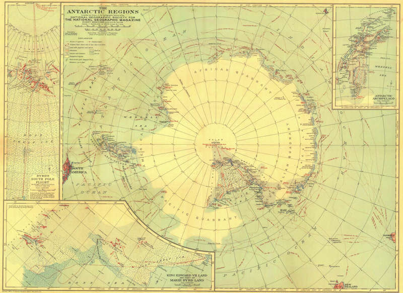
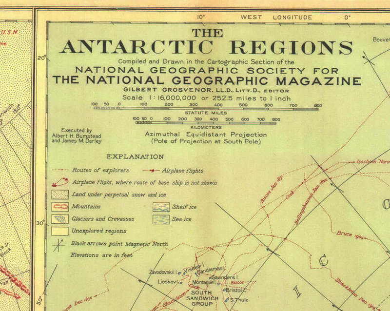
Title: The National Geographic Society Antarctic Regions 1932 Digital Maps Digital Download.
Publisher: National Geographic Society.
Format: Vintage Printed Maps that have been scanned and saved as Tiff images.
File Size: 4.2MB.
Scale: 1: 16 000 000  / 1 Inch = 252.5 Miles.
Print To A2 / A1 Size.
Info: Compiled and Drawn by the National Geographic Society for The National Geographic Magazine.
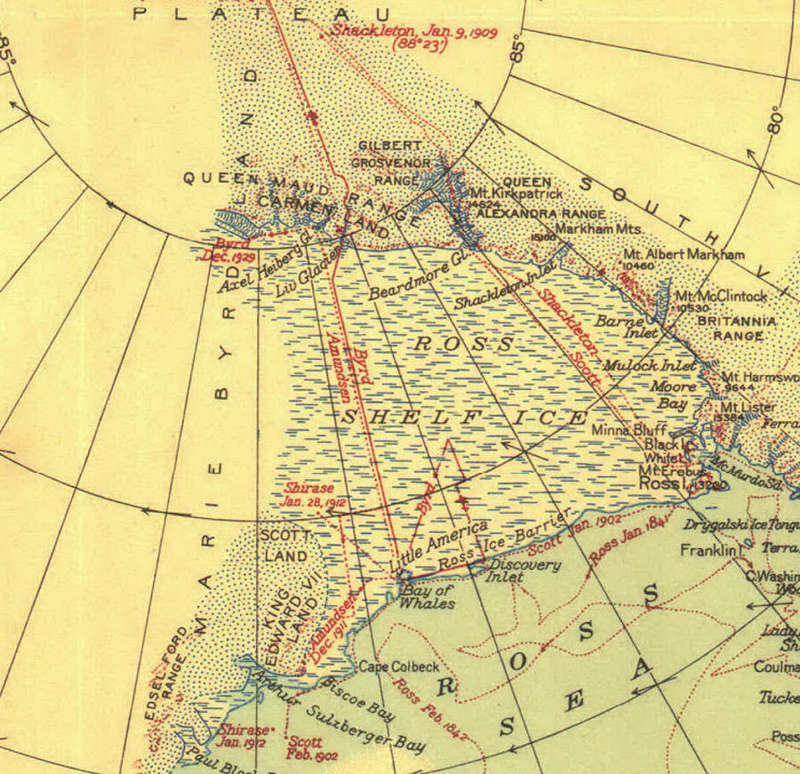
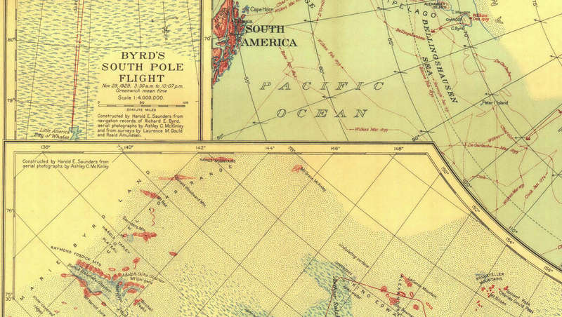
Published in 1932 the map depicts the various regions that have been explored as well as unexplored regions. With Insets of Byrds South Pole Flight of 1929 and the routes taken by the famous explorers such as Scott, Shackleton and of course Amundsen who achieved the South Pole first.
A fantastic vintage map for those interested in exploration.
Format: Digital files transferred via WeTransfer - A download Link will be forwarded on completion of order.
Price: R 245.00 Inc Vat.


Add to cart

Recently viewed

See more
26% OFF
Tinselcorn
New
R89.00 R120.00
Ratchet: Gladiator (PS2)
Secondhand
R99.00
1pc 30x80cm Castle Dragon Rubber Non-Slip Mouse Pad Suitable for Office Study and Gaming
New
R370.00 No bids
Free shipping
9% OFF
Pandora Women's Charm Link (793531C01)
New
R1,075.23 R1,178.84

Similar products

Malawi, Rhodesia & Zambia 1966 & Southern Africa National Geographic 1962 2 x Maps Digital Download
New
R195.00
National Geographic Pacific Ocean 1952 Digital Maps Digital Download
New
R195.00
British Antarctic Expedition 1907 (Nimrod Expedition) Digital Map Digital Download
New
R195.00
Arctic Regions 1862 With The North West Passage Digital Maps Digital Download
New
R245.00